Trail Walking Septvaux - La route serpentine - Photo

La route serpentine

Randonnées de RandoFamili

© OpenStreetMap contributors
Length
Length
10.2 km
Max alt
Max alt
205 m
Uphill gradient
Uphill gradient
175 m
Km-Effort
Km-Effort  
12.5 km
Min alt
Min alt
97 m
Downhill gradient
Downhill gradient
172 m
Boucle
Boucle
Yes
Creation date :
2014-12-10 00:00:00.0
Updated on :
2014-12-10 00:00:00.0

(1 Reviews)

Walking
Walking
--
Difficulty : Unknown

Scan this QR Code to open this trail in the SityTrail application

FREE GPS app for hiking

Logo SityTrail SityTrail

IGN / Geographical institutes

Download SityTrail from the App Store Download SityTrail from Google Play

Logo SityTrail SityTrail World

The world is yours!

Download SityTrail from the App Store Download SityTrail from Google Play Download SityTrail on Huawei AppGallery

About

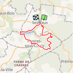
Trail Walking of 10.2 km to be discovered at Hauts-de-France, Aisne, Septvaux. This trail is proposed by Rando Famili.

Description

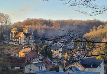
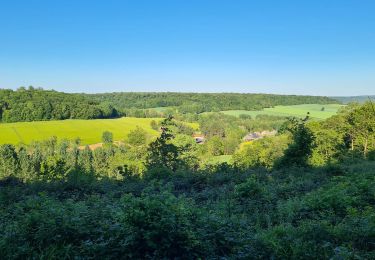
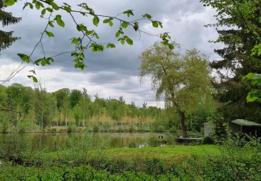
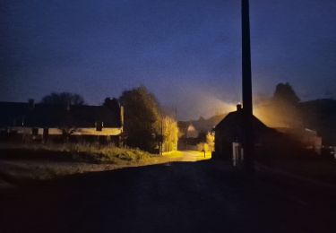
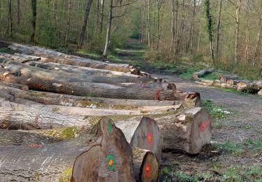
On dit que la commune de Septvaux tient son nom des sept vallons qui l'entourent et des sept pignons de son église remarquable. Cette balade vous permettra de découvrir les richesses de l'architecture locale tout en parcourant les paysages mystérieux de la forêt domaniale de Saint-Gobain.

Elevation profile

Photos

Points of interest

Point of interest Fresnes-sous-Coucy - La forêt de Saint-Gobain - Photo
Rando Famili
FRESNES-SOUS-COUCY 
Point of interest Septvaux - Chambres d'Hôtes de Brellemont - Photo
Rando Famili
Point of interest Septvaux - L'église de Septvaux - Photo
Rando Famili

Positioning

Country:
France
Region :
Hauts-de-France
Department/Province :
Aisne
Municipality :
Septvaux
Location:
Unknown
Start:(Dec)
Start:(UTM)
527294 ; 5490850 (31U) N.

Comments

Please log in to post a review or rate the element


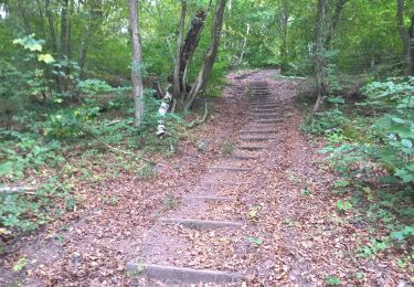
Rando faite le 07/04/2015. Super ballade mêlant plaine et forêt par un excellent sentier .Pas de difficulté particulière.Balisage irrégulier


Trails nearby

Trail Walking Saint-Gobain - Les abbayes - Photo
Walking
tracegps

Walking

Very easy
(3)
Saint-Gobain, Hauts-de-France, Aisne, France
14.8 km | 19.8 km-effort
4h 30min
Yes
Trail Walking Fresnes-sous-Coucy - Une belle forêt française - Photo
Walking
tracegps

Walking

Very difficult
(1)
Fresnes-sous-Coucy, Hauts-de-France, Aisne, France
13.1 km | 16.4 km-effort
4h 0min
Yes
Trail Walking Barisis-aux-Bois - soirée calme en première ligne  - Photo
Walking
José800

Walking

Difficult
Barisis-aux-Bois, Hauts-de-France, Aisne, France
10.6 km | 14.1 km-effort
2h 45min
Yes
Trail Walking Coucy-la-Ville - coucy la ville. septvaux - Photo
Walking
alainwald

Walking

Easy
Coucy-la-Ville, Hauts-de-France, Aisne, France
18.2 km | 22 km-effort
3h 45min
Yes
Trail Mountain bike Saint-Gobain - Parcours Errancourt - Photo
Mountain bike
alainwald

Mountain bike

Difficult
Saint-Gobain, Hauts-de-France, Aisne, France
41 km | 50 km-effort
3h 39min
Yes
Trail Walking Saint-Gobain - parcours Barisis-aux-bois - Photo
Walking
alainwald

Walking

Medium
Saint-Gobain, Hauts-de-France, Aisne, France
18.1 km | 23 km-effort
4h 17min
Yes
Trail Walking Saint-Gobain - SityTrail - 831699 - cdt2-70 - Photo
Walking
TURLUPIN2010

Walking

Very difficult
Saint-Gobain, Hauts-de-France, Aisne, France
14.8 km | 19.9 km-effort
4h 31min
Yes
Trail Walking Saint-Gobain - errancourt-saint Nicolas aux bois  - Photo
Walking
alainwald

Walking

Medium
Saint-Gobain, Hauts-de-France, Aisne, France
9.9 km | 12.7 km-effort
2h 53min
Yes
Trail Walking Prémontré - Laon - Photo
Walking
MERMOZ33

Walking

Very difficult
Prémontré, Hauts-de-France, Aisne, France
17.7 km | 21 km-effort
4h 25min
No


Close
My subscriptions