Trail Walking Noidant-le-Rocheux - Sentier Vosges-Pyrénées - de Noidant le Rocheux à Auberive - Photo

Sentier Vosges-Pyrénées - de Noidant le Rocheux à Auberive

 tracegps
tracegps

User

© OpenStreetMap contributors
Length
Length
21 km
Max alt
Max alt
521 m
Uphill gradient
Uphill gradient
320 m
Km-Effort
Km-Effort  
25 km
Min alt
Min alt
342 m
Downhill gradient
Downhill gradient
364 m
Boucle
Boucle
No
Creation date :
2014-12-10 00:00:00.0
Updated on :
2014-12-10 00:00:00.0

(0 Reviews)

Walking
Walking
5h30
Difficulty : Difficult

Scan this QR Code to open this trail in the SityTrail application

FREE GPS app for hiking

Logo SityTrail SityTrail

IGN / Geographical institutes

Download SityTrail from the App Store Download SityTrail from Google Play

Logo SityTrail SityTrail World

The world is yours!

Download SityTrail from the App Store Download SityTrail from Google Play Download SityTrail on Huawei AppGallery

About

Trail Walking of 21 km to be discovered at Grand Est, Haute-Marne, Noidant-le-Rocheux. This trail is proposed by tracegps.

Description

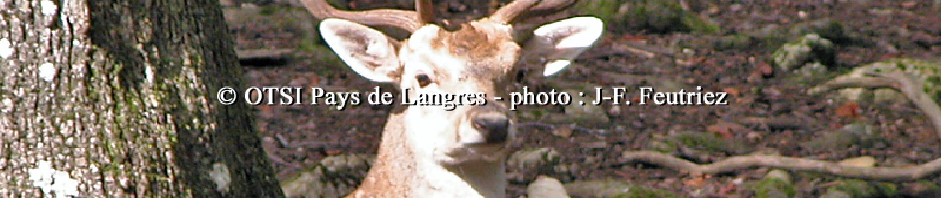
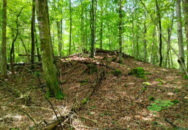
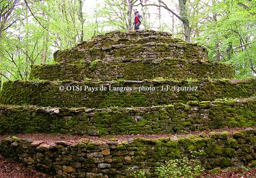
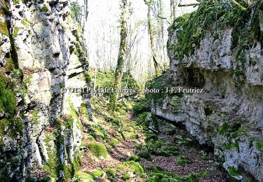
Office de Tourisme du Pays de Langres Sixième étape: Sites traversés : Bois du Prachey -Forêt domaniale d’Auberive. A ne pas manquer : La croix romaine de Perrogney-les-Fontaines, le panorama du Haut du Sec et le village d’Auberive (abbaye, promenade de l’entre deux eaux…). La fiche est téléchargeable ICI Nota : Les données de l'OT du Pays de Langres sont officielles et restent la référence; toute différence dans le kilométrage provient d'un décalage de calcul entre les différents logiciels.

Elevation profile

Photos

Positioning

Country:
France
Region :
Grand Est
Department/Province :
Haute-Marne
Municipality :
Noidant-le-Rocheux
Location:
Unknown
Start:(UTM)
668630 ; 5299771 (31T) N.

Trails nearby

Trail Walking Perrogney-les-Fontaines - sur les hauts: Sommets de Haute Marne - Photo
Walking
Nicole SIMONNET

Walking

Medium
Perrogney-les-Fontaines, Grand Est, Haute-Marne, France
15.1 km | 18.9 km-effort
5h 42min
Yes
Trail Nordic walking Perrancey-les-Vieux-Moulins - domaine de Montauban  - Photo
Nordic walking
avier

Nordic walking

Very easy
Perrancey-les-Vieux-Moulins, Grand Est, Haute-Marne, France
31 km | 35 km-effort
2h 25min
No
Trail Cycle Brennes - Boucle 3 autour de la Voie Verte - Brennes - Photo
Cycle
tracegps

Cycle

Medium
Brennes, Grand Est, Haute-Marne, France
19.6 km | 23 km-effort
1h 30min
Yes
Trail Mountain bike Noidant-le-Rocheux - Lacs et falaises de la Mouche - Photo
Mountain bike
tracegps

Mountain bike

Difficult
(1)
Noidant-le-Rocheux, Grand Est, Haute-Marne, France
16.3 km | 20 km-effort
2h 0min
Yes
Trail Walking Noidant-le-Rocheux - Lacs et falaises de la Mouche - Photo
Walking
tracegps

Walking

Difficult
Noidant-le-Rocheux, Grand Est, Haute-Marne, France
16.3 km | 20 km-effort
5h 0min
Yes
Trail Electric bike Saints-Geosmes - Charmes - Photo
Electric bike
lionel.marcoux

Electric bike

Easy
Saints-Geosmes, Grand Est, Haute-Marne, France
44 km | 53 km-effort
3h 33min
No
Trail Mountain bike Noidant-le-Rocheux - Mougeanne - Photo
Mountain bike
lionel.marcoux

Mountain bike

Medium
Noidant-le-Rocheux, Grand Est, Haute-Marne, France
70 km | 85 km-effort
4h 43min
Yes
Trail Electric bike Brennes - entre Bennett et Melville - Photo
Electric bike
zombie52

Electric bike

Very easy
Brennes, Grand Est, Haute-Marne, France
28 km | 31 km-effort
1h 29min
No
Trail Mountain bike Noidant-le-Rocheux - Lac et Falaises de la Mouche - Photo
Mountain bike
delestrai

Mountain bike

Medium
(1)
Noidant-le-Rocheux, Grand Est, Haute-Marne, France
15.9 km | 19.8 km-effort
2h 20min
Yes


Close
My subscriptions