Trail Walking Larribar-Sorhapuru - De Larribar - Sorhapuru à Ostabat - Photo

De Larribar - Sorhapuru à Ostabat

 tracegps
tracegps

User

© OpenStreetMap contributors
Length
Length
9.2 km
Max alt
Max alt
291 m
Uphill gradient
Uphill gradient
368 m
Km-Effort
Km-Effort  
14 km
Min alt
Min alt
64 m
Downhill gradient
Downhill gradient
319 m
Boucle
Boucle
No
Creation date :
2014-12-10 00:00:00.0
Updated on :
2014-12-10 00:00:00.0

(0 Reviews)

Walking
Walking
2h40
Difficulty : Medium

Scan this QR Code to open this trail in the SityTrail application

FREE GPS app for hiking

Logo SityTrail SityTrail

IGN / Geographical institutes

Download SityTrail from the App Store Download SityTrail from Google Play

Logo SityTrail SityTrail World

The world is yours!

Download SityTrail from the App Store Download SityTrail from Google Play Download SityTrail on Huawei AppGallery

About

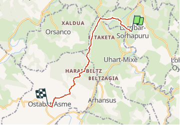
Trail Walking of 9.2 km to be discovered at New Aquitaine, Pyrénées-Atlantiques, Larribar-Sorhapuru. This trail is proposed by tracegps.

Description

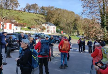
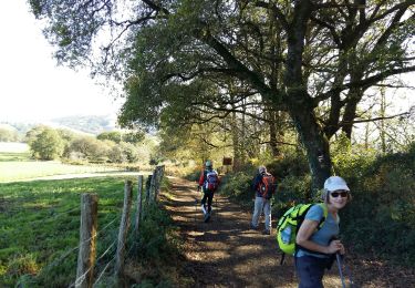
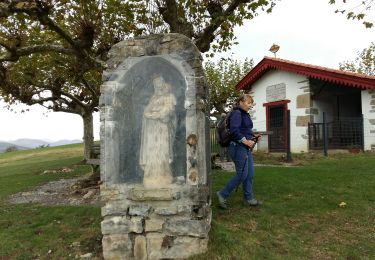
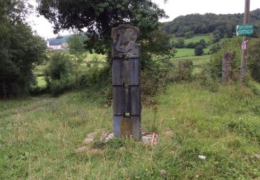
De Larribar - Sorhapuru à Ostabat Traversant la Bidouze et jouant à saute-mouton avec les premières collines de la Basse-Navarre, ce tronçon de la voie du Puy enchante le pèlerin et le randonneur avec ses pavés, ses panoramas et ses bosquets au détour de stèles et des chapelles de Soyarza et d’Harambeltz pour se terminer au village d’Ostabat. Téléchargez la carte et le descriptif de cette randonnée. Retrouvez d’autres itinéraires de rando sur le site Rando 64.

Elevation profile

Photos

Positioning

Country:
France
Region :
New Aquitaine
Department/Province :
Pyrénées-Atlantiques
Municipality :
Larribar-Sorhapuru
Location:
Unknown
Start:(UTM)
661083 ; 4795216 (30T) N.

Trails nearby

Trail Walking Arhansus - Balade autour d'Arhansus - Photo
Walking
tracegps

Walking

Medium
(1)
Arhansus, New Aquitaine, Pyrénées-Atlantiques, France
6.1 km | 8.9 km-effort
2h 0min
Yes
Trail Walking Uhart-Mixe - UHART MIXE journée présidents et animateurs
Walking
GUIDE
marmotte65

Walking

Difficult
Uhart-Mixe, New Aquitaine, Pyrénées-Atlantiques, France
10.3 km | 14.6 km-effort
3h 18min
Yes
Trail Walking Ostabat-Asme - OSTABAT-ASME St Nicolas-Soyarze-Fntaine de la vierge G3
Walking
GUIDE
marmotte65

Walking

Difficult
Ostabat-Asme, New Aquitaine, Pyrénées-Atlantiques, France
11.7 km | 16.9 km-effort
3h 29min
Yes
Trail Walking Uhart-Mixe - UHART-MIXE journée Presidents / animateurs
Walking
GUIDE
marmotte65

Walking

Difficult
(1)
Uhart-Mixe, New Aquitaine, Pyrénées-Atlantiques, France
10.1 km | 14.4 km-effort
2h 48min
Yes
Trail Walking Uhart-Mixe - UHART MIXE reco  du 5/11/2022 Circuit Urbeltz journee presidents
Walking
GUIDE
marmotte65

Walking

Difficult
Uhart-Mixe, New Aquitaine, Pyrénées-Atlantiques, France
10.3 km | 14.6 km-effort
2h 47min
Yes
Trail Walking Ostabat-Asme - OSTABAT G3 Chapelles St Nicolas et Soyarze reco
Walking
GUIDE
marmotte65

Walking

Difficult
Ostabat-Asme, New Aquitaine, Pyrénées-Atlantiques, France
11.7 km | 17.1 km-effort
3h 14min
Yes
Trail Walking Ostabat-Asme - CC_Velay_GC_30_Ostabat-Asme_St-Jean-Pied-Port_20090414 - Photo
Walking
patrickdanilo

Walking

Medium
Ostabat-Asme, New Aquitaine, Pyrénées-Atlantiques, France
23 km | 28 km-effort
6h 0min
No
Trail Walking Ostabat-Asme - Ostabat et Haranbeltz - Photo
Walking
boombop

Walking

Medium
Ostabat-Asme, New Aquitaine, Pyrénées-Atlantiques, France
10.9 km | 15 km-effort
2h 54min
Yes
Trail Walking Ostabat-Asme - Ostabat et Haranbeltz - Photo
Walking
boombop

Walking

Medium
Ostabat-Asme, New Aquitaine, Pyrénées-Atlantiques, France
10.9 km | 15 km-effort
2h 54min
Yes


Close
My subscriptions