Trail Walking Grévillers - Le sentier du Florion (Grévillers) - Photo

Le sentier du Florion (Grévillers)

 tracegps
tracegps

User

© OpenStreetMap contributors
Length
Length
8.5 km
Max alt
Max alt
145 m
Uphill gradient
Uphill gradient
65 m
Km-Effort
Km-Effort  
9.4 km
Min alt
Min alt
114 m
Downhill gradient
Downhill gradient
66 m
Boucle
Boucle
Yes
Creation date :
2014-12-10 00:00:00.0
Updated on :
2014-12-10 00:00:00.0

(0 Reviews)

Walking
Walking
2h10
Difficulty : Medium

Scan this QR Code to open this trail in the SityTrail application

FREE GPS app for hiking

Logo SityTrail SityTrail

IGN / Geographical institutes

Download SityTrail from the App Store Download SityTrail from Google Play

Logo SityTrail SityTrail World

The world is yours!

Download SityTrail from the App Store Download SityTrail from Google Play Download SityTrail on Huawei AppGallery

About

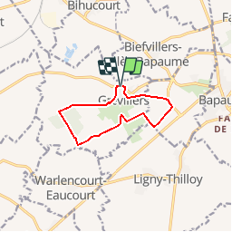
Trail Walking of 8.5 km to be discovered at Hauts-de-France, Pas-de-Calais, Grévillers. This trail is proposed by tracegps.

Description

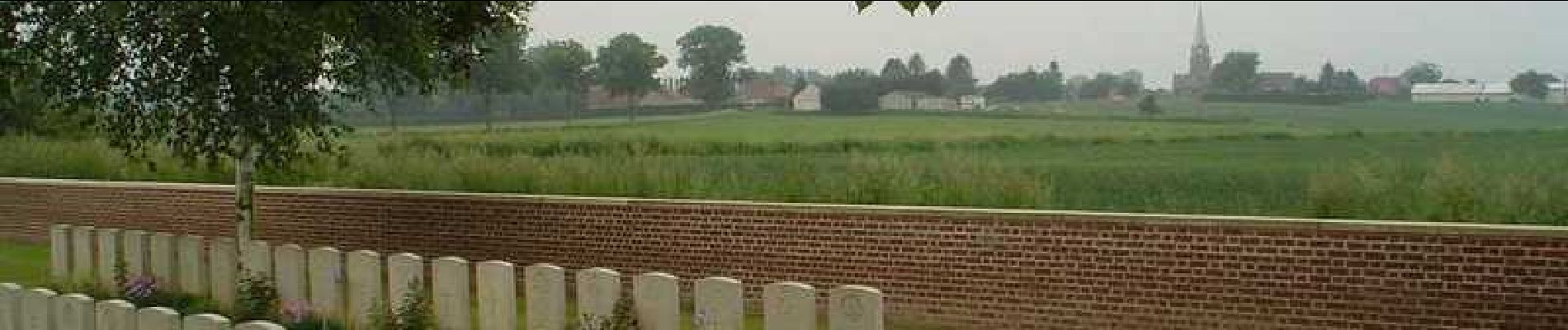
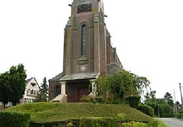
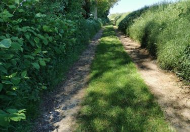
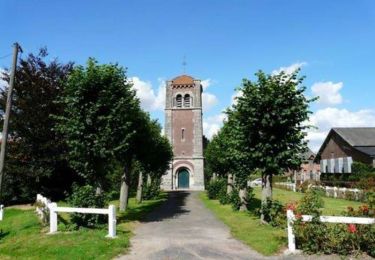
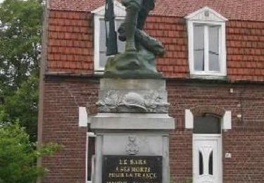
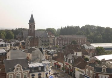
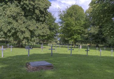
Circuit proposé par l’Office de Tourisme du Seuil de l’Artois Bapaume – Bertincourt . Départ de la salle des fêtes de Grévillers. Ce sentier vous présente en quelques kilomètres un condensé des grands évènements du XXème siècle. Éléments visibles de la 1ère Guerre Mondiale, au gré des cimetières et mémoriaux britanniques, de la 2e Guerre Mondiale avec les vestiges d'un aérodrome, mais surtout les destins de 2 hommes au cours de ces deux conflits : le Lieutenant Commander Oswald Wainwright et le Général Aubert Frère. En plus de ce riche passé, Grévilliers a su garder une âme rurale qui fait de ce petit coin, entre bois, prairies et champs, cultivés le bonheur des promeneurs. Retrouvez le plan et son descriptif ICI. Ce circuit a été numérisé par les randonneurs du CODEPEM. Merci à Jean-Marie.
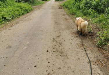
Elevation profile

Photos

Positioning

Country:
France
Region :
Hauts-de-France
Department/Province :
Pas-de-Calais
Municipality :
Grévillers
Location:
Unknown
Start:(UTM)
486413 ; 5550542 (31U) N.

Trails nearby

Trail Walking Irles - IRLES (80) - Les sources de l'Ancre - Photo
Walking
temmichel

Walking

Difficult
Irles, Hauts-de-France, Somme, France
12.4 km | 14.4 km-effort
3h 15min
Yes
Trail Walking Grévillers - BOUCLE GREVILLERS-WARLENCOURT EAUCOURT- LIGNY TILLOY - GREVILLERS - Photo
Walking
Géraldine Parsy

Walking

Medium
Grévillers, Hauts-de-France, Pas-de-Calais, France
10.5 km | 11.6 km-effort
2h 3min
Yes
Trail Walking Grévillers - randonnée grévillers  - Photo
Walking
Géraldine Parsy

Walking

Medium
Grévillers, Hauts-de-France, Pas-de-Calais, France
9.9 km | 11.1 km-effort
1h 31min
Yes
Trail Walking Biefvillers-lès-Bapaume - Sur les traces de la Guerre Franco-Prussienne : 1870-1871 (Biefvillers-lés-Bapaume) - Photo
Walking
tracegps

Walking

Difficult
Biefvillers-lès-Bapaume, Hauts-de-France, Pas-de-Calais, France
15.5 km | 17.3 km-effort
4h 0min
Yes
Trail Walking Warlencourt-Eaucourt - Le sentier de la Butte de Warlencourt (Warlencourt-Eaucourt) - Photo
Walking
tracegps

Walking

Medium
Warlencourt-Eaucourt, Hauts-de-France, Pas-de-Calais, France
9.7 km | 11.1 km-effort
2h 30min
Yes
Trail Walking Achiet-le-Grand - Le sentier des Trois Pourchains (Achiet-le-Grand) - Photo
Walking
tracegps

Walking

Medium
Achiet-le-Grand, Hauts-de-France, Pas-de-Calais, France
11.8 km | 13 km-effort
3h 0min
Yes
Trail Walking Bapaume - Le sentier de la ronde des Tilleuls (Bapaume) - Photo
Walking
tracegps

Walking

Medium
Bapaume, Hauts-de-France, Pas-de-Calais, France
10.7 km | 11.9 km-effort
2h 45min
Yes
Trail Walking Achiet-le-Grand - Achiet le Grand - Bihucourt - Achiet le Petit - Photo
Walking
tracegps

Walking

Medium
Achiet-le-Grand, Hauts-de-France, Pas-de-Calais, France
10.6 km | 11.7 km-effort
2h 0min
No
Trail Mountain bike Biefvillers-lès-Bapaume - Stéphane  - Photo
Mountain bike
cnockaert

Mountain bike

Very easy
Biefvillers-lès-Bapaume, Hauts-de-France, Pas-de-Calais, France
23 km | 25 km-effort
1h 11min
Yes


Close
My subscriptions