Trail Walking Saint-Remèze - Rapide de Gournier - Dolmen du Chanet - Photo

Rapide de Gournier - Dolmen du Chanet

 tracegps
tracegps

User

© OpenStreetMap contributors
Length
Length
5.9 km
Max alt
Max alt
316 m
Uphill gradient
Uphill gradient
260 m
Km-Effort
Km-Effort  
9.4 km
Min alt
Min alt
67 m
Downhill gradient
Downhill gradient
260 m
Boucle
Boucle
Yes
Creation date :
2014-12-10 00:00:00.0
Updated on :
2014-12-10 00:00:00.0

(3 Reviews)

Walking
Walking
2h30
Difficulty : Difficult

Scan this QR Code to open this trail in the SityTrail application

FREE GPS app for hiking

Logo SityTrail SityTrail

IGN / Geographical institutes

Download SityTrail from the App Store Download SityTrail from Google Play

Logo SityTrail SityTrail World

The world is yours!

Download SityTrail from the App Store Download SityTrail from Google Play Download SityTrail on Huawei AppGallery

About

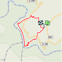
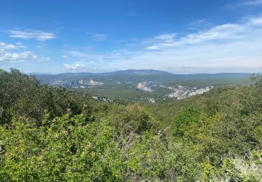
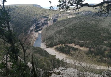
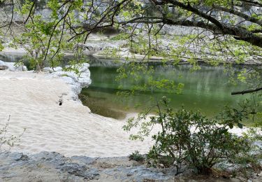
Trail Walking of 5.9 km to be discovered at Auvergne-Rhône-Alpes, Ardèche, Saint-Remèze. This trail is proposed by tracegps.

Description

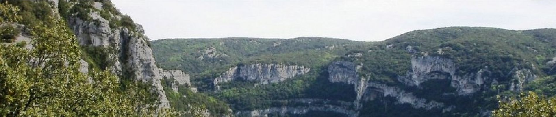
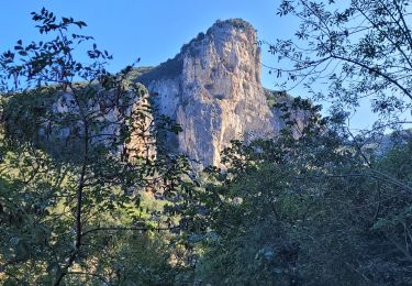
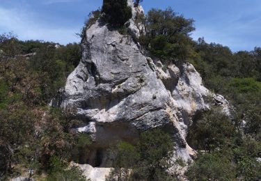
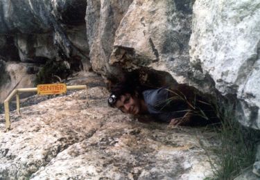
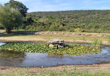
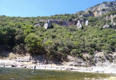
Promenade dans les gorges de l'Ardèche au rapide de Gournier en passant par le dolmen du Chanet. La suite et d’autres informations et photos sur le site des Balades de Stéphane.

Elevation profile

Photos

Positioning

Country:
France
Region :
Auvergne-Rhône-Alpes
Department/Province :
Ardèche
Municipality :
Saint-Remèze
Location:
Unknown
Start:(UTM)
617938 ; 4911833 (31T) N.

Comments

Please log in to post a review or rate the element


Bien j'aimerai pouvoir preparer une randonnée


Trails nearby

Trail Walking Labastide-de-Virac - les gorges de l'Ardèche  - Photo
Walking
loca.yves

Walking

Medium
Labastide-de-Virac, Auvergne-Rhône-Alpes, Ardèche, France
8.9 km | 14.1 km-effort
5h 14min
Yes
Trail Walking Vallon-Pont-d'Arc - Vallon pont d'arc au bivouac du gournier  - Photo
Walking
nadd73

Walking

Medium
Vallon-Pont-d'Arc, Auvergne-Rhône-Alpes, Ardèche, France
18.8 km | 31 km-effort
3h 45min
No
Trail Walking Le Garn - Le Garn à l’Ardeche - Photo
Walking
GUIDE
Roger Philippe Wallez

Walking

Very difficult
Le Garn, Occitania, Gard, France
17.7 km | 26 km-effort
7h 4min
No
Trail Walking Labastide-de-Virac - les crottes - Photo
Walking
Vero7684

Walking

Medium
Labastide-de-Virac, Auvergne-Rhône-Alpes, Ardèche, France
12.2 km | 17.5 km-effort
4h 35min
Yes
Trail Walking Labastide-de-Virac - Gorges de l’Ardeche - Photo
Walking
BrigitteBertrand

Walking

Difficult
Labastide-de-Virac, Auvergne-Rhône-Alpes, Ardèche, France
8.1 km | 12.5 km-effort
2h 44min
Yes
Trail Walking Saint-Remèze - Gorges de l’Ardèche  - Photo
Walking
caroline83150

Walking

Medium
Saint-Remèze, Auvergne-Rhône-Alpes, Ardèche, France
15.1 km | 22 km-effort
8h 40min
No
Trail On foot Aiguèze - FR-PR 24 - Photo
On foot
PRO

On foot

Easy
Aiguèze, Occitania, Gard, France
6.9 km | 10 km-effort
2h 15min
No
Trail Walking Le Garn - Gorges de l'Ardèche  - Photo
Walking
GUIDE
nadinebondoux

Walking

Difficult
Le Garn, Occitania, Gard, France
17.8 km | 26 km-effort
5h 59min
Yes
Trail On foot Labastide-de-Virac - Wikiloc Gorges de l'Ardeche - Photo
On foot
GUIDE
Peter.vdbergh

On foot

Difficult
Labastide-de-Virac, Auvergne-Rhône-Alpes, Ardèche, France
14.3 km | 23 km-effort
6h 19min
Yes


Close
My subscriptions