


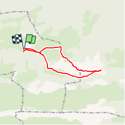


12.2 km | 25 km-effort

User


FREE GPS app for hiking
 SityTrail
IGN / Geographical institutes
SityTrail World
The world is yours!
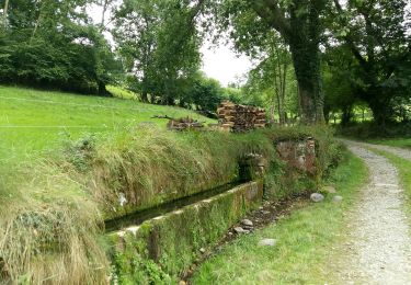
Trail Walking of 11.1 km to be discovered at New Aquitaine, Pyrénées-Atlantiques, Castet. This trail is proposed by tracegps.
Le Mail 1665m et le Pic Durban 1700m depuis le plateau d'Espioubet (915m) Point culminant des crêtes entourant Pé-de-Hourat, le pic Durban est un intéressant belvédère que l'on peut aborder par l'Ouest après avoir bénéficié de la route pastorale reliant Castet au plateau d'Espioubet, ce qui diminue considérablement la dénivellation. Après une montée franche en boucle, nous effectuons un long parcours de crêtes et reviendrons en boucle pour découvrir de curieux vallons karstiques. Ceux qui le désirent se contenteront du Mail (1665m) et effectueront un circuit plus réduit. D’autres indications, photos et panoramiques sur le site « Les Pyrénées vues par Mariano ».


Walking
On foot
On foot
On foot
On foot
Walking
Walking
Walking

Mountain bike