Trail Walking Saint-Geniès - De Vialard à Saint Amand de Coly - Photo

De Vialard à Saint Amand de Coly

 tracegps
tracegps

User

© OpenStreetMap contributors
Length
Length
5.9 km
Max alt
Max alt
257 m
Uphill gradient
Uphill gradient
173 m
Km-Effort
Km-Effort  
8.1 km
Min alt
Min alt
171 m
Downhill gradient
Downhill gradient
139 m
Boucle
Boucle
No
Creation date :
2014-12-10 00:00:00.0
Updated on :
2014-12-10 00:00:00.0

(0 Reviews)

Walking
Walking
1h49
Difficulty : Medium

Scan this QR Code to open this trail in the SityTrail application

FREE GPS app for hiking

Logo SityTrail SityTrail

IGN / Geographical institutes

Download SityTrail from the App Store Download SityTrail from Google Play

Logo SityTrail SityTrail World

The world is yours!

Download SityTrail from the App Store Download SityTrail from Google Play Download SityTrail on Huawei AppGallery

About

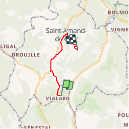
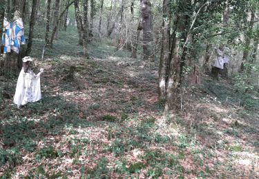
Trail Walking of 5.9 km to be discovered at New Aquitaine, Dordogne, Saint-Geniès. This trail is proposed by tracegps.

Description

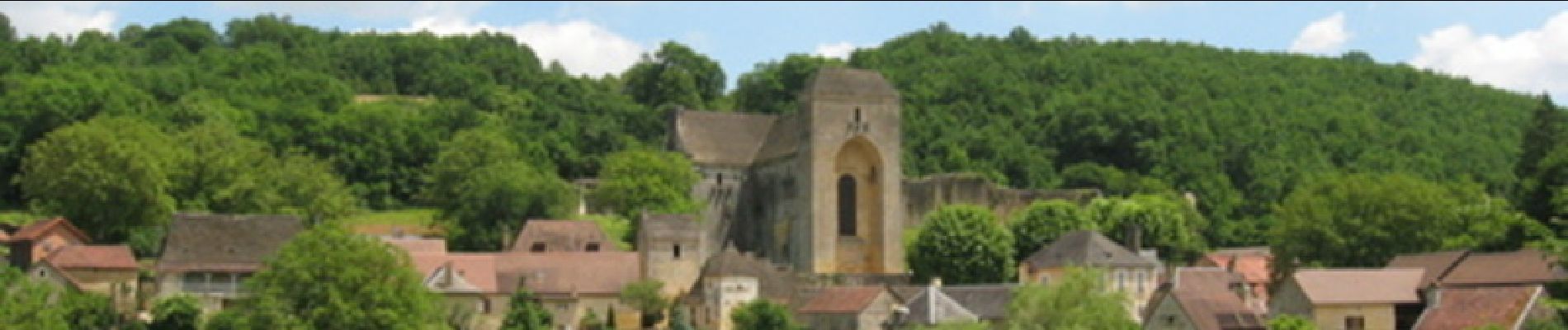
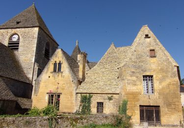
A une vingtaine de kilomètres de Sarlat et quelques pas de Lascaux, Saint-Amand-de-Coly s’est confortablement installé entre deux vallons boisés. Son abbatiale du XIIe siècle, considérée comme la plus belle église fortifiée du Périgord, veille sur les maisons du village qui, tout comme elle, sont faites de cette pierre sarladaise et de ces lauzes typiques de la région dans un contraste harmonieux de tons ocres et gris. (source Mairie de Saint Amand de Coly) Balade proposée par « Les Balades et Randonnées de Fred »

Elevation profile

Photos

Positioning

Country:
France
Region :
New Aquitaine
Department/Province :
Dordogne
Municipality :
Saint-Geniès
Location:
Unknown
Start:(Dec)
Start:(UTM)
361607 ; 4988201 (31T) N.

Trails nearby

Trail On foot Saint-Geniès - Boucle des Moulins - Photo
On foot
PRO

On foot

Easy
Saint-Geniès, New Aquitaine, Dordogne, France
8 km | 10.1 km-effort
2h 18min
Yes
Trail Walking La Chapelle-Aubareil - Lavoir de Valojoux - Photo
Walking
FPortier

Walking

Medium
La Chapelle-Aubareil, New Aquitaine, Dordogne, France
7.2 km | 9.4 km-effort
1h 53min
Yes
Trail Walking La Cassagne - rivière de Coly - Photo
Walking
GuyLab

Walking

Very easy
La Cassagne, New Aquitaine, Dordogne, France
5.4 km | 6.8 km-effort
2h 12min
Yes
Trail Walking Coly-Saint-Amand - vezere_19 - Photo
Walking
fanthou

Walking

Medium
(3)
Coly-Saint-Amand, New Aquitaine, Dordogne, France
8.2 km | 11.1 km-effort
2h 22min
Yes
Trail Mountain bike La Chapelle-Aubareil - montignac 230617 - Photo
Mountain bike
Julliengamo

Mountain bike

Difficult
La Chapelle-Aubareil, New Aquitaine, Dordogne, France
28 km | 35 km-effort
2h 25min
No
Trail Walking Saint-Geniès - Saint Génies 19-09-2020 - Photo
Walking
robinier

Walking

Saint-Geniès, New Aquitaine, Dordogne, France
4.5 km | 5.7 km-effort
2h 1min
Yes
Trail Walking Coly-Saint-Amand - Saint Amand de Coly  - Photo
Walking
alainjoseph6

Walking

Easy
Coly-Saint-Amand, New Aquitaine, Dordogne, France
1.6 km | 2.4 km-effort
1h 17min
Yes
Trail Walking Saint-Geniès - Saint-Geniès - Photo
Walking
tracegps

Walking

Medium
(3)
Saint-Geniès, New Aquitaine, Dordogne, France
9.9 km | 12.2 km-effort
2h 30min
Yes
Trail Mountain bike Coly-Saint-Amand - Dordogne 1 - Photo
Mountain bike
kerdi17

Mountain bike

Coly-Saint-Amand, New Aquitaine, Dordogne, France
18.4 km | 22 km-effort
1h 30min
Yes


Close
My subscriptions