Trail Walking Marmont-Pachas - Marmont-Pachas, sur le chemin des pélerins de St-Jacques - Pays de l'Agenais - Photo

Marmont-Pachas, sur le chemin des pélerins de St-Jacques - Pays de l'Agenais

 tracegps
tracegps

User

© OpenStreetMap contributors
Length
Length
13.4 km
Max alt
Max alt
193 m
Uphill gradient
Uphill gradient
292 m
Km-Effort
Km-Effort  
17.3 km
Min alt
Min alt
103 m
Downhill gradient
Downhill gradient
296 m
Boucle
Boucle
Yes
Creation date :
2014-12-10 00:00:00.0
Updated on :
2014-12-10 00:00:00.0

(0 Reviews)

Walking
Walking
3h30
Difficulty : Medium

Scan this QR Code to open this trail in the SityTrail application

FREE GPS app for hiking

Logo SityTrail SityTrail

IGN / Geographical institutes

Download SityTrail from the App Store Download SityTrail from Google Play

Logo SityTrail SityTrail World

The world is yours!

Download SityTrail from the App Store Download SityTrail from Google Play Download SityTrail on Huawei AppGallery

About

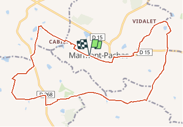
Trail Walking of 13.4 km to be discovered at New Aquitaine, Lot-et-Garonne, Marmont-Pachas. This trail is proposed by tracegps.

Description

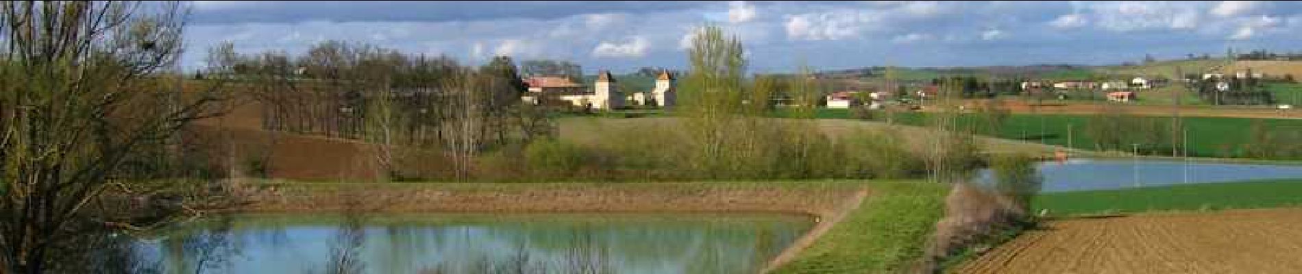
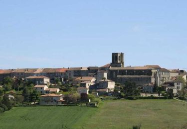
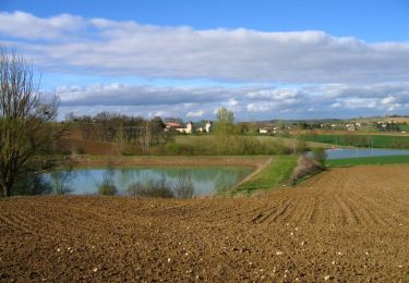
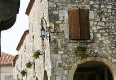
Marmont Pachas / sud C. C. du Canton de Laplume en Bruilhois. Marmont-Pachas, village sans bourg, se remarque par son église au clocher en pierre, rond et très effilé. C’est d’ici que démarre cette randonnée, à travers des coteaux arrondis très ouverts et qui accompagne les pèlerins de St-Jacques, de la ferme des Aouillès à l’ancien cimetière près de Curton. Téléchargez la fiche de cette randonnée sur le site du Tourisme du Lot et Garonne.

Elevation profile

Photos

Positioning

Country:
France
Region :
New Aquitaine
Department/Province :
Lot-et-Garonne
Municipality :
Marmont-Pachas
Location:
Unknown
Start:(UTM)
306253 ; 4884228 (31T) N.

Trails nearby

Trail On foot Lamontjoie - Lamontjoie, bastide de Gascogne 7.8 km - Photo
On foot
PRO

On foot

Easy
Lamontjoie, New Aquitaine, Lot-et-Garonne, France
7.5 km | 9.7 km-effort
2h 11min
No
Trail Walking Laplume - Laplume, le circuit des trois lavoirs - Pays de l'Agenais - Photo
Walking
tracegps

Walking

Medium
Laplume, New Aquitaine, Lot-et-Garonne, France
5.1 km | 7.1 km-effort
1h 30min
Yes
Trail Equestrian Laplume - Randonnée dans les coteaux du Bruilhois- Laplume - Photo
Equestrian
tracegps

Equestrian

Medium
Laplume, New Aquitaine, Lot-et-Garonne, France
16 km | 20 km-effort
2h 45min
Yes
Trail Mountain bike Laplume - Randonnée dans les coteaux du Bruilhois- Laplume - Photo
Mountain bike
tracegps

Mountain bike

Medium
Laplume, New Aquitaine, Lot-et-Garonne, France
16 km | 20 km-effort
2h 0min
Yes
Trail Walking Laplume - Randonnée dans les coteaux du Bruilhois- Laplume - Photo
Walking
tracegps

Walking

Difficult
Laplume, New Aquitaine, Lot-et-Garonne, France
16 km | 20 km-effort
4h 15min
Yes
Trail Equestrian Lamontjoie - Lamontjoie, un cheminement de Lot-et-Garonne en Gers - Pays d'Albret - Photo
Equestrian
tracegps

Equestrian

Medium
Lamontjoie, New Aquitaine, Lot-et-Garonne, France
13.5 km | 16.6 km-effort
2h 15min
Yes
Trail Mountain bike Lamontjoie - Lamontjoie, un cheminement de Lot-et-Garonne en Gers - Pays d'Albret - Photo
Mountain bike
tracegps

Mountain bike

Medium
Lamontjoie, New Aquitaine, Lot-et-Garonne, France
13.5 km | 16.6 km-effort
1h 45min
Yes
Trail Walking Lamontjoie - Lamontjoie, un cheminement de Lot-et-Garonne en Gers - Pays d'Albret - Photo
Walking
tracegps

Walking

Medium
Lamontjoie, New Aquitaine, Lot-et-Garonne, France
13.5 km | 16.6 km-effort
3h 30min
Yes
Trail Equestrian Lamontjoie - Lamontjoie, bastide de Gascogne - Pays d'Albret - Photo
Equestrian
tracegps

Equestrian

Medium
Lamontjoie, New Aquitaine, Lot-et-Garonne, France
7.8 km | 10 km-effort
1h 19min
Yes


Close
My subscriptions