Trail Walking Couthures-sur-Garonne - Couthures, la promenade des Gens de Garonne - Pays Val de Garonne - Gascogne - Photo

Couthures, la promenade des Gens de Garonne - Pays Val de Garonne - Gascogne

 tracegps
tracegps

User

© OpenStreetMap contributors
Length
Length
4.7 km
Max alt
Max alt
30 m
Uphill gradient
Uphill gradient
40 m
Km-Effort
Km-Effort  
5.2 km
Min alt
Min alt
13 m
Downhill gradient
Downhill gradient
42 m
Boucle
Boucle
Yes
Creation date :
2014-12-10 00:00:00.0
Updated on :
2014-12-10 00:00:00.0

(1 Reviews)

Walking
Walking
1h40
Difficulty : Easy

Scan this QR Code to open this trail in the SityTrail application

FREE GPS app for hiking

Logo SityTrail SityTrail

IGN / Geographical institutes

Download SityTrail from the App Store Download SityTrail from Google Play

Logo SityTrail SityTrail World

The world is yours!

Download SityTrail from the App Store Download SityTrail from Google Play Download SityTrail on Huawei AppGallery

About

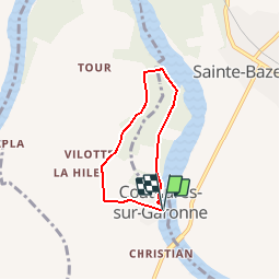
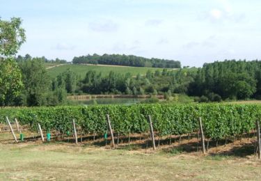
Trail Walking of 4.7 km to be discovered at New Aquitaine, Lot-et-Garonne, Couthures-sur-Garonne. This trail is proposed by tracegps.

Description

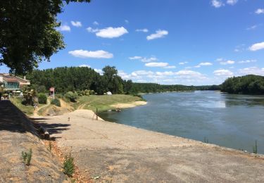
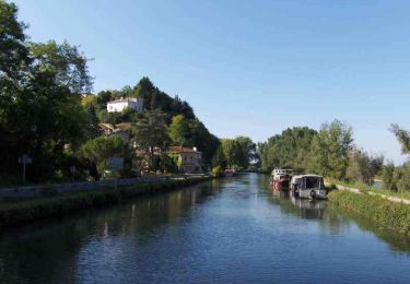
Couthures sur Garonne Cté de Communes Val de Garonne. Cette petite boucle démarre de la place de la Calle, près de l’église, suit la grande boucle du fleuve et se termine par une visite à « Gens de Garonne », musée, scénovision et maquette des crues. Téléchargez la fiche de cette randonnée sur le site du Tourisme du Lot et Garonne. Gens de garonne par CDT47

Elevation profile

Photos

Positioning

Country:
France
Region :
New Aquitaine
Department/Province :
Lot-et-Garonne
Municipality :
Couthures-sur-Garonne
Location:
Unknown
Start:(UTM)
267887 ; 4933061 (31T) N.

Comments

Please log in to post a review or rate the element


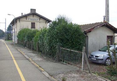
sympa, mais on ne voit presque jamais la garonne. ne pas hesiter à suivre les digues. très boueux en cette saison.


Trails nearby

Trail Walking Jusix - Jusix - Photo
Walking
Briarwood

Walking

Very easy
Jusix, New Aquitaine, Lot-et-Garonne, France
7.9 km | 8.2 km-effort
2h 18min
Yes
Trail Walking Sainte-Bazeille - couthures  - Photo
Walking
sandrineh

Walking

Very easy
Sainte-Bazeille, New Aquitaine, Lot-et-Garonne, France
6.3 km | 6.9 km-effort
2h 58min
Yes
Trail Walking Sainte-Bazeille - couthures  - Photo
Walking
sandrineh

Walking

Very easy
Sainte-Bazeille, New Aquitaine, Lot-et-Garonne, France
6.3 km | 6.9 km-effort
2h 58min
Yes
Trail Walking Meilhan-sur-Garonne - Meillhan sur Garonne - Photo
Walking
Briarwood

Walking

Easy
Meilhan-sur-Garonne, New Aquitaine, Lot-et-Garonne, France
4.6 km | 5.7 km-effort
1h 31min
Yes
Trail Walking Sainte-Bazeille - Sainte-Bazeille, Paysage et Archéologie - Pays Val de Garonne - Gascogne - Photo
Walking
tracegps

Walking

Easy
Sainte-Bazeille, New Aquitaine, Lot-et-Garonne, France
3.4 km | 3.9 km-effort
1h 15min
Yes
Trail Mountain bike Meilhan-sur-Garonne - Meilhan, entre Canal et Garonne - Pays Val de Garonne - Gascogne - Photo
Mountain bike
tracegps

Mountain bike

Easy
Meilhan-sur-Garonne, New Aquitaine, Lot-et-Garonne, France
5.8 km | 7 km-effort
45min
Yes
Trail Walking Meilhan-sur-Garonne - Meilhan, entre Canal et Garonne - Pays Val de Garonne - Gascogne - Photo
Walking
tracegps

Walking

Easy
Meilhan-sur-Garonne, New Aquitaine, Lot-et-Garonne, France
5.8 km | 7 km-effort
2h 0min
Yes
Trail Mountain bike Marcellus - Marcellus et la Vénus de Milo - Pays Val de Garonne - Gascogne - Photo
Mountain bike
tracegps

Mountain bike

Easy
Marcellus, New Aquitaine, Lot-et-Garonne, France
4.9 km | 5.8 km-effort
40min
Yes
Trail Walking Marcellus - Marcellus et la Vénus de Milo - Pays Val de Garonne - Gascogne - Photo
Walking
tracegps

Walking

Easy
Marcellus, New Aquitaine, Lot-et-Garonne, France
4.9 km | 5.8 km-effort
1h 40min
Yes


Close
My subscriptions