Trail Walking Villeneuve-sur-Lot - Villeneuve-sur-Lot, la visite de la Bastide - Pays de la vallée du Lot - Photo

Villeneuve-sur-Lot, la visite de la Bastide - Pays de la vallée du Lot

 tracegps
tracegps

User

© OpenStreetMap contributors
Length
Length
3.4 km
Max alt
Max alt
62 m
Uphill gradient
Uphill gradient
36 m
Km-Effort
Km-Effort  
3.9 km
Min alt
Min alt
43 m
Downhill gradient
Downhill gradient
36 m
Boucle
Boucle
Yes
Creation date :
2014-12-10 00:00:00.0
Updated on :
2014-12-10 00:00:00.0

(1 Reviews)

Walking
Walking
1h15
Difficulty : Easy

Scan this QR Code to open this trail in the SityTrail application

FREE GPS app for hiking

Logo SityTrail SityTrail

IGN / Geographical institutes

Download SityTrail from the App Store Download SityTrail from Google Play

Logo SityTrail SityTrail World

The world is yours!

Download SityTrail from the App Store Download SityTrail from Google Play Download SityTrail on Huawei AppGallery

About

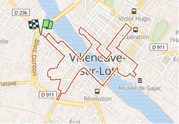
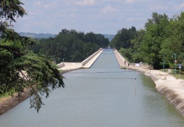
Trail Walking of 3.4 km to be discovered at New Aquitaine, Lot-et-Garonne, Villeneuve-sur-Lot. This trail is proposed by tracegps.

Description

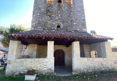
Villeneuve sur Lot / Bastide Cté de Communes du Villeneuvois. Du Pont Vieux au Pont Neuf, de la Porte de Paris à celle de Pujols, ce parcours dans la ville vous fera découvrir les hauts lieux historiques de cette bastide créée en 1264 par Alphonse de Poitiers. Téléchargez la fiche de cette randonnée sur le site du Tourisme du Lot et Garonne.

Elevation profile

Photos

Positioning

Country:
France
Region :
New Aquitaine
Department/Province :
Lot-et-Garonne
Municipality :
Villeneuve-sur-Lot
Location:
Unknown
Start:(UTM)
316848 ; 4919700 (31T) N.

Comments

Please log in to post a review or rate the element


Trails nearby

Trail Walking Pujols - Cambes, un circuit autour d'une combe boisée - Pays de la vallée du Lot - Photo
Walking
tracegps

Walking

Easy
(1)
Pujols, New Aquitaine, Lot-et-Garonne, France
4.2 km | 5.7 km-effort
1h 15min
Yes
Trail Walking Pujols - Pujols, panoramas sur les vallées du Lot et du Mail - Pays de la vallée du Lot - Photo
Walking
tracegps

Walking

Difficult
(1)
Pujols, New Aquitaine, Lot-et-Garonne, France
11.7 km | 17.3 km-effort
3h 15min
Yes
Trail On foot Pujols - Pujols - Vallée de la Mail - 10.5 - Photo
On foot
PRO

On foot

Easy
Pujols, New Aquitaine, Lot-et-Garonne, France
7.3 km | 11.3 km-effort
2h 33min
Yes
Trail On foot Pujols - Pujols - Petit-Tour - 5,5km - Photo
On foot
PRO

On foot

Easy
Pujols, New Aquitaine, Lot-et-Garonne, France
5 km | 7.4 km-effort
1h 40min
No
Trail Walking Pujols - La balade de Pujols 47 - Photo
Walking
alainjoseph6

Walking

Very easy
Pujols, New Aquitaine, Lot-et-Garonne, France
7.7 km | 11.7 km-effort
3h 5min
Yes
Trail Cycle Villeneuve-sur-Lot - de Villeneuve sur Lot à Moissac en passant par Aiguillon - Photo
Cycle
destras

Cycle

Medium
Villeneuve-sur-Lot, New Aquitaine, Lot-et-Garonne, France
129 km | 143 km-effort
6h 0min
No
Trail Walking Bias - La balade de Senelles - Bias - Photo
Walking
tracegps

Walking

Easy
Bias, New Aquitaine, Lot-et-Garonne, France
4.4 km | 4.8 km-effort
1h 30min
Yes
Trail Walking Pujols - Cambes Pujols - Photo
Walking
jacaimee

Walking

Easy
Pujols, New Aquitaine, Lot-et-Garonne, France
11.9 km | 14.9 km-effort
2h 54min
Yes
Trail On foot Pujols - Cambes-de-Pujols, la randonnée du Cap de l’Homme - 11,8km - Photo
On foot
PRO

On foot

Easy
Pujols, New Aquitaine, Lot-et-Garonne, France
11.8 km | 14.8 km-effort
3h 22min
Yes


Close
My subscriptions