Trail Walking Pomps - De Castillon à Arthez de Béarn - Photo

De Castillon à Arthez de Béarn

 tracegps
tracegps

User

© OpenStreetMap contributors
Length
Length
8.1 km
Max alt
Max alt
213 m
Uphill gradient
Uphill gradient
166 m
Km-Effort
Km-Effort  
10 km
Min alt
Min alt
131 m
Downhill gradient
Downhill gradient
89 m
Boucle
Boucle
No
Creation date :
2014-12-10 00:00:00.0
Updated on :
2014-12-10 00:00:00.0

(0 Reviews)

Walking
Walking
1h45
Difficulty : Medium

Scan this QR Code to open this trail in the SityTrail application

FREE GPS app for hiking

Logo SityTrail SityTrail

IGN / Geographical institutes

Download SityTrail from the App Store Download SityTrail from Google Play

Logo SityTrail SityTrail World

The world is yours!

Download SityTrail from the App Store Download SityTrail from Google Play Download SityTrail on Huawei AppGallery

About

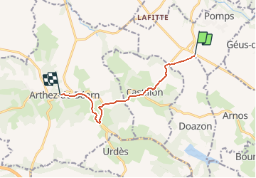
Trail Walking of 8.1 km to be discovered at New Aquitaine, Pyrénées-Atlantiques, Pomps. This trail is proposed by tracegps.

Description

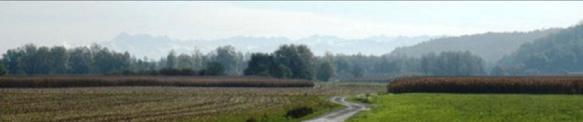
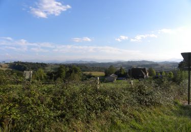
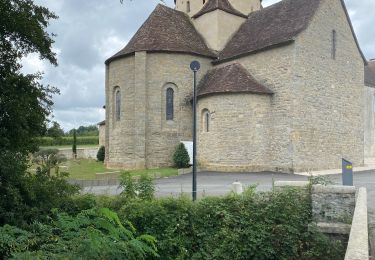
A la belle saison, ce sentier irrigue les coteaux et les vallons de la région d´Arthez-de-Béarn d´un flux régulier de Pèlerins se dirigeant vers Compostelle. Ce parcours emprunte la Voie du Puy en traversant le Sud-Ouest en diagonale. C´est le premier qui fut remis au goût du jour par les bénévoles de la randonnée. Pour ceux qui marchent d´étape à étape, il est utile de signaler que ce tronçon de chemin est issu d´Arzacq et de Pomps. Retrouvez d’autres informations et la fiche descriptive sur le site Pays Basque et Béarn.

Elevation profile

Photos

Positioning

Country:
France
Region :
New Aquitaine
Department/Province :
Pyrénées-Atlantiques
Municipality :
Pomps
Location:
Unknown
Start:(UTM)
698020 ; 4816919 (30T) N.

Trails nearby

Trail Walking Morlanne - MORLANNE les palombieres   G4   313 33 43 - Photo
Walking
GUIDE
marmotte65

Walking

Difficult
(1)
Morlanne, New Aquitaine, Pyrénées-Atlantiques, France
12.3 km | 16.4 km-effort
3h 33min
Yes
Trail Walking Castillon - CC_Velay_FD_27_Castillon_Sauvelade_20081112 - Photo
Walking
patrickdanilo

Walking

Easy
Castillon, New Aquitaine, Pyrénées-Atlantiques, France
22 km | 27 km-effort
5h 15min
No
Trail Walking Pomps - Mon Compostelle quatorzième étape - Photo
Walking
Ardeiserois

Walking

Very difficult
Pomps, New Aquitaine, Pyrénées-Atlantiques, France
55 km | 68 km-effort
10h 45min
No
Trail Walking Arthez-de-Béarn - GR 65 Artez en Béarn > Sauvelade  - Photo
Walking
choubaka77

Walking

Easy
Arthez-de-Béarn, New Aquitaine, Pyrénées-Atlantiques, France
19.5 km | 23 km-effort
4h 48min
No
Trail Walking Morlanne - MORLANNE Terra aventura     2899492 - Photo
Walking
GUIDE
marmotte65

Walking

Easy
Morlanne, New Aquitaine, Pyrénées-Atlantiques, France
2.3 km | 2.7 km-effort
47min
Yes
Trail Walking Pomps - 6 pomps - Photo
Walking
GUIDE
thonyc

Walking

Difficult
Pomps, New Aquitaine, Pyrénées-Atlantiques, France
27 km | 33 km-effort
7h 47min
No
Trail Walking Pomps - arzacq arraziguet-pomps - Photo
Walking
Compostel61

Walking

Very easy
Pomps, New Aquitaine, Pyrénées-Atlantiques, France
21 km | 27 km-effort
5h 51min
No
Trail Walking Casteide-Candau - Compostelle 29 - Casteide -> Maslacq - Photo
Walking
uru2010

Walking

Medium
Casteide-Candau, New Aquitaine, Pyrénées-Atlantiques, France
25 km | 29 km-effort
6h 12min
No
Trail Walking Pomps - StJ-J41-Pomps-Sauvelade - Photo
Walking
Bonsaicd

Walking

Very difficult
Pomps, New Aquitaine, Pyrénées-Atlantiques, France
27 km | 33 km-effort
4h 53min
No


Close
My subscriptions