Trail Walking Oloron-Sainte-Marie - Chemin du Piémont Pyrénéen - De Oloron Sainte Marie à L'Hopital St Blaise - Photo

Chemin du Piémont Pyrénéen - De Oloron Sainte Marie à L'Hopital St Blaise

 tracegps
tracegps

User

© OpenStreetMap contributors
Length
Length
22 km
Max alt
Max alt
258 m
Uphill gradient
Uphill gradient
311 m
Km-Effort
Km-Effort  
27 km
Min alt
Min alt
153 m
Downhill gradient
Downhill gradient
392 m
Boucle
Boucle
No
Creation date :
2014-12-10 00:00:00.0
Updated on :
2014-12-10 00:00:00.0

(0 Reviews)

Walking
Walking
5h45
Difficulty : Difficult

Scan this QR Code to open this trail in the SityTrail application

FREE GPS app for hiking

Logo SityTrail SityTrail

IGN / Geographical institutes

Download SityTrail from the App Store Download SityTrail from Google Play

Logo SityTrail SityTrail World

The world is yours!

Download SityTrail from the App Store Download SityTrail from Google Play Download SityTrail on Huawei AppGallery

About

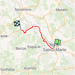
Trail Walking of 22 km to be discovered at New Aquitaine, Pyrénées-Atlantiques, Oloron-Sainte-Marie. This trail is proposed by tracegps.

Description

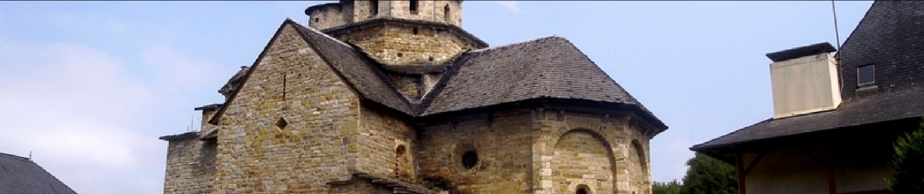
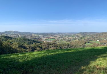
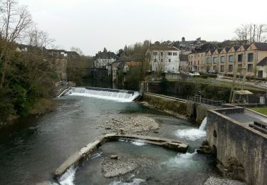
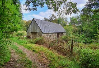
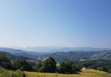
Le sentier la "Voie de Piémont" poursuit sa progression vers l´ouest, traversant des paysages de plaines et de coteaux boisés avec vue sur les montagnes toujours présentes. Au passage, il nous donne à voir des villages, véritables petites perles d´architecture et d´histoire, tels Moumour, Aren et enfin l´Hôpital- Saint-Blaise, haut lieu de la tradition jacquaire. Retrouvez d’autres informations et la fiche descriptive sur le site Pays Basque et Béarn.

Elevation profile

Photos

Positioning

Country:
France
Region :
New Aquitaine
Department/Province :
Pyrénées-Atlantiques
Municipality :
Oloron-Sainte-Marie
Location:
Unknown
Start:(UTM)
693707 ; 4784397 (30T) N.

Trails nearby

Trail Walking Oloron-Sainte-Marie - 2023 10 12 CHEMIN du PIÉMONT PYRÉNÉEN - 20ème étape 1ere partie  : Oloron-Ste-Marie - Moumour - Orin - Géronce - St Goin - Gëus d’Oloron - l’Hopital st Blaise - Mauléon-Lichare. - Photo
Walking
LEGUE

Walking

Difficult
Oloron-Sainte-Marie, New Aquitaine, Pyrénées-Atlantiques, France
42 km | 54 km-effort
18h 1min
No
Trail Walking Oloron-Sainte-Marie - OLORON ST MARIE Terra aventura    - Photo
Walking
GUIDE
marmotte65

Walking

Very easy
Oloron-Sainte-Marie, New Aquitaine, Pyrénées-Atlantiques, France
4.6 km | 6.1 km-effort
3h 18min
Yes
Trail On foot Oloron-Sainte-Marie - OLORON Ecomobilité
On foot
GUIDE
marmotte65

On foot

Medium
Oloron-Sainte-Marie, New Aquitaine, Pyrénées-Atlantiques, France
15.5 km | 20 km-effort
4h 20min
Yes
Trail Mountain bike Estos - Tour crètes jusqu'à Louvie - Photo
Mountain bike
claudemen

Mountain bike

Very difficult
(1)
Estos, New Aquitaine, Pyrénées-Atlantiques, France
58 km | 70 km-effort
4h 49min
No
Trail Walking Escout - Pont du Diable - Photo
Walking
HaschKnight

Walking

Easy
Escout, New Aquitaine, Pyrénées-Atlantiques, France
5.6 km | 6.6 km-effort
57min
Yes
Trail Bicycle tourism Oloron-Sainte-Marie - Oloron - St-Palais - Photo
Bicycle tourism
karawatsj

Bicycle tourism

Difficult
Oloron-Sainte-Marie, New Aquitaine, Pyrénées-Atlantiques, France
55 km | 67 km-effort
3h 22min
No
Trail Walking Goès - hors G4 fait - Photo
Walking
LouisROGER

Walking

Very easy
Goès, New Aquitaine, Pyrénées-Atlantiques, France
8.9 km | 12.1 km-effort
4h 36min
Yes
Trail Walking Oloron-Sainte-Marie - oloron ste marie - Photo
Walking
penaud

Walking

Very easy
Oloron-Sainte-Marie, New Aquitaine, Pyrénées-Atlantiques, France
4.9 km | 6.1 km-effort
2h 8min
Yes
Trail Walking Oloron-Sainte-Marie - Chemin d'Arles à Compostelle - Oloron Ste Marie - Sarrance - Photo
Walking
tracegps

Walking

Medium
Oloron-Sainte-Marie, New Aquitaine, Pyrénées-Atlantiques, France
22 km | 28 km-effort
5h 30min
No


Close
My subscriptions