Trail Bicycle tourism Oloron-Sainte-Marie - Oloron - St-Palais - Photo
© OpenStreetMap contributors
Length
Length
55 km
Max alt
Max alt
408 m
Uphill gradient
Uphill gradient
848 m
Km-Effort
Km-Effort  
67 km
Min alt
Min alt
48 m
Downhill gradient
Downhill gradient
1018 m
Boucle
Boucle
No
Creation date :
2019-07-04 07:00:47.874
Updated on :
2019-07-04 15:47:10.213

(0 Reviews)

Bicycle tourism
Bicycle tourism
3h22
Difficulty : Difficult

Scan this QR Code to open this trail in the SityTrail application

FREE GPS app for hiking

Logo SityTrail SityTrail

IGN / Geographical institutes

Download SityTrail from the App Store Download SityTrail from Google Play

Logo SityTrail SityTrail World

The world is yours!

Download SityTrail from the App Store Download SityTrail from Google Play Download SityTrail on Huawei AppGallery

About

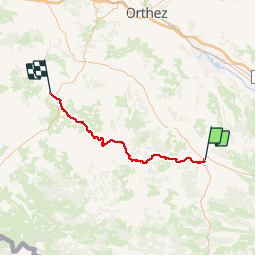
Trail Bicycle tourism of 55 km to be discovered at New Aquitaine, Pyrénées-Atlantiques, Oloron-Sainte-Marie. This trail is proposed by karawatsj.

Description

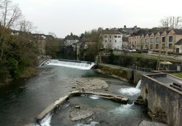
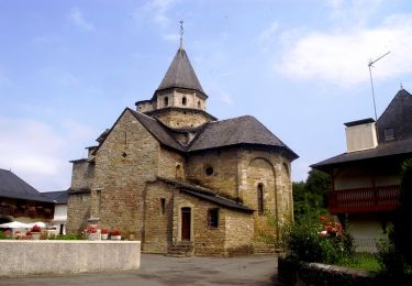
We verlaten Oloron langs de kathedraal Ste Marie met Romaans portaal (12e eeuw) in de richting Mauléon via de D24. Mauléon is de hoofdstad van Soule een baskische provincie.

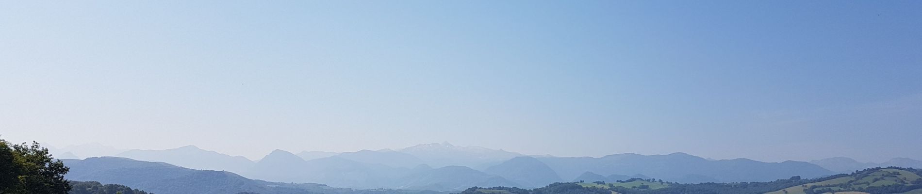
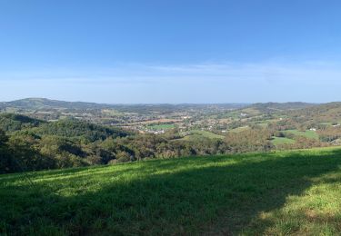
We beginnen al snel te klimmen en boven kunnen we genieten van prachtige vergezichten.

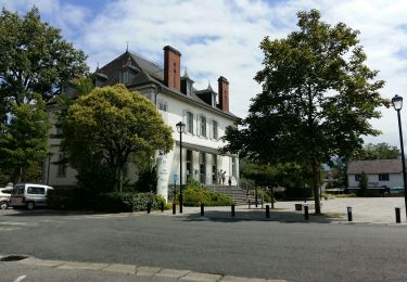
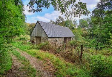
We komen snel in Baskenland. Dit is te merken aan de typische gebouwen met rode luiken en vensters. Blijkbaar een traditie uit de tijd dat die houten onderdelen geschilderd werden, tegen verwering, met ossenbloed.

In elk dorpje staat er ook een (meestal roos geverfde) muur als kaatsmuur van dé nationale sport van de Basken "pelote". Iets vergelijkbaar met squash maar met een lederen bal en een speciale handschoen. Vroeger werd er zwaar op gegokt. Nu kan men er ook nog op inzetten.

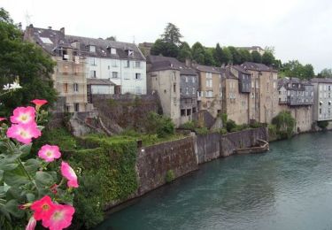
De dorpen en steden zijn uitzonderlijk mooi verzorgd en proper.

We dalen weer af naar Mauléon. 

Dan wordt het weer flink stijgen en dalen langs de D242 tot St-Palais.

Elevation profile

Photos

Positioning

Country:
France
Region :
New Aquitaine
Department/Province :
Pyrénées-Atlantiques
Municipality :
Oloron-Sainte-Marie
Location:
Unknown
Start:(UTM)
694005 ; 4785071 (30T) N.

Trails nearby

Trail Walking Oloron-Sainte-Marie - 2023 10 12 CHEMIN du PIÉMONT PYRÉNÉEN - 20ème étape 1ere partie  : Oloron-Ste-Marie - Moumour - Orin - Géronce - St Goin - Gëus d’Oloron - l’Hopital st Blaise - Mauléon-Lichare. - Photo
Walking
LEGUE

Walking

Difficult
Oloron-Sainte-Marie, New Aquitaine, Pyrénées-Atlantiques, France
42 km | 54 km-effort
18h 1min
No
Trail Walking Oloron-Sainte-Marie - OLORON ST MARIE Terra aventura    - Photo
Walking
GUIDE
marmotte65

Walking

Very easy
Oloron-Sainte-Marie, New Aquitaine, Pyrénées-Atlantiques, France
4.6 km | 6.1 km-effort
3h 18min
Yes
Trail On foot Oloron-Sainte-Marie - OLORON Ecomobilité
On foot
GUIDE
marmotte65

On foot

Medium
Oloron-Sainte-Marie, New Aquitaine, Pyrénées-Atlantiques, France
15.5 km | 20 km-effort
4h 20min
Yes
Trail Mountain bike Estos - Tour crètes jusqu'à Louvie - Photo
Mountain bike
claudemen

Mountain bike

Very difficult
(1)
Estos, New Aquitaine, Pyrénées-Atlantiques, France
58 km | 70 km-effort
4h 49min
No
Trail Walking Escout - Pont du Diable - Photo
Walking
HaschKnight

Walking

Easy
Escout, New Aquitaine, Pyrénées-Atlantiques, France
5.6 km | 6.6 km-effort
57min
Yes
Trail Walking Goès - hors G4 fait - Photo
Walking
LouisROGER

Walking

Very easy
Goès, New Aquitaine, Pyrénées-Atlantiques, France
8.9 km | 12.1 km-effort
4h 36min
Yes
Trail Walking Oloron-Sainte-Marie - oloron ste marie - Photo
Walking
penaud

Walking

Very easy
Oloron-Sainte-Marie, New Aquitaine, Pyrénées-Atlantiques, France
4.9 km | 6.1 km-effort
2h 8min
Yes
Trail Walking Oloron-Sainte-Marie - Chemin du Piémont Pyrénéen - De Oloron Sainte Marie à L'Hopital St Blaise - Photo
Walking
tracegps

Walking

Difficult
Oloron-Sainte-Marie, New Aquitaine, Pyrénées-Atlantiques, France
22 km | 27 km-effort
5h 45min
No
Trail Walking Oloron-Sainte-Marie - Chemin d'Arles à Compostelle - Oloron Ste Marie - Sarrance - Photo
Walking
tracegps

Walking

Medium
Oloron-Sainte-Marie, New Aquitaine, Pyrénées-Atlantiques, France
22 km | 28 km-effort
5h 30min
No


Close
My subscriptions