Trail Walking Saint-Quentin-la-Chabanne - Sur la trace des canards - Saint-Quentin-la-Chabanne - Photo

Sur la trace des canards - Saint-Quentin-la-Chabanne

 tracegps
tracegps

User

© OpenStreetMap contributors
Length
Length
13.3 km
Max alt
Max alt
686 m
Uphill gradient
Uphill gradient
333 m
Km-Effort
Km-Effort  
17.7 km
Min alt
Min alt
541 m
Downhill gradient
Downhill gradient
333 m
Boucle
Boucle
Yes
Creation date :
2014-12-10 00:00:00.0
Updated on :
2014-12-10 00:00:00.0

(0 Reviews)

Walking
Walking
3h30
Difficulty : Difficult

Scan this QR Code to open this trail in the SityTrail application

FREE GPS app for hiking

Logo SityTrail SityTrail

IGN / Geographical institutes

Download SityTrail from the App Store Download SityTrail from Google Play

Logo SityTrail SityTrail World

The world is yours!

Download SityTrail from the App Store Download SityTrail from Google Play Download SityTrail on Huawei AppGallery

About

Trail Walking of 13.3 km to be discovered at New Aquitaine, Creuse, Saint-Quentin-la-Chabanne. This trail is proposed by tracegps.

Description

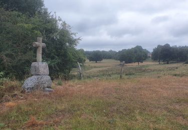
La Communauté de Communes Aubusson-Felletin vous propose ce circuit de randonnée entre Le Verminier et Hussard. Venez découvrir les paysages en bordure du plateau de Millevaches, où les dénivellations douces forment des vallées accessibles mélangeant bois et prairies. Les collines encadrent des fonds humides avec la présence de nombreuses sources, ruisseaux, étangs. Départ de Le Verminier, commune de à Saint-Quentin-la-Chabanne. Retrouvez ce circuit sur le site de la Communauté de Communes Aubusson-Felletin.

Elevation profile

Photos

Positioning

Country:
France
Region :
New Aquitaine
Department/Province :
Creuse
Municipality :
Saint-Quentin-la-Chabanne
Location:
Unknown
Start:(UTM)
433952 ; 5082576 (31T) N.

Trails nearby

Trail Walking Felletin - Vallées et châteaux - Felletin / St Frion - Photo
Walking
tracegps

Walking

Very difficult
(1)
Felletin, New Aquitaine, Creuse, France
19.8 km | 27 km-effort
5h 0min
Yes
Trail Mountain bike La Nouaille - rando vttæ le Cluzeau 14 08 22 - Photo
Mountain bike
marcagif

Mountain bike

Medium
La Nouaille, New Aquitaine, Creuse, France
37 km | 47 km-effort
3h 4min
Yes
Trail Walking Vallière - Le cluzeau rando 25 07 2020 - Photo
Walking
marcagif

Walking

Easy
Vallière, New Aquitaine, Creuse, France
11 km | 14.1 km-effort
2h 39min
No
Trail Walking Saint-Marc-à-Frongier - Montrujas - Photo
Walking
DanieleBocourt

Walking

Easy
Saint-Marc-à-Frongier, New Aquitaine, Creuse, France
3.3 km | 4.2 km-effort
51min
Yes
Trail Other activity Moutier-Rozeille - m - Photo
Other activity
mflamy

Other activity

Very easy
Moutier-Rozeille, New Aquitaine, Creuse, France
9.1 km | 11.5 km-effort
2h 1min
Yes
Trail Walking Felletin - felletin-1 - Photo
Walking
fanthou

Walking

Medium
Felletin, New Aquitaine, Creuse, France
10.6 km | 14 km-effort
2h 59min
Yes
Trail Walking Moutier-Rozeille - moutier-rozeille-2 - Photo
Walking
fanthou

Walking

Medium
Moutier-Rozeille, New Aquitaine, Creuse, France
7.8 km | 10.2 km-effort
2h 12min
Yes
Trail Walking Moutier-Rozeille - moutier-rozeille-1 - Photo
Walking
fanthou

Walking

Medium
Moutier-Rozeille, New Aquitaine, Creuse, France
6.8 km | 9.4 km-effort
2h 0min
Yes


Close
My subscriptions