Trail Mountain bike Saint-Pierre-de-Buzet - St Pierre de Buzet, la randonnée du Cap-du-Bosc - Pays d'Albret - Photo

St Pierre de Buzet, la randonnée du Cap-du-Bosc - Pays d'Albret

 tracegps
tracegps

User

© OpenStreetMap contributors
Length
Length
11.6 km
Max alt
Max alt
168 m
Uphill gradient
Uphill gradient
290 m
Km-Effort
Km-Effort  
15.5 km
Min alt
Min alt
73 m
Downhill gradient
Downhill gradient
290 m
Boucle
Boucle
Yes
Creation date :
2014-12-10 00:00:00.0
Updated on :
2014-12-10 00:00:00.0

(0 Reviews)

Mountain bike
Mountain bike
1h00
Difficulty : Medium

Scan this QR Code to open this trail in the SityTrail application

FREE GPS app for hiking

Logo SityTrail SityTrail

IGN / Geographical institutes

Download SityTrail from the App Store Download SityTrail from Google Play

Logo SityTrail SityTrail World

The world is yours!

Download SityTrail from the App Store Download SityTrail from Google Play Download SityTrail on Huawei AppGallery

About

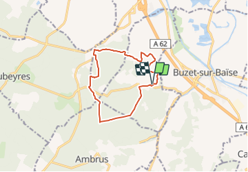
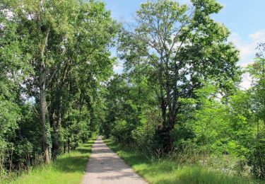
Trail Mountain bike of 11.6 km to be discovered at New Aquitaine, Lot-et-Garonne, Saint-Pierre-de-Buzet. This trail is proposed by tracegps.

Description

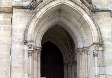
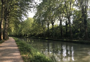
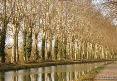
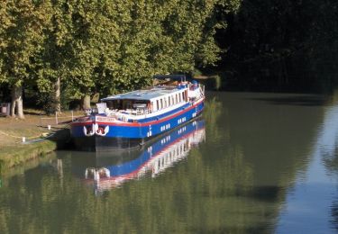
St-Pierre-de-Buzet, la randonnée du Cap-du-Bosc - Pays d'Albret. Saint Pierre de Buzet / Cap du Bosc Cté Com. du Val d’Albret En gascon, ce toponyme signifie l’extrémité du bois. Ce circuit en surplomb sur la vallée de la Garonne quitte les vignes pour entrer dans les landes. Il alterne panoramas et ambiance feutrée de la forêt. Téléchargez la fiche de cette randonnée sur le site du Tourisme du Lot et Garonne.

Elevation profile

Photos

Positioning

Country:
France
Region :
New Aquitaine
Department/Province :
Lot-et-Garonne
Municipality :
Saint-Pierre-de-Buzet
Location:
Unknown
Start:(Dec)
Start:(UTM)
282372 ; 4903756 (31T) N.

Trails nearby

Trail On foot Xaintrailles - Xaintrailles, la balade du château - 4.7 km - Photo
On foot
PRO

On foot

Easy
Xaintrailles, New Aquitaine, Lot-et-Garonne, France
4.6 km | 5.9 km-effort
1h 19min
Yes
Trail On foot Buzet-sur-Baïse - Buzet, un port entre Canal et Baïse - 13.1 km - Photo
On foot
PRO

On foot

Easy
Buzet-sur-Baïse, New Aquitaine, Lot-et-Garonne, France
6.8 km | 7.6 km-effort
1h 43min
No
Trail On foot Buzet-sur-Baïse - Buzet-sur-Baïse, randonnée autour du Château - 11.1 km - Photo
On foot
PRO

On foot

Easy
Buzet-sur-Baïse, New Aquitaine, Lot-et-Garonne, France
11.7 km | 14.3 km-effort
3h 15min
Yes
Trail On foot Saint-Pierre-de-Buzet - Saint-Pierre-de-Buzet, vignes, pins et chênes lièges - 6.5 km - Photo
On foot
PRO

On foot

Easy
Saint-Pierre-de-Buzet, New Aquitaine, Lot-et-Garonne, France
6.4 km | 8.5 km-effort
1h 56min
Yes
Trail On foot Vianne - Buzet, un pont-canal sur la Baïse - 8.5 km - Photo
On foot
PRO

On foot

Easy
Vianne, New Aquitaine, Lot-et-Garonne, France
5.9 km | 6.3 km-effort
1h 26min
No
Trail Hybrid bike Damazan - Canal de la Garonne  - Photo
Hybrid bike
Domie38

Hybrid bike

Easy
Damazan, New Aquitaine, Lot-et-Garonne, France
12.9 km | 14.2 km-effort
1h 37min
Yes
Trail Mountain bike Damazan - La bastide du Canal de Garonne - Damazan - Photo
Mountain bike
tracegps

Mountain bike

Easy
Damazan, New Aquitaine, Lot-et-Garonne, France
9.7 km | 10.8 km-effort
1h 15min
Yes
Trail Walking Damazan - La bastide du Canal de Garonne - Damazan - Photo
Walking
tracegps

Walking

Medium
Damazan, New Aquitaine, Lot-et-Garonne, France
9.7 km | 10.8 km-effort
2h 30min
Yes
Trail Walking Buzet-sur-Baïse - Buzet-sur-Baïse, un pont-canal sur la Baïse - Photo
Walking
tracegps

Walking

Medium
Buzet-sur-Baïse, New Aquitaine, Lot-et-Garonne, France
9 km | 9.7 km-effort
2h 45min
Yes


Close
My subscriptions