Trail Walking La Chapelle-Moulière - Promenade buissonnière - La chapelle Moulière (version courte)   - Photo

Promenade buissonnière - La chapelle Moulière (version courte)

 tracegps
tracegps

User

© OpenStreetMap contributors
Length
Length
13.3 km
Max alt
Max alt
122 m
Uphill gradient
Uphill gradient
165 m
Km-Effort
Km-Effort  
15.5 km
Min alt
Min alt
62 m
Downhill gradient
Downhill gradient
165 m
Boucle
Boucle
Yes
Creation date :
2014-12-10 00:00:00.0
Updated on :
2014-12-10 00:00:00.0

(0 Reviews)

Walking
Walking
3h19
Difficulty : Difficult

Scan this QR Code to open this trail in the SityTrail application

FREE GPS app for hiking

Logo SityTrail SityTrail

IGN / Geographical institutes

Download SityTrail from the App Store Download SityTrail from Google Play

Logo SityTrail SityTrail World

The world is yours!

Download SityTrail from the App Store Download SityTrail from Google Play Download SityTrail on Huawei AppGallery

About

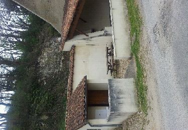
Trail Walking of 13.3 km to be discovered at New Aquitaine, Vienne, La Chapelle-Moulière. This trail is proposed by tracegps.

Description

Circuit proposé par la Communauté de Communes de Vienne et Moulière . Départ de la mairie de La chapelle Moulière

Elevation profile

Photos

Positioning

Country:
France
Region :
New Aquitaine
Department/Province :
Vienne
Municipality :
La Chapelle-Moulière
Location:
Unknown
Start:(UTM)
313670 ; 5169218 (31T) N.

Trails nearby

Trail Walking Liniers - Le vétérinaire en visite - Liniers - Photo
Walking
tracegps

Walking

Very difficult
Liniers, New Aquitaine, Vienne, France
17 km | 19 km-effort
4h 15min
Yes
Trail Walking Bonneuil-Matours - 2012-04-09 17h56m20 - Photo
Walking
Jpr75015

Walking

Medium
Bonneuil-Matours, New Aquitaine, Vienne, France
8 km | 9.1 km-effort
2h 52min
Yes
Trail Walking La Chapelle-Moulière - Promenade buissonnière - La chapelle Moulière - Photo
Walking
tracegps

Walking

Very difficult
La Chapelle-Moulière, New Aquitaine, Vienne, France
17.1 km | 20 km-effort
4h 15min
Yes
Trail Walking Liniers - Forêt Moulière 10 Km - Photo
Walking
Chomdu

Walking

Medium
Liniers, New Aquitaine, Vienne, France
9.3 km | 10.7 km-effort
2h 26min
Yes
Trail Equestrian Bonneuil-Matours - Forêt de Moulière - Photo
Equestrian
socrate86

Equestrian

Easy
Bonneuil-Matours, New Aquitaine, Vienne, France
344 km | 395 km-effort
46h 33min
No
Trail Mountain bike La Chapelle-Moulière - Zevtt - La Chapelle Mouliére - Photo
Mountain bike
kipoura

Mountain bike

Medium
La Chapelle-Moulière, New Aquitaine, Vienne, France
47 km | 56 km-effort
2h 30min
Yes
Trail Mountain bike Bonneuil-Matours - Zevtt - Bonneuil Matours 39 km - Photo
Mountain bike
kipoura

Mountain bike

Easy
Bonneuil-Matours, New Aquitaine, Vienne, France
39 km | 46 km-effort
2h 0min
Yes
Trail Mountain bike Bonneuil-Matours - Zevtt - Bonneuil Matours 41km - Photo
Mountain bike
kipoura

Mountain bike

Easy
Bonneuil-Matours, New Aquitaine, Vienne, France
42 km | 48 km-effort
2h 0min
Yes
Trail Mountain bike Bonneuil-Matours - Bonneuil - Montamisé par la Moulière - Photo
Mountain bike
tracegps

Mountain bike

Medium
Bonneuil-Matours, New Aquitaine, Vienne, France
38 km | 46 km-effort
2h 30min
Yes


Close
My subscriptions