


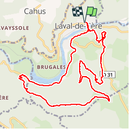


14 km | 17.5 km-effort


User


FREE GPS app for hiking
 SityTrail
IGN / Geographical institutes
SityTrail World
The world is yours!
Trail Walking of 13.5 km to be discovered at Occitania, Lot, Laval-de-Cère. This trail is proposed by neleda.


Walking

Walking


Walking

Mountain bike
Mountain bike
Mountain bike
Walking

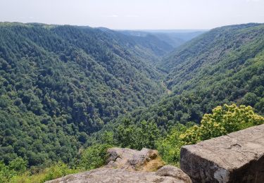
août 2019-belle ballade dans une forêt naturelle cadre superbe. balisage jaune 12 sur tout le parcours. je classe dans 'moyen' cf longueur et dénivelé.