Trail Walking Pavie - Autour de Pavie - Photo

Autour de Pavie

 tracegps
tracegps

User

© OpenStreetMap contributors
Length
Length
7.5 km
Max alt
Max alt
250 m
Uphill gradient
Uphill gradient
134 m
Km-Effort
Km-Effort  
9.3 km
Min alt
Min alt
137 m
Downhill gradient
Downhill gradient
136 m
Boucle
Boucle
Yes
Creation date :
2014-12-10 00:00:00.0
Updated on :
2014-12-10 00:00:00.0

(0 Reviews)

Walking
Walking
2h00
Difficulty : Medium

Scan this QR Code to open this trail in the SityTrail application

FREE GPS app for hiking

Logo SityTrail SityTrail

IGN / Geographical institutes

Download SityTrail from the App Store Download SityTrail from Google Play

Logo SityTrail SityTrail World

The world is yours!

Download SityTrail from the App Store Download SityTrail from Google Play Download SityTrail on Huawei AppGallery

About

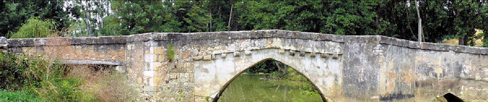
Trail Walking of 7.5 km to be discovered at Occitania, Gers, Pavie. This trail is proposed by tracegps.

Description

Jolie balade autour du Gers.

Elevation profile

Photos

Points of interest

Point of interest Pavie - 001 - Photo
tracegps
PAVIE 
Point of interest Pavie - 002 - Photo
tracegps
PAVIE 
Point of interest Pavie - 003 - Photo
tracegps
PAVIE 
Point of interest Pavie - 004 - Photo
tracegps
PAVIE 
Point of interest Pavie - 005 - Photo
tracegps
PAVIE 
Point of interest Pavie - 006 - Photo
tracegps
PAVIE 
Point of interest Pavie - 007 - Photo
tracegps
PAVIE 
Point of interest Pavie - 008 - Photo
tracegps
PAVIE 
Point of interest Pavie - 009 - Photo
tracegps
PAVIE 
Point of interest Pavie - 010 - Photo
tracegps
PAVIE 
Point of interest Pavie - 011 - Photo
tracegps
PAVIE 
Point of interest Pavie - 012 - Photo
tracegps
PAVIE 
Point of interest Pavie - 013 - Photo
tracegps
PAVIE 
Point of interest Pavie - 014 - Photo
tracegps
PAVIE 
Point of interest Pavie - 015 - Photo
tracegps
PAVIE 
Point of interest Pavie - 016 - Photo
tracegps
PAVIE 
Point of interest Pavie - 017 - Photo
tracegps
PAVIE 
Point of interest Pavie - 018 - Photo
tracegps
PAVIE 
Point of interest Pavie - 019 - Photo
tracegps
PAVIE 
Point of interest Pavie - 020 - Photo
tracegps
PAVIE 
Point of interest Pavie - 021 - Photo
tracegps
PAVIE 
Point of interest Pavie - 022 - Photo
tracegps
PAVIE 

Positioning

Country:
France
Region :
Occitania
Department/Province :
Gers
Municipality :
Pavie
Location:
Unknown
Start:(UTM)
305909 ; 4831454 (31T) N.

Trails nearby

Trail Bicycle tourism Auch - B - Auch - Coeurs de Gascogne - Photo
Bicycle tourism
potofe

Bicycle tourism

Medium
Auch, Occitania, Gers, France
129 km | 155 km-effort
Unknown
Yes
Trail Walking Pavie - Pavie PR2 - Photo
Walking
lataboge

Walking

Easy
Pavie, Occitania, Gers, France
9.8 km | 11.9 km-effort
Unknown
Yes
Trail Walking Pavie - Pavie  - Photo
Walking
Pascal Bernaud

Walking

Medium
Pavie, Occitania, Gers, France
6.3 km | 7.6 km-effort
1h 48min
Yes
Trail Walking Pavie - Pavie Auterive  - Photo
Walking
Pascal Bernaud

Walking

Medium
Pavie, Occitania, Gers, France
7 km | 8.4 km-effort
2h 8min
Yes
Trail Walking Pavie - Pavie - Photo
Walking
Pascal Bernaud

Walking

Difficult
Pavie, Occitania, Gers, France
10.8 km | 14.1 km-effort
3h 4min
Yes
Trail Walking Montégut - Étape 2 - Photo
Walking
Camsity

Walking

Very easy
Montégut, Occitania, Gers, France
27 km | 33 km-effort
22h 0min
No
Trail Walking Auch - 05.05.17 Auch  Montesquiou - Photo
Walking
donda

Walking

Very difficult
Auch, Occitania, Gers, France
31 km | 39 km-effort
8h 29min
No
Trail Walking Auch - S-J-AUCH-L''ISLE de NOE - Photo
Walking
CANON2

Walking

Medium
Auch, Occitania, Gers, France
24 km | 30 km-effort
6h 18min
No
Trail Walking Auch - auch1 - Photo
Walking
phil 26

Walking

Very easy
Auch, Occitania, Gers, France
1.3 km | 1.8 km-effort
25min
No


Close
My subscriptions