Trail Walking Saint-André-de-Valborgne - Sentier du col Salidès - Saint André de Valborgne - Photo

Sentier du col Salidès - Saint André de Valborgne

 tracegps
tracegps

User

© OpenStreetMap contributors
Length
Length
18 km
Max alt
Max alt
1101 m
Uphill gradient
Uphill gradient
738 m
Km-Effort
Km-Effort  
28 km
Min alt
Min alt
441 m
Downhill gradient
Downhill gradient
738 m
Boucle
Boucle
Yes
Creation date :
2014-12-10 00:00:00.0
Updated on :
2014-12-10 00:00:00.0

(2 Reviews)

Walking
Walking
6h00
Difficulty : Very difficult

Scan this QR Code to open this trail in the SityTrail application

FREE GPS app for hiking

Logo SityTrail SityTrail

IGN / Geographical institutes

Download SityTrail from the App Store Download SityTrail from Google Play

Logo SityTrail SityTrail World

The world is yours!

Download SityTrail from the App Store Download SityTrail from Google Play Download SityTrail on Huawei AppGallery

About

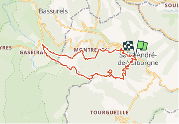
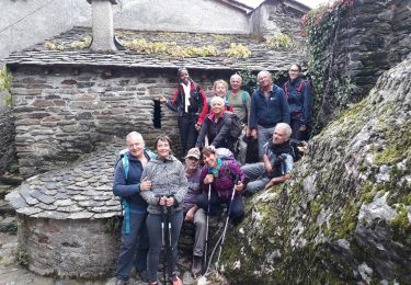
Trail Walking of 18 km to be discovered at Occitania, Gard, Saint-André-de-Valborgne. This trail is proposed by tracegps.

Description

Circuit proposé par l'Office de Tourisme de la Vallée Borgne. La balade du col Salidès chemine à la frontière du Gard et de la Lozère. Elle permet de contempler de vastes panoramas et de pénétrer, sur le parcours de la célèbre draille de Margeride, une jeune forêt complantée d’espèces très diverses. Départ de l'église Romane de St André de Valbogne. La pochette de 15 circuits balisés est en vente (5€) à l’Office de Tourisme de la Vallée Borgne. L’Office de Tourisme est ouvert toute l'année. Vous trouverez sur place de quoi se restaurer et dormir.

Elevation profile

Photos

Positioning

Country:
France
Region :
Occitania
Department/Province :
Gard
Municipality :
Saint-André-de-Valborgne
Location:
Unknown
Start:(Dec)
Start:(UTM)
554516 ; 4889488 (31T) N.

Comments

Please log in to post a review or rate the element


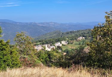
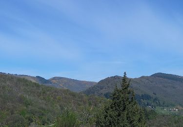
Très bon parcours, varié avec de beaux points de vue. Quelques repères effacés


Trails nearby

Trail Walking Les Plantiers - Sentier de Saint Marcel de Fontfouillouse -  Les Plantiers - Photo
Walking
tracegps

Walking

Very difficult
(1)
Les Plantiers, Occitania, Gard, France
13.6 km | 21 km-effort
4h 0min
Yes
Trail Walking Le Pompidou - Le Pompidou à l'Hospitalet  - Photo
Walking
GUIDE
nadinebondoux

Walking

Difficult
(1)
Le Pompidou, Occitania, Lozère, France
18.5 km | 26 km-effort
5h 34min
Yes
Trail Walking Saint-André-de-Valborgne - Col du Salidès  - Photo
Walking
GUIDE
nadinebondoux

Walking

Difficult
Saint-André-de-Valborgne, Occitania, Gard, France
18.9 km | 28 km-effort
5h 32min
Yes
Trail On foot Gabriac - Sentier de Gabriac - Photo
On foot
PRO

On foot

Easy
Gabriac, Occitania, Lozère, France
9.3 km | 15.5 km-effort
3h 31min
Yes
Trail Walking Les Plantiers - vallée Borgne - Photo
Walking
GUIDE
nadinebondoux

Walking

Difficult
Les Plantiers, Occitania, Gard, France
25 km | 36 km-effort
6h 15min
Yes
Trail Walking Saint-André-de-Valborgne - vallée Borgne - Photo
Walking
GUIDE
nadinebondoux

Walking

Difficult
Saint-André-de-Valborgne, Occitania, Gard, France
18.7 km | 30 km-effort
5h 44min
Yes
Trail Walking Saint-André-de-Valborgne - vallée Borgne - Photo
Walking
GUIDE
nadinebondoux

Walking

Difficult
Saint-André-de-Valborgne, Occitania, Gard, France
18.7 km | 30 km-effort
5h 44min
Yes
Trail Walking Bassurels - Aire de Côte - Mas Corbières - Photo
Walking
jeanluc.smets

Walking

Medium
(1)
Bassurels, Occitania, Lozère, France
13.9 km | 20 km-effort
4h 5min
No
Trail Walking Les Plantiers - Les Plantiers et st Marcel de Fontfouillouse - Photo
Walking
GUIDE
randotines

Walking

Difficult
(1)
Les Plantiers, Occitania, Gard, France
13.6 km | 21 km-effort
4h 33min
Yes


Close
My subscriptions