Trail Walking Corscia - Trek de Corscia à Castiglione en 4 jours - Photo

Trek de Corscia à Castiglione en 4 jours

 tracegps
tracegps

User

© OpenStreetMap contributors
Length
Length
31 km
Max alt
Max alt
2282 m
Uphill gradient
Uphill gradient
2641 m
Km-Effort
Km-Effort  
67 km
Min alt
Min alt
702 m
Downhill gradient
Downhill gradient
2808 m
Boucle
Boucle
No
Creation date :
2014-12-10 00:00:00.0
Updated on :
2014-12-10 00:00:00.0

(1 Reviews)

Walking
Walking
30h00
Difficulty : Very difficult

Scan this QR Code to open this trail in the SityTrail application

FREE GPS app for hiking

Logo SityTrail SityTrail

IGN / Geographical institutes

Download SityTrail from the App Store Download SityTrail from Google Play

Logo SityTrail SityTrail World

The world is yours!

Download SityTrail from the App Store Download SityTrail from Google Play Download SityTrail on Huawei AppGallery

About

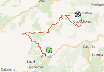
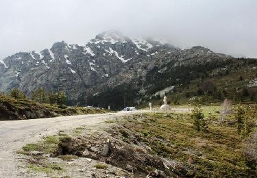
Trail Walking of 31 km to be discovered at Corsica, Haute-Corse, Corscia. This trail is proposed by tracegps.

Description

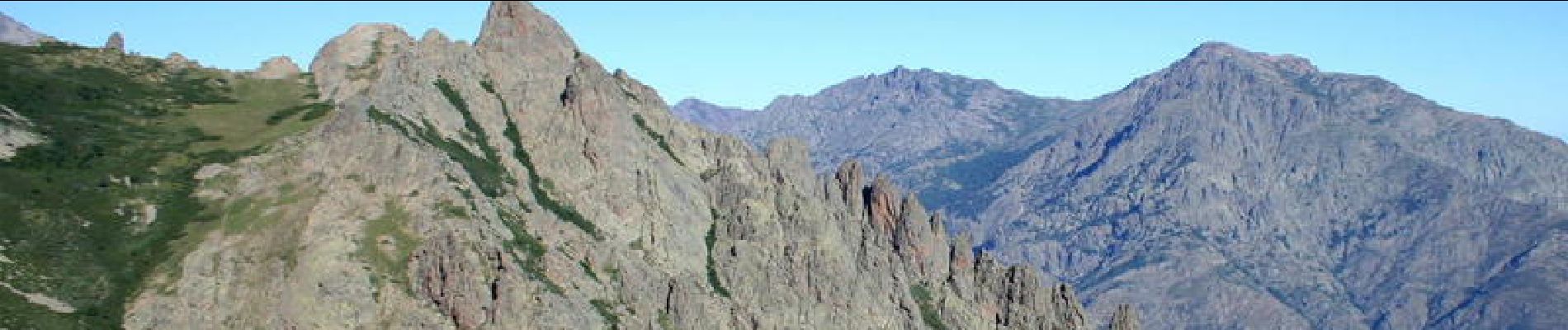
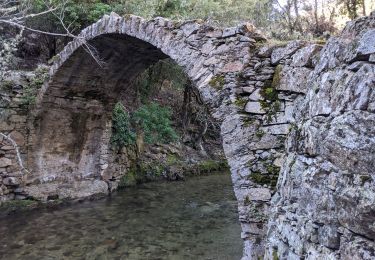
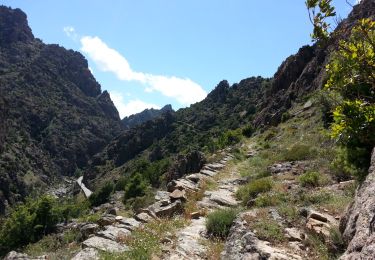
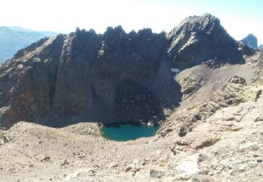
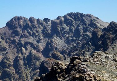
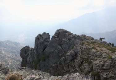
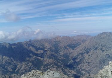
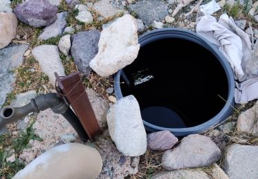
Ce trek de quatre jours propose de partir à l'assaut des crêtes entre Corscia et Castiglione, avec comme points d'orgue, les lacs du Verdatu, les cabanes et la fontaine de Vetta di Muro (sans doute le site le plus extraordinaire pour un bivouac en Corse), et la grotte de Scaffa. La description complète et d'autres photos sur cette page.

Elevation profile

Photos

Points of interest

Point of interest Castiglione - Arrivée Castiglione - Photo
tracegps
Point of interest Corscia - Bergerie Caracuta - Photo
tracegps
Point of interest Corscia - Bergerie Urcula - Photo
tracegps
Point of interest Castiglione - Biivouac Scaffa - Photo
tracegps
CASTIGLIONE 
Point of interest Corscia - Bivouac Ghiarghe Rosse - Photo
tracegps
Point of interest Corscia - Bocca Bella Bona - Photo
tracegps
Point of interest Corscia - Bocca Di Serra Piana - Photo
tracegps
Point of interest Asco - Bocca Meria - Photo
tracegps
Point of interest Asco - Capo Di a Mucciosa - Photo
tracegps
Point of interest Corscia - Capo Di Lino - Photo
tracegps
CORSCIA 
Point of interest Asco - Capo Di U Dénte - Photo
tracegps
Point of interest Asco - Capu a U Verdatu - Photo
tracegps
Point of interest Asco - Capu Biancu - Photo
tracegps
Point of interest Asco - Cima a I Miori - Photo
tracegps
Point of interest Corscia - Départ Corscia - Photo
tracegps
Point of interest Asco - Dent d'Asco - Photo
tracegps
Point of interest Corscia - Lac Maggiore - Photo
tracegps
CORSCIA 
Point of interest Asco - Monte Pianello - Photo
tracegps
Point of interest Popolasca - Popolasca - Photo
tracegps
POPOLASCA 
Point of interest Corscia - Repas J2 - Photo
tracegps
CORSCIA 
Point of interest Asco - Repas J3 - Photo
tracegps
ASCO 
Point of interest Corscia - Source Callaiola - Photo
tracegps
Point of interest Corscia - Source Ghiarghe Rosse - Photo
tracegps
Point of interest Asco - Source Vetta di Muro - Photo
tracegps
Point of interest Castiglione - Srce Chataigneraie - Photo
tracegps
CASTIGLIONE 
Point of interest Castiglione - Srce Terrivola - Photo
tracegps
CASTIGLIONE 
Point of interest Castiglione - Turone - Photo
tracegps
CASTIGLIONE 

Positioning

Country:
France
Region :
Corsica
Department/Province :
Haute-Corse
Municipality :
Corscia
Location:
Unknown
Start:(UTM)
503339 ; 4689207 (32T) N.

Comments

Please log in to post a review or rate the element


super


Trails nearby

Trail Walking Corscia - Corscia par l’ancienne Scala, retour par les gorges de la Ruda - Photo
Walking
olivecoco

Walking

Easy
Corscia, Corsica, Haute-Corse, France
11.4 km | 20 km-effort
4h 0min
Yes
Trail Walking Corscia - 31/05/2013 14:51 Scala Di Regina - Photo
Walking
Orcal37

Walking

Medium
Corscia, Corsica, Haute-Corse, France
5.6 km | 10.4 km-effort
4h 0min
No
Trail Walking Lozzi - boucle monte Cinto côté sud - Photo
Walking
PVERTICAL

Walking

Difficult
Lozzi, Corsica, Haute-Corse, France
18.8 km | 41 km-effort
8h 22min
Yes
Trail Walking Corscia - Verdatu et Biancu - Trek de 4 jours - Photo
Walking
tracegps

Walking

Difficult
Corscia, Corsica, Haute-Corse, France
32 km | 70 km-effort
75h 0min
Yes
Trail Walking Corscia - Monte Pinerole - Photo
Walking
tracegps

Walking

Easy
Corscia, Corsica, Haute-Corse, France
7.8 km | 13.2 km-effort
4h 0min
Yes
Trail Walking Corscia - monte verdattu  - Photo
Walking
Antoine Grateau

Walking

Very easy
Corscia, Corsica, Haute-Corse, France
3.5 km | 8.6 km-effort
35min
No
Trail Walking Albertacce - GR® de Corse - Mare a Mare Nord - De Albertacce à Verghju - Photo
Walking
tracegps

Walking

Difficult
Albertacce, Corsica, Haute-Corse, France
12.1 km | 21 km-effort
4h 30min
No
Trail Motor Calacuccia - cap Corse - Photo
Motor
wimpy

Motor

Easy
Calacuccia, Corsica, Haute-Corse, France
189 km | 240 km-effort
10h 52min
No
Trail Walking Lozzi - refuge - Photo
Walking
Lewuiss

Walking

Difficult
Lozzi, Corsica, Haute-Corse, France
8.8 km | 15.4 km-effort
4h 54min
No


Close
My subscriptions