Trail Mountain bike Montalieu-Vercieu - MMMO tour réveil musculaire - Photo

MMMO tour réveil musculaire

© OpenStreetMap contributors
Length
Length
24 km
Max alt
Max alt
311 m
Uphill gradient
Uphill gradient
312 m
Km-Effort
Km-Effort  
29 km
Min alt
Min alt
199 m
Downhill gradient
Downhill gradient
309 m
Boucle
Boucle
Yes
Creation date :
2014-12-10 00:00:00.0
Updated on :
2014-12-10 00:00:00.0

(0 Reviews)

Mountain bike
Mountain bike
--
Difficulty : Easy

Scan this QR Code to open this trail in the SityTrail application

FREE GPS app for hiking

Logo SityTrail SityTrail

IGN / Geographical institutes

Download SityTrail from the App Store Download SityTrail from Google Play

Logo SityTrail SityTrail World

The world is yours!

Download SityTrail from the App Store Download SityTrail from Google Play Download SityTrail on Huawei AppGallery

About

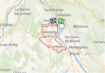
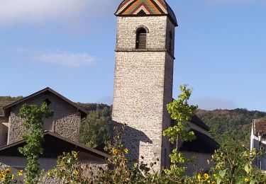
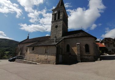
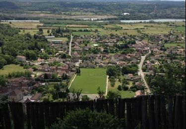
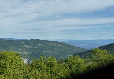
Trail Mountain bike of 24 km to be discovered at Auvergne-Rhône-Alpes, Isère, Montalieu-Vercieu. This trail is proposed by zitounemtb01.

Description

parcours simple, départ de la vallée bleue, passage sur route et chemin en gravier ! idéal pour réveil musculaire ou reprise facile, montée simple ou de courte durée.

Elevation profile

Positioning

Country:
France
Region :
Auvergne-Rhône-Alpes
Department/Province :
Isère
Municipality :
Montalieu-Vercieu
Location:
Unknown
Start:(UTM)
687835 ; 5077498 (31T) N.

Trails nearby

Trail Walking Souclin - 01-soudon-cleyzieu-20km825m - Photo
Walking
SyMA

Walking

Difficult
Souclin, Auvergne-Rhône-Alpes, Ain, France
20 km | 31 km-effort
7h 2min
Yes
Trail Walking Sault-Brénaz - 18 novembre 2022 Sault Brenat - Photo
Walking
Parodie69

Walking

Medium
Sault-Brénaz, Auvergne-Rhône-Alpes, Ain, France
20 km | 31 km-effort
8h 8min
Yes
Trail Walking Villebois - les balcons de souclin hameau de buis - Photo
Walking
colomb24

Walking

Medium
(1)
Villebois, Auvergne-Rhône-Alpes, Ain, France
16.1 km | 24 km-effort
5h 3min
Yes
Trail Walking Sault-Brénaz - 01-Sault-Brenaz-18.5km-740m-sept22 - Photo
Walking
SyMA

Walking

Medium
Sault-Brénaz, Auvergne-Rhône-Alpes, Ain, France
18.5 km | 28 km-effort
5h 57min
Yes
Trail Walking Bénonces - Cascade de Luiset /Rocher de Cuny  - Photo
Walking
GuyCharvier

Walking

Medium
(1)
Bénonces, Auvergne-Rhône-Alpes, Ain, France
17 km | 26 km-effort
4h 36min
Yes
Trail Walking Bouvesse-Quirieu - Cascade de la Roche - étangs de l’Isle Crémieu  - Photo
Walking
Galoche

Walking

Medium
Bouvesse-Quirieu, Auvergne-Rhône-Alpes, Isère, France
15.3 km | 17.9 km-effort
4h 7min
Yes
Trail Mountain bike Parmilieu - Parmilieu 10 2014 - Photo
Mountain bike
adupuped

Mountain bike

Medium
(1)
Parmilieu, Auvergne-Rhône-Alpes, Isère, France
16.3 km | 21 km-effort
1h 49min
Yes
Trail Walking Serrières-de-Briord - voir la vierge - Photo
Walking
zab

Walking

Easy
Serrières-de-Briord, Auvergne-Rhône-Alpes, Ain, France
5.6 km | 9.3 km-effort
1h 48min
Yes
Trail Mountain bike Serrières-de-Briord - Serrieres de Briord - Calvaire de Portes - Photo
Mountain bike
tracegps

Mountain bike

Very difficult
Serrières-de-Briord, Auvergne-Rhône-Alpes, Ain, France
64 km | 91 km-effort
6h 30min
Yes


Close
My subscriptions