


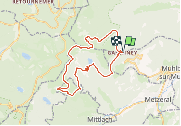
Gaschney, Rainkopf

bob68
User

Length
16.3 km

Max alt
1345 m

Uphill gradient
749 m
Km-Effort
26 km

Min alt
922 m

Downhill gradient
747 m
Boucle
Yes
Creation date :
2014-12-10 00:00:00.0
Updated on :
2014-12-10 00:00:00.0
5h00
Difficulty : Difficult

FREE GPS app for hiking
 SityTrail
IGN / Geographical institutes
SityTrail Plus
The world is yours!
About
Trail Walking of 16.3 km to be discovered at Grand Est, Haut-Rhin, Stosswihr. This trail is proposed by bob68.
Description
Gaschney, Schalleren, Frankental, Hohneck, Kastelberg, Kerbohlz
Positioning
Country:
France
Region :
Grand Est
Department/Province :
Haut-Rhin
Municipality :
Stosswihr
Location:
Unknown
Start:(Dec)
Start:(UTM)
354450 ; 5321975 (32U) N.
Comments