Trail Walking Feillens - FEILLENS: Circuit LE LAC - Photo

FEILLENS: Circuit LE LAC

© OpenStreetMap contributors
Length
Length
12.6 km
Max alt
Max alt
185 m
Uphill gradient
Uphill gradient
75 m
Km-Effort
Km-Effort  
13.6 km
Min alt
Min alt
164 m
Downhill gradient
Downhill gradient
75 m
Boucle
Boucle
Yes
Creation date :
2014-12-10 00:00:00.0
Updated on :
2014-12-10 00:00:00.0

(0 Reviews)

Walking
Walking
3h00
Difficulty : Unknown

Scan this QR Code to open this trail in the SityTrail application

FREE GPS app for hiking

Logo SityTrail SityTrail

IGN / Geographical institutes

Download SityTrail from the App Store Download SityTrail from Google Play

Logo SityTrail SityTrail World

The world is yours!

Download SityTrail from the App Store Download SityTrail from Google Play Download SityTrail on Huawei AppGallery

About

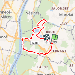
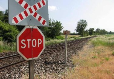
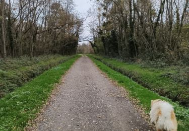
Trail Walking of 12.6 km to be discovered at Auvergne-Rhône-Alpes, Ain, Feillens. This trail is proposed by robertdurand.

Description

Randonnée au Pays de Bâgé: Le circuit Le Lac vous permettra de découvrir le centre du village jalonné de portillons à ferronneries et le lac de Feillens, vaste plan d'eau très apprécié des pecheurs et des chasseurs locaux.

Elevation profile

Positioning

Country:
France
Region :
Auvergne-Rhône-Alpes
Department/Province :
Ain
Municipality :
Feillens
Location:
Unknown
Start:(UTM)
645299 ; 5132951 (31T) N.

Trails nearby

Trail Walking Mâcon - Macon Cluny Chalon Macon 148km - Photo
Walking
GUIDE
thonyc

Walking

Medium
Mâcon, Bourgogne-Franche-Comté, Saône-et-Loire, France
148 km | 165 km-effort
13h 44min
Yes
Trail sport Replonges - 2023-12-17_13h47m13_retour_a_laiz-18080067-1702813386-845-1 - Photo
sport
Pascale Pâris

sport

Very easy
(1)
Replonges, Auvergne-Rhône-Alpes, Ain, France
17.9 km | 19.8 km-effort
Unknown
No
Trail Walking Mâcon - Séjour RCY Les Crêtes du Haut Beaujolais -  - Photo
Walking
chessyca

Walking

Very easy
Mâcon, Bourgogne-Franche-Comté, Saône-et-Loire, France
9 km | 10.2 km-effort
1h 54min
No
Trail Walking Saint-Laurent-sur-Saône - Autour de St Laurent sur Saône - Photo
Walking
robertdurand

Walking

Very easy
Saint-Laurent-sur-Saône, Auvergne-Rhône-Alpes, Ain, France
5 km | 5.4 km-effort
1h 22min
Yes
Trail Mountain bike Saint-Laurent-sur-Saône - De Breurey lès Faverney à Vignieu en VTT- Étape 5/6 - Photo
Mountain bike
tracegps

Mountain bike

Medium
Saint-Laurent-sur-Saône, Auvergne-Rhône-Alpes, Ain, France
83 km | 93 km-effort
9h 10min
No
Trail Walking Feillens - Montgrimoux chevroux  - Photo
Walking
Lillie Zennily

Walking

Difficult
Feillens, Auvergne-Rhône-Alpes, Ain, France
14.2 km | 15.7 km-effort
3h 7min
Yes
Trail Walking Manziat - manziat  - Photo
Walking
Lillie Zennily

Walking

Difficult
Manziat, Auvergne-Rhône-Alpes, Ain, France
14.4 km | 15.6 km-effort
3h 9min
Yes
Trail Walking Feillens - balade du jour - Photo
Walking
Lillie Zennily

Walking

Medium
Feillens, Auvergne-Rhône-Alpes, Ain, France
9.9 km | 11 km-effort
2h 4min
Yes
Trail Walking Replonges - la découverte de replonge - Photo
Walking
Lillie Zennily

Walking

Medium
Replonges, Auvergne-Rhône-Alpes, Ain, France
12.3 km | 13.4 km-effort
2h 42min
Yes


Close
My subscriptions