Trail Mountain bike Figanières - rando vtt figa le rouet - Photo
© OpenStreetMap contributors
Length
Length
40 km
Max alt
Max alt
453 m
Uphill gradient
Uphill gradient
1057 m
Km-Effort
Km-Effort  
54 km
Min alt
Min alt
49 m
Downhill gradient
Downhill gradient
1052 m
Boucle
Boucle
Yes
Creation date :
2014-12-10 00:00:00.0
Updated on :
2014-12-10 00:00:00.0

(1 Reviews)

Mountain bike
Mountain bike
3h25
Difficulty : Difficult

Scan this QR Code to open this trail in the SityTrail application

FREE GPS app for hiking

Logo SityTrail SityTrail

IGN / Geographical institutes

Download SityTrail from the App Store Download SityTrail from Google Play

Logo SityTrail SityTrail World

The world is yours!

Download SityTrail from the App Store Download SityTrail from Google Play Download SityTrail on Huawei AppGallery

About

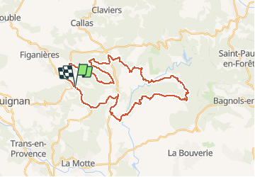
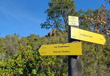
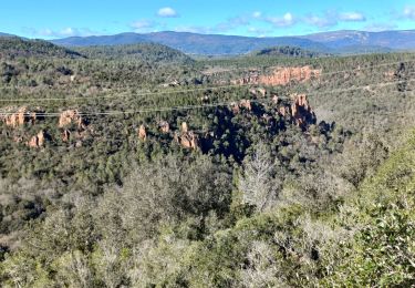
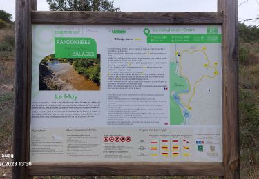
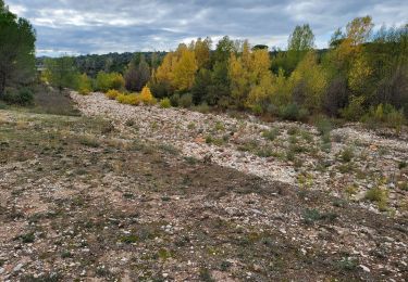
Trail Mountain bike of 40 km to be discovered at Provence-Alpes-Côte d'Azur, Var, Figanières. This trail is proposed by biesbrouck.

Elevation profile

Positioning

Country:
France
Region :
Provence-Alpes-Côte d'Azur
Department/Province :
Var
Municipality :
Figanières
Location:
Unknown
Start:(UTM)
300700 ; 4824584 (32T) N.

Comments

Please log in to post a review or rate the element


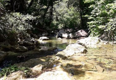
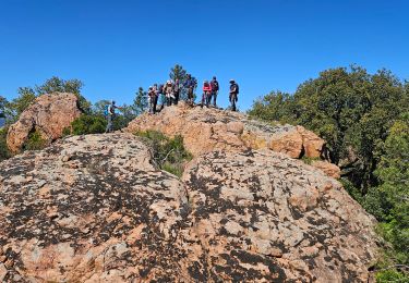
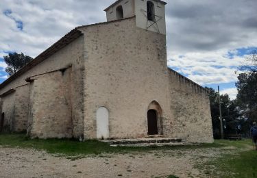
merci pour ce superbe itineraire...de belles pistes...decors grandioses...a faire absolument...


Trails nearby

Trail Walking Callas - gorge de Penafore - Photo
Walking
marmotte83

Walking

Very easy
(1)
Callas, Provence-Alpes-Côte d'Azur, Var, France
1.1 km | 1.3 km-effort
1h 33min
Yes
Trail Walking Figanières - Figanières 01 - Photo
Walking
jeanclaude83

Walking

Very easy
(1)
Figanières, Provence-Alpes-Côte d'Azur, Var, France
8.4 km | 11.8 km-effort
2h 30min
Yes
Trail Walking Le Muy - 2024-04-17_09h53m25_visorando-2024-04-19-les-roches-de-la-fille-isnard-gilles - Photo
Walking
GrouGary

Walking

Medium
Le Muy, Provence-Alpes-Côte d'Azur, Var, France
16.6 km | 23 km-effort
5h 16min
Yes
Trail Walking Callas - Callas- Autour de la Chapelle Saint-Auxile - Photo
Walking
Chantheys

Walking

Medium
Callas, Provence-Alpes-Côte d'Azur, Var, France
6.4 km | 9.5 km-effort
2h 9min
Yes
Trail Walking Le Muy - Le Castel Diaou  -  Crête Fille d'Isnard depuis le pont de L'Endre - Photo
Walking
donda

Walking

Very difficult
Le Muy, Provence-Alpes-Côte d'Azur, Var, France
22 km | 31 km-effort
7h 4min
Yes
Trail Walking Le Muy - Pas des Vaches - Pic rébéquier - Fontaine du Chasseur - Pic Castel Diaou - Photo
Walking
donda

Walking

Very difficult
Le Muy, Provence-Alpes-Côte d'Azur, Var, France
22 km | 30 km-effort
6h 55min
Yes
Trail Walking Callas - La catalane ,Font Blanche, les Cabanons - Photo
Walking
boulinevelyne

Walking

Medium
(1)
Callas, Provence-Alpes-Côte d'Azur, Var, France
10.3 km | 14.2 km-effort
3h 19min
Yes
Trail Walking La Motte - 20230225 La colle du Rouet, lac de l'Endre - Photo
Walking
Sugg

Walking

Easy
La Motte, Provence-Alpes-Côte d'Azur, Var, France
8.2 km | 9.4 km-effort
2h 42min
Yes
Trail Walking Le Muy - VALLÉE DE L'ENDRE - CASCADE DU GOURNIE - Photo
Walking
jean-marie.parachini

Walking

Very easy
Le Muy, Provence-Alpes-Côte d'Azur, Var, France
7.5 km | 8.5 km-effort
8h 58min
Yes


Close
My subscriptions