Trail Walking Névache - Lac Vert - Névache - Photo
 tracegps
tracegps

User

© OpenStreetMap contributors
Length
Length
8.9 km
Max alt
Max alt
2121 m
Uphill gradient
Uphill gradient
410 m
Km-Effort
Km-Effort  
14.3 km
Min alt
Min alt
1754 m
Downhill gradient
Downhill gradient
412 m
Boucle
Boucle
Yes
Creation date :
2014-12-10 00:00:00.0
Updated on :
2014-12-10 00:00:00.0

(1 Reviews)

Walking
Walking
3h00
Difficulty : Medium

Scan this QR Code to open this trail in the SityTrail application

FREE GPS app for hiking

Logo SityTrail SityTrail

IGN / Geographical institutes

Download SityTrail from the App Store Download SityTrail from Google Play

Logo SityTrail SityTrail World

The world is yours!

Download SityTrail from the App Store Download SityTrail from Google Play Download SityTrail on Huawei AppGallery

About

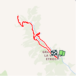
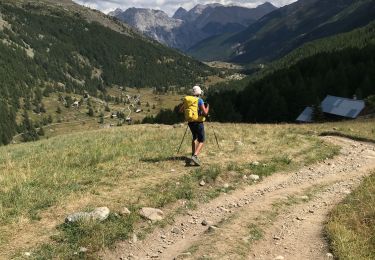
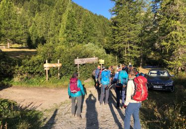
Trail Walking of 8.9 km to be discovered at Provence-Alpes-Côte d'Azur, Hautes-Alpes, Névache. This trail is proposed by tracegps.

Description

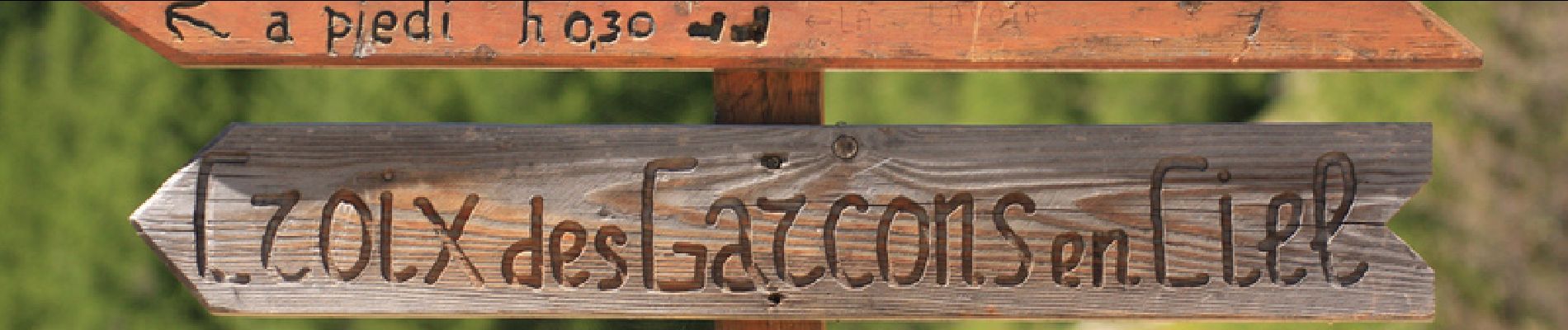
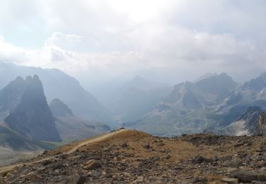
Lac très caractéristique dont le nom n'est pas usurpé. On y accède par un sentier pittoresque et peu connu. On agrémente la randonnée en reprenant le GR jusqu'à la mine du Blanchet et la maison des chamois afin de profiter d'une vue plongeante sur la vallée étroite. Possibilité de prolonger jusqu'au lac Lavoir.

Elevation profile

Photos

Positioning

Country:
France
Region :
Provence-Alpes-Côte d'Azur
Department/Province :
Hautes-Alpes
Municipality :
Névache
Location:
Unknown
Start:(UTM)
313072 ; 4993331 (32T) N.

Comments

Please log in to post a review or rate the element


Trails nearby

Trail Walking Névache - Lac Vert.Vallée Etroite.(27-09-17) - Photo
Walking
Dervalmarc

Walking

Very easy
(1)
Névache, Provence-Alpes-Côte d'Azur, Hautes-Alpes, France
4.2 km | 5.9 km-effort
1h 19min
Yes
Trail Walking Névache - les granges de la vallée étroite au refuge du Mont Thabor - Photo
Walking
reneperrin

Walking

Easy
(1)
Névache, Provence-Alpes-Côte d'Azur, Hautes-Alpes, France
8.6 km | 16.2 km-effort
3h 44min
No
Trail Mountain bike Névache - Tour des Rois Mages en VTT - Névache - Photo
Mountain bike
tracegps

Mountain bike

Difficult
(2)
Névache, Provence-Alpes-Côte d'Azur, Hautes-Alpes, France
35 km | 55 km-effort
5h 0min
Yes
Trail Walking Névache - le Mont Thabor - Photo
Walking
GUIDE
amiral13

Walking

Difficult
Névache, Provence-Alpes-Côte d'Azur, Hautes-Alpes, France
19.9 km | 40 km-effort
8h 44min
Yes
Trail Walking Névache - Vallée  étroite    refuge du Thabor - Photo
Walking
Sorriaux

Walking

Difficult
Névache, Provence-Alpes-Côte d'Azur, Hautes-Alpes, France
10.2 km | 18.4 km-effort
3h 6min
No
Trail Walking Névache - J4 2023 - Le Thabor épisode 2 - Photo
Walking
ETMU5496

Walking

Very difficult
Névache, Provence-Alpes-Côte d'Azur, Hautes-Alpes, France
24 km | 44 km-effort
7h 13min
Yes
Trail Walking Névache - Mont Thabor à partir des Granges  - Photo
Walking
Hugues Michel

Walking

Very difficult
Névache, Provence-Alpes-Côte d'Azur, Hautes-Alpes, France
18.1 km | 37 km-effort
6h 39min
No
Trail Walking Névache - Col roche noire  - Photo
Walking
jouans

Walking

Difficult
Névache, Provence-Alpes-Côte d'Azur, Hautes-Alpes, France
17.1 km | 31 km-effort
6h 37min
Yes
Trail Walking Névache - Vallée de la Clarée - Buffère / Moulette / Roche noire / Chardonnet - Photo
Walking
ETMU5496

Walking

Difficult
Névache, Provence-Alpes-Côte d'Azur, Hautes-Alpes, France
18 km | 32 km-effort
7h 37min
Yes


Close
My subscriptions