Trail Mountain bike Montclar - VTT à Arnauteille - Montclar - Photo

VTT à Arnauteille - Montclar

 tracegps
tracegps

User

© OpenStreetMap contributors
Length
Length
21 km
Max alt
Max alt
362 m
Uphill gradient
Uphill gradient
538 m
Km-Effort
Km-Effort  
28 km
Min alt
Min alt
164 m
Downhill gradient
Downhill gradient
539 m
Boucle
Boucle
Yes
Creation date :
2014-12-10 00:00:00.0
Updated on :
2014-12-10 00:00:00.0

(3 Reviews)

Mountain bike
Mountain bike
1h40
Difficulty : Difficult

Scan this QR Code to open this trail in the SityTrail application

FREE GPS app for hiking

Logo SityTrail SityTrail

IGN / Geographical institutes

Download SityTrail from the App Store Download SityTrail from Google Play

Logo SityTrail SityTrail World

The world is yours!

Download SityTrail from the App Store Download SityTrail from Google Play Download SityTrail on Huawei AppGallery

About

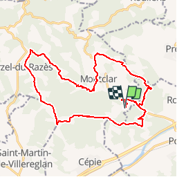
Trail Mountain bike of 21 km to be discovered at Occitania, Aude, Montclar. This trail is proposed by tracegps.

Description

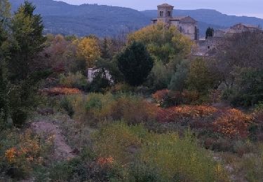
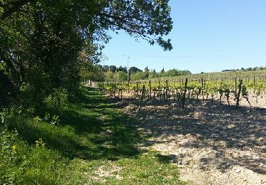
Départ du camping d'Arnauteille. On peut partir de Montclar et traverser le camping. Une partie se fait sur une crête où l'on peut apercevoir les Pyrénées. Sur une autre crête on voit la citée de Carcassonne. Deux belles descentes.

Elevation profile

Photos

Positioning

Country:
France
Region :
Occitania
Department/Province :
Aude
Municipality :
Montclar
Location:
Unknown
Start:(UTM)
439887 ; 4774875 (31T) N.

Comments

Please log in to post a review or rate the element


Tres beau parcours


Superbe parcours, à recommander.


Trails nearby

Trail Walking Saint-Martin-de-Villereglan - rando saint Martin de villereglan - Photo
Walking
Mamilaure

Walking

Easy
(1)
Saint-Martin-de-Villereglan, Occitania, Aude, France
10.7 km | 13.5 km-effort
2h 23min
Yes
Trail Walking Cépie - Cépié - Photo
Walking
GUIDE
Ada11

Walking

Very easy
Cépie, Occitania, Aude, France
12.9 km | 16.8 km-effort
2h 34min
Yes
Trail Walking Preixan - preixan - Photo
Walking
Mascart

Walking

Very easy
(1)
Preixan, Occitania, Aude, France
9.1 km | 12.1 km-effort
2h 42min
Yes
Trail On foot Saint-Hilaire - Boucle de Saint-Hilaire - Photo
On foot
PRO

On foot

Easy
Saint-Hilaire, Occitania, Aude, France
7.3 km | 9.5 km-effort
2h 9min
Yes
Trail Walking Saint-Hilaire - Boucle de Saint-Hilaire - Photo
Walking
PI11

Walking

Medium
(1)
Saint-Hilaire, Occitania, Aude, France
8.8 km | 11.2 km-effort
2h 32min
Yes
Trail Walking Leuc - 2021-09-20_11h56m18_les-justices - Photo
Walking
dufland

Walking

Medium
(1)
Leuc, Occitania, Aude, France
6.2 km | 8.5 km-effort
1h 55min
Yes
Trail Walking Roullens - roullens-lac de taure 01 VM - Photo
Walking
dufland

Walking

Medium
(1)
Roullens, Occitania, Aude, France
7.5 km | 9.4 km-effort
2h 7min
Yes
Trail Walking Roullens - promenade du domaine fantôme  - Photo
Walking
dovy

Walking

Very easy
Roullens, Occitania, Aude, France
7.3 km | 9.2 km-effort
1h 57min
Yes
Trail Walking Roullens - promenade du domaine fantôme  - Photo
Walking
dovy

Walking

Very easy
Roullens, Occitania, Aude, France
7.3 km | 9.2 km-effort
1h 57min
Yes


Close
My subscriptions