Trail Mountain bike Saint-Diéry - Espace VTT FFC du Sancy - Circuit n°34 - La Bataille - Secteur St Diery - Photo

Espace VTT FFC du Sancy - Circuit n°34 - La Bataille - Secteur St Diery

 tracegps
tracegps

User

© OpenStreetMap contributors
Length
Length
17.4 km
Max alt
Max alt
858 m
Uphill gradient
Uphill gradient
538 m
Km-Effort
Km-Effort  
25 km
Min alt
Min alt
611 m
Downhill gradient
Downhill gradient
537 m
Boucle
Boucle
Yes
Creation date :
2014-12-10 00:00:00.0
Updated on :
2014-12-10 00:00:00.0

(0 Reviews)

Mountain bike
Mountain bike
1h19
Difficulty : Very difficult

Scan this QR Code to open this trail in the SityTrail application

FREE GPS app for hiking

Logo SityTrail SityTrail

IGN / Geographical institutes

Download SityTrail from the App Store Download SityTrail from Google Play

Logo SityTrail SityTrail World

The world is yours!

Download SityTrail from the App Store Download SityTrail from Google Play Download SityTrail on Huawei AppGallery

About

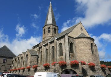
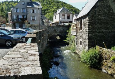
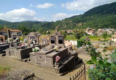
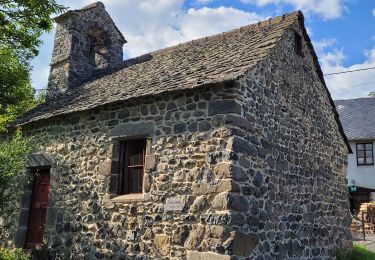
Trail Mountain bike of 17.4 km to be discovered at Auvergne-Rhône-Alpes, Puy-de-Dôme, Saint-Diéry. This trail is proposed by tracegps.

Description

Espace VTT FFC du Sancy - Circuit n°34 - La Bataille - Secteur St Diery Circuit officiel labellisé par la Fédération Française de Cyclisme. Secteur magique offrant une vue sur le Pays des Couzes, avec des passages sur plateaux et en vallée, avec en toile de fond les grottes de Jonas. Départ de Cotteuge, place du hameau. Téléchargez le plan des circuits.

Elevation profile

Photos

Positioning

Country:
France
Region :
Auvergne-Rhône-Alpes
Department/Province :
Puy-de-Dôme
Municipality :
Saint-Diéry
Location:
Saint-Diéry
Start:(UTM)
500635 ; 5042552 (31T) N.

Trails nearby

Trail Walking Besse-et-Saint-Anastaise - Cascades de Chiloza - Photo
Walking
jome63

Walking

Medium
(2)
Besse-et-Saint-Anastaise, Auvergne-Rhône-Alpes, Puy-de-Dôme, France
4.6 km | 6.6 km-effort
1h 44min
Yes
Trail Walking Saint-Nectaire - Puy de Mazeires - Photo
Walking
tracegps

Walking

Medium
(2)
Saint-Nectaire, Auvergne-Rhône-Alpes, Puy-de-Dôme, France
8.2 km | 12 km-effort
3h 30min
Yes
Trail On foot Saint-Diéry - Le Cheix - Photo
On foot
PRO

On foot

Easy
Saint-Diéry, Auvergne-Rhône-Alpes, Puy-de-Dôme, France
4.8 km | 6.6 km-effort
1h 30min
Yes
Trail On foot Saint-Pierre-Colamine - Ourcière - Photo
On foot
PRO

On foot

Easy
Saint-Pierre-Colamine, Auvergne-Rhône-Alpes, Puy-de-Dôme, France
9.5 km | 14 km-effort
3h 10min
Yes
Trail On foot Saint-Victor-la-Rivière - Roche-Romaine - Photo
On foot
PRO

On foot

Easy
Saint-Victor-la-Rivière, Auvergne-Rhône-Alpes, Puy-de-Dôme, France
10.1 km | 13.8 km-effort
3h 7min
Yes
Trail On foot Saurier - Le Pic de Brionnet - Photo
On foot
PRO

On foot

Easy
(1)
Saurier, Auvergne-Rhône-Alpes, Puy-de-Dôme, France
4.2 km | 7.8 km-effort
1h 46min
No
Trail On foot Saint-Nectaire - Le Puy d'Eraigne - Photo
On foot
PRO

On foot

Easy
Saint-Nectaire, Auvergne-Rhône-Alpes, Puy-de-Dôme, France
7.2 km | 10.6 km-effort
2h 24min
Yes
Trail Walking Courgoul - Les-Gorges-de-Courgoul-Marcenat_T - Photo
Walking
force

Walking

Very difficult
Courgoul, Auvergne-Rhône-Alpes, Puy-de-Dôme, France
12.7 km | 21 km-effort
3h 36min
Yes
Trail Electric bike Saint-Nectaire - camping St nectaire \camping Murat le quaire - Photo
Electric bike
ricou1964

Electric bike

Very easy
Saint-Nectaire, Auvergne-Rhône-Alpes, Puy-de-Dôme, France
33 km | 50 km-effort
58min
No


Close
My subscriptions