Trail Running Vielmur-sur-Agout - Les Eoliennes de Cuq Serviès - Vielmur sur Agout - Photo

Les Eoliennes de Cuq Serviès - Vielmur sur Agout

 tracegps
tracegps

User

© OpenStreetMap contributors
Length
Length
18.9 km
Max alt
Max alt
335 m
Uphill gradient
Uphill gradient
271 m
Km-Effort
Km-Effort  
22 km
Min alt
Min alt
148 m
Downhill gradient
Downhill gradient
271 m
Boucle
Boucle
Yes
Creation date :
2014-12-10 00:00:00.0
Updated on :
2014-12-10 00:00:00.0

(0 Reviews)

Running
Running
1h40
Difficulty : Difficult

Scan this QR Code to open this trail in the SityTrail application

FREE GPS app for hiking

Logo SityTrail SityTrail

IGN / Geographical institutes

Download SityTrail from the App Store Download SityTrail from Google Play

Logo SityTrail SityTrail World

The world is yours!

Download SityTrail from the App Store Download SityTrail from Google Play Download SityTrail on Huawei AppGallery

About

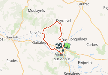
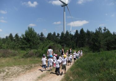
Trail Running of 18.9 km to be discovered at Occitania, Tarn, Vielmur-sur-Agout. This trail is proposed by tracegps.

Description

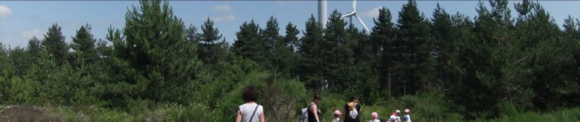
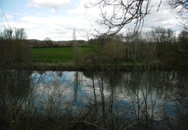
Départ stade de Vielmur sur Agout. Rejoindre Cuq les Vielmur par le bord du Bagas, puis monter sur les coteaux en passant au dessus du hameau d'En Catalo. Rejoindre les éoliennes par l'antenne hertzienne de la Broque. Descendre par le chemin à droite de la dernière éolienne et rejoindre le hameau de Varagnes. Retour à Vielmur par la petite route de Lalbarède.

Elevation profile

Photos

Positioning

Country:
France
Region :
Occitania
Department/Province :
Tarn
Municipality :
Vielmur-sur-Agout
Location:
Unknown
Start:(UTM)
426644 ; 4830827 (31T) N.

Trails nearby

Trail Walking Puylaurens - Boucle de Saint Sébastien - Puylaurens - Photo
Walking
tracegps

Walking

Medium
Puylaurens, Occitania, Tarn, France
12 km | 16.3 km-effort
3h 30min
Yes
Trail Walking Cuq - randonnée avec club maman - Photo
Walking
sandymocko

Walking

Medium
Cuq, Occitania, Tarn, France
14.1 km | 18.7 km-effort
3h 51min
Yes
Trail Mountain bike Vielmur-sur-Agout - Les Eoliennes de Cuq Serviès - Vielmur sur Agout - Photo
Mountain bike
tracegps

Mountain bike

Medium
Vielmur-sur-Agout, Occitania, Tarn, France
18.9 km | 22 km-effort
1h 15min
Yes
Trail Walking Sémalens - Sentier des amoureux Semalens - Photo
Walking
tabouelle

Walking

Very easy
Sémalens, Occitania, Tarn, France
8.7 km | 9.3 km-effort
2h 20min
Yes
Trail Walking Serviès - Autour des eoliènes - Photo
Walking
jpipacific

Walking

Medium
Serviès, Occitania, Tarn, France
7.5 km | 10.4 km-effort
1h 44min
Yes
Trail Other activity Puylaurens - Saint-Sébastien - Photo
Other activity
jpp2caunes

Other activity

Very easy
Puylaurens, Occitania, Tarn, France
12.8 km | 17.2 km-effort
6h 27min
Yes
Trail Walking Puylaurens - Puylaurens St sebastien  - Photo
Walking
arqdan

Walking

Very easy
Puylaurens, Occitania, Tarn, France
12.8 km | 17.2 km-effort
3h 38min
Yes
Trail Walking Serviès - 81_Servies - Photo
Walking
jab31

Walking

Easy
(1)
Serviès, Occitania, Tarn, France
9.7 km | 12.6 km-effort
2h 22min
Yes
Trail Walking Puylaurens - 81_Vielmur - Photo
Walking
jab31

Walking

Easy
Puylaurens, Occitania, Tarn, France
12.6 km | 17 km-effort
2h 28min
Yes


Close
My subscriptions