Trail Running Asté - Casque de Lhéris depuis Asté - Photo

Casque de Lhéris depuis Asté

 tracegps
tracegps

User

© OpenStreetMap contributors
Length
Length
16.8 km
Max alt
Max alt
1577 m
Uphill gradient
Uphill gradient
1317 m
Km-Effort
Km-Effort  
34 km
Min alt
Min alt
626 m
Downhill gradient
Downhill gradient
1289 m
Boucle
Boucle
No
Creation date :
2014-12-10 00:00:00.0
Updated on :
2014-12-10 00:00:00.0

(0 Reviews)

Running
Running
3h00
Difficulty : Difficult

Scan this QR Code to open this trail in the SityTrail application

FREE GPS app for hiking

Logo SityTrail SityTrail

IGN / Geographical institutes

Download SityTrail from the App Store Download SityTrail from Google Play

Logo SityTrail SityTrail World

The world is yours!

Download SityTrail from the App Store Download SityTrail from Google Play Download SityTrail on Huawei AppGallery

About

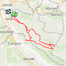
Trail Running of 16.8 km to be discovered at Occitania, Hautespyrenees, Asté. This trail is proposed by tracegps.

Description

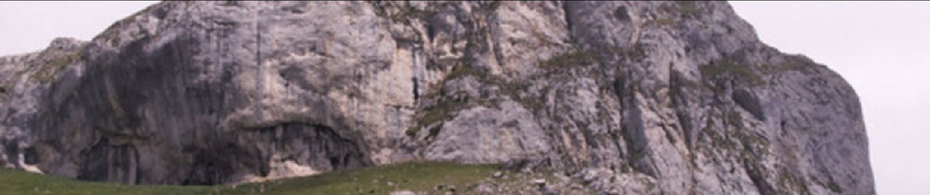
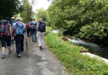
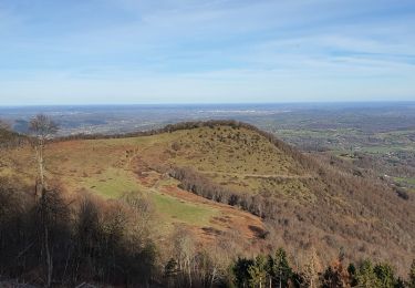
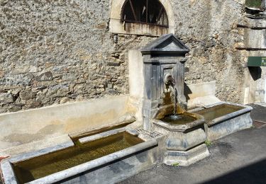
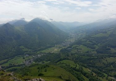
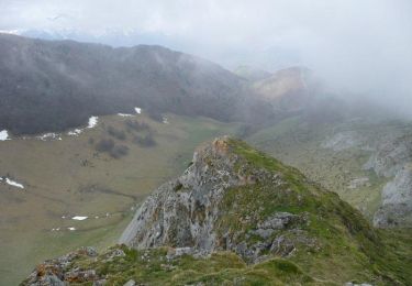
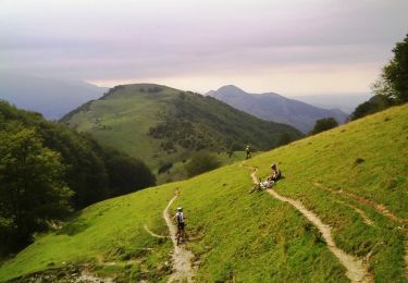
Très beau circuit de trail à faire toute l'année! Le départ se fait gentiment sur une petite route goudronnée qui, rapidement se transforme en piste. On attaque le sentier qui permet de faire la première ascension au bout de 1km. Celle-ci est de suite intense jusqu'à l'arrivée du plateau qui permet de relier le col de Lhéris. Ensuite, il ne reste plus qu'à effectuer l'ascension finale jusqu'au sommet du casque qui culmine à 1595m. La descente se fera par un sentier différent de la montée, qui est à la fois dur en raison de sa forte pente, et technique, un pur régal! Dès la sortie de la forêt, vous pourrez bénéficier d'une vue superbe sur la chaîne des Pyrénées, avec un face-à-face magistral avec le Pic du Midi.

Elevation profile

Photos

Positioning

Country:
France
Region :
Occitania
Department/Province :
Hautespyrenees
Municipality :
Asté
Location:
Unknown
Start:(UTM)
269728 ; 4769186 (31T) N.

Trails nearby

Trail Walking Beaudéan - LESPONNE entre torrents et cascades (G3) fait le 17 Juillet 2020
Walking
GUIDE
marmotte65

Walking

Very easy
Beaudéan, Occitania, Hautespyrenees, France
8.8 km | 12.9 km-effort
4h 30min
Yes
Trail Walking Bagnères-de-Bigorre - FEU 2015 - Etape 5 - Photo
Walking
Blavis

Walking

Easy
(1)
Bagnères-de-Bigorre, Occitania, Hautespyrenees, France
18.2 km | 30 km-effort
6h 29min
No
Trail Walking Gerde - Casque du Lheris - Photo
Walking
chrisgps

Walking

Medium
Gerde, Occitania, Hautespyrenees, France
16.8 km | 28 km-effort
6h 25min
Yes
Trail Road bike Beaudéan - hourquette - Photo
Road bike
BARAN

Road bike

Very difficult
(1)
Beaudéan, Occitania, Hautespyrenees, France
50 km | 65 km-effort
2h 54min
Yes
Trail Mountain bike Bagnères-de-Bigorre - Randonnée 1 mai haut de Bagneres  - Photo
Mountain bike
fred47

Mountain bike

Very difficult
Bagnères-de-Bigorre, Occitania, Hautespyrenees, France
28 km | 38 km-effort
3h 18min
Yes
Trail Walking Bagnères-de-Bigorre - tour du castelmouly - Photo
Walking
Martinet.Claude

Walking

Easy
(2)
Bagnères-de-Bigorre, Occitania, Hautespyrenees, France
12.7 km | 20 km-effort
4h 3min
Yes
Trail Walking Campan - Le Tour de la Bouche  - Campan - Photo
Walking
tracegps

Walking

Difficult
Campan, Occitania, Hautespyrenees, France
15.2 km | 28 km-effort
7h 0min
Yes
Trail Walking Gerde - Casque du Lhéris - Gerde - Photo
Walking
tracegps

Walking

Medium
Gerde, Occitania, Hautespyrenees, France
14.1 km | 24 km-effort
5h 0min
Yes
Trail Mountain bike Asté - Bagnères de Bigorre bis VTT - Photo
Mountain bike
tracegps

Mountain bike

Difficult
Asté, Occitania, Hautespyrenees, France
23 km | 36 km-effort
2h 30min
Yes


Close
My subscriptions