Trail Running Bevons - Tour du Peydiou -  Bevons - Photo
 tracegps
tracegps

User

© OpenStreetMap contributors
Length
Length
11.1 km
Max alt
Max alt
967 m
Uphill gradient
Uphill gradient
442 m
Km-Effort
Km-Effort  
17 km
Min alt
Min alt
681 m
Downhill gradient
Downhill gradient
441 m
Boucle
Boucle
Yes
Creation date :
2014-12-10 00:00:00.0
Updated on :
2014-12-10 00:00:00.0

(0 Reviews)

Running
Running
1h40
Difficulty : Medium

Scan this QR Code to open this trail in the SityTrail application

FREE GPS app for hiking

Logo SityTrail SityTrail

IGN / Geographical institutes

Download SityTrail from the App Store Download SityTrail from Google Play

Logo SityTrail SityTrail World

The world is yours!

Download SityTrail from the App Store Download SityTrail from Google Play Download SityTrail on Huawei AppGallery

About

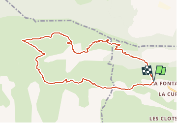
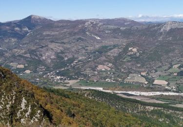
Trail Running of 11.1 km to be discovered at Provence-Alpes-Côte d'Azur, Alpes-de-Haute-Provence, Bevons. This trail is proposed by tracegps.

Description

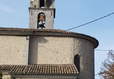
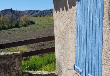
Au départ des Bastides, prendre le GR6 (marquage rouge et blanc) à gauche en direction de Noyers sur Jabron. Le suivre sur un peu plus de 4 km jusqu'à la jonction avec le route de Durban. Suivre en suite le PR (marquage jaune) en direction du Pas de l'Essaillon/Bevons. Ne pas le quitter jusqu'à l'arrivée aux Bastides.

Elevation profile

Photos

Positioning

Country:
France
Region :
Provence-Alpes-Côte d'Azur
Department/Province :
Alpes-de-Haute-Provence
Municipality :
Bevons
Location:
Unknown
Start:(UTM)
729712 ; 4896412 (31T) N.

Trails nearby

Trail Walking Valbelle - Valbelle - Chapelle Saint Pons - Photo
Walking
GUIDE
R@ph

Walking

Medium
(1)
Valbelle, Provence-Alpes-Côte d'Azur, Alpes-de-Haute-Provence, France
5.5 km | 10.6 km-effort
2h 20min
Yes
Trail Walking Valbelle -  Chapelle St Pons  - Photo
Walking
cousam

Walking

Difficult
Valbelle, Provence-Alpes-Côte d'Azur, Alpes-de-Haute-Provence, France
8.4 km | 14.3 km-effort
3h 29min
Yes
Trail Walking Valbelle - 04 chapelle St Pons 03.08.23 - Photo
Walking
himba26100

Walking

Difficult
Valbelle, Provence-Alpes-Côte d'Azur, Alpes-de-Haute-Provence, France
8.2 km | 13.6 km-effort
3h 27min
No
Trail Walking Val-Buëch-Méouge - Rocher de pierre Impie, roc de l'aigle,  pas de Berches  - Photo
Walking
nadd73

Walking

Medium
Val-Buëch-Méouge, Provence-Alpes-Côte d'Azur, Hautes-Alpes, France
12.4 km | 23 km-effort
6h 1min
No
Trail Walking Valbelle - cirque de Valbelle  - Photo
Walking
marie04

Walking

Very difficult
Valbelle, Provence-Alpes-Côte d'Azur, Alpes-de-Haute-Provence, France
18.4 km | 31 km-effort
7h 4min
Yes
Trail Walking Noyers-sur-Jabron - Les Chapelles du vieux Noyer - Photo
Walking
liocol

Walking

Medium
Noyers-sur-Jabron, Provence-Alpes-Côte d'Azur, Alpes-de-Haute-Provence, France
10.6 km | 16.6 km-effort
4h 2min
Yes
Trail Walking Sisteron - BEVONS    crêtes de Chapage o l s m - Photo
Walking
RobinMicheline

Walking

Medium
Sisteron, Provence-Alpes-Côte d'Azur, Alpes-de-Haute-Provence, France
8.2 km | 15 km-effort
2h 37min
Yes
Trail Walking Valbelle - Tour de Sumiou - Photo
Walking
Marco05

Walking

Difficult
Valbelle, Provence-Alpes-Côte d'Azur, Alpes-de-Haute-Provence, France
13.4 km | 23 km-effort
5h 14min
No
Trail Walking Sisteron - Bois de Buche depart Sisteron 417 + - Photo
Walking
claude nier

Walking

Easy
Sisteron, Provence-Alpes-Côte d'Azur, Alpes-de-Haute-Provence, France
11.8 km | 17.4 km-effort
6h 13min
Yes


Close
My subscriptions