Trail Walking Tauxigny-Saint-Bauld - St Bauld - Photo
 LEMENIO
LEMENIO

User

© OpenStreetMap contributors
Length
Length
10.8 km
Max alt
Max alt
101 m
Uphill gradient
Uphill gradient
82 m
Km-Effort
Km-Effort  
11.9 km
Min alt
Min alt
75 m
Downhill gradient
Downhill gradient
82 m
Boucle
Boucle
Yes
Creation date :
2014-12-10 00:00:00.0
Updated on :
2014-12-10 00:00:00.0

(0 Reviews)

Walking
Walking
2h38
Difficulty : Easy

Scan this QR Code to open this trail in the SityTrail application

FREE GPS app for hiking

Logo SityTrail SityTrail

IGN / Geographical institutes

Download SityTrail from the App Store Download SityTrail from Google Play

Logo SityTrail SityTrail World

The world is yours!

Download SityTrail from the App Store Download SityTrail from Google Play Download SityTrail on Huawei AppGallery

About

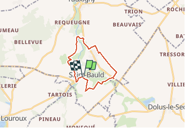
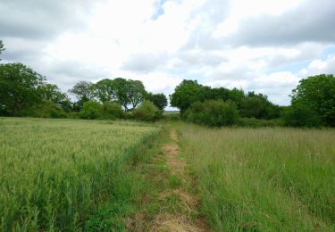
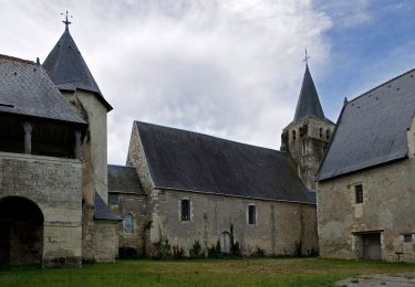
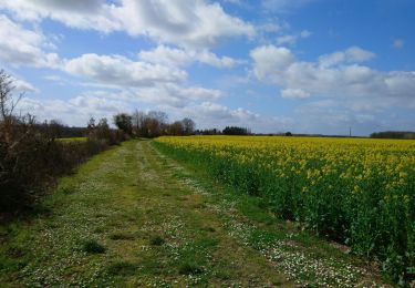
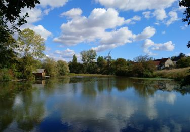
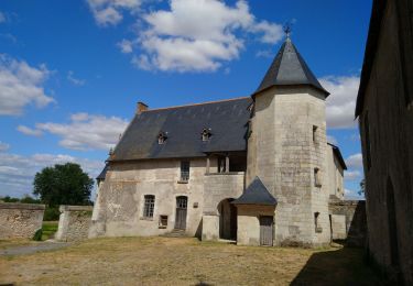
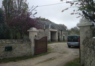
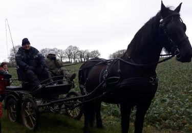
Trail Walking of 10.8 km to be discovered at Centre-Loire Valley, Indre-et-Loire, Tauxigny-Saint-Bauld. This trail is proposed by LEMENIO.

Description

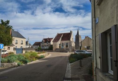
Départ sur le parking du cimetière.
         

Elevation profile

Positioning

Country:
France
Region :
Centre-Loire Valley
Department/Province :
Indre-et-Loire
Municipality :
Tauxigny-Saint-Bauld
Location:
Unknown
Start:(UTM)
336071 ; 5227371 (31T) N.

Trails nearby

Trail Walking Le Louroux - le Louroux - variante PR Boucle 2 - 17km 105m 3h45 (45mn) - 2023 09 27 - Photo
Walking
Orcal37

Walking

Easy
Le Louroux, Centre-Loire Valley, Indre-et-Loire, France
17 km | 18.3 km-effort
3h 45min
Yes
Trail Walking Dolus-le-Sec - Dolus-le-Sec - variante circuits des champs et de l'éolienne - 19.8km 110m 4h45 - 2022 05 26 - Photo
Walking
Orcal37

Walking

Easy
Dolus-le-Sec, Centre-Loire Valley, Indre-et-Loire, France
19.8 km | 21 km-effort
4h 45min
Yes
Trail On foot Le Louroux - Étang du Louroux - Photo
On foot
PRO

On foot

Easy
Le Louroux, Centre-Loire Valley, Indre-et-Loire, France
5.5 km | 5.8 km-effort
1h 19min
Yes
Trail Walking Tauxigny-Saint-Bauld - Tauxigny - 26.7km 170m 5h20 (30mn) - 2021 03 27 - Photo
Walking
Orcal37

Walking

Easy
Tauxigny-Saint-Bauld, Centre-Loire Valley, Indre-et-Loire, France
27 km | 29 km-effort
5h 20min
Yes
Trail Walking Tauxigny-Saint-Bauld - Saint-Bauld - La Vallée de l'Echandon - 16.4km 170m 3h35 - 2020 09 26 - Photo
Walking
Orcal37

Walking

Easy
Tauxigny-Saint-Bauld, Centre-Loire Valley, Indre-et-Loire, France
16.4 km | 18.7 km-effort
3h 35min
Yes
Trail Walking Le Louroux - Le Louroux - boucle 1 - 20.9km 100m 4h45 (35mn) - 2019 07 28 - Photo
Walking
Orcal37

Walking

Easy
Le Louroux, Centre-Loire Valley, Indre-et-Loire, France
21 km | 22 km-effort
4h 45min
Yes
Trail Walking Le Louroux - le Louroux - Photo
Walking
fustier

Walking

Very easy
Le Louroux, Centre-Loire Valley, Indre-et-Loire, France
21 km | 0 m-effort
5h 55min
Yes
Trail Hybrid bike Tauxigny-Saint-Bauld - Boucle Tauxigny Reignac Cormery - Photo
Hybrid bike
Dp35

Hybrid bike

Medium
(1)
Tauxigny-Saint-Bauld, Centre-Loire Valley, Indre-et-Loire, France
22 km | 25 km-effort
Unknown
Yes
Trail Walking Manthelan - Manthelan - Photo
Walking
danaubrac

Walking

Easy
Manthelan, Centre-Loire Valley, Indre-et-Loire, France
9.2 km | 9.9 km-effort
2h 1min
Yes


Close
My subscriptions