Trail Snowshoes Laye - Col de gleize - Photo
 will83
will83

User

© OpenStreetMap contributors
Length
Length
11.8 km
Max alt
Max alt
1709 m
Uphill gradient
Uphill gradient
490 m
Km-Effort
Km-Effort  
18.4 km
Min alt
Min alt
1244 m
Downhill gradient
Downhill gradient
498 m
Boucle
Boucle
Yes
Creation date :
2014-12-10 00:00:00.0
Updated on :
2014-12-10 00:00:00.0

(0 Reviews)

Snowshoes
Snowshoes
3h30
Difficulty : Medium

Scan this QR Code to open this trail in the SityTrail application

FREE GPS app for hiking

Logo SityTrail SityTrail

IGN / Geographical institutes

Download SityTrail from the App Store Download SityTrail from Google Play

Logo SityTrail SityTrail World

The world is yours!

Download SityTrail from the App Store Download SityTrail from Google Play Download SityTrail on Huawei AppGallery

About

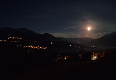
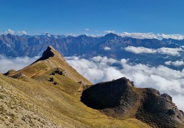
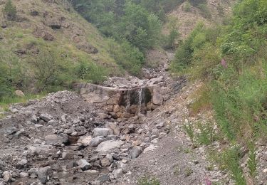
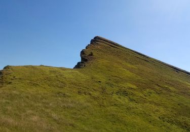
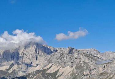
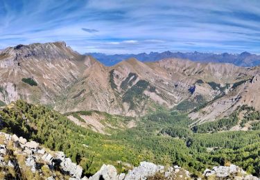
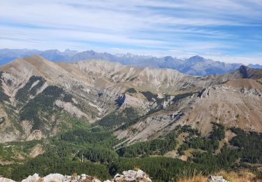
Trail Snowshoes of 11.8 km to be discovered at Provence-Alpes-Côte d'Azur, Hautes-Alpes, Laye. This trail is proposed by will83.

Description

Départ de la station de Laye.
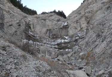
Attention.. Prévoyez plutôt le retour par le même itinéraire que l''aller. (variante possible au clôt de la dame pour retour sur la station).
Le tracé du retour par le Lauzon n''est à envisager uniquement si vous êtes pris par le temps (ce qui a été mon cas)    

Elevation profile

Photos

Points of interest

Point of interest Gap - Col de Lauzon - Photo
will83

Positioning

Country:
France
Region :
Provence-Alpes-Côte d'Azur
Department/Province :
Hautes-Alpes
Municipality :
Laye
Location:
Unknown
Start:(UTM)
267967 ; 4947324 (32T) N.

Trails nearby

Trail Walking Laye - Sentier de la Cuque prolongé - Photo
Walking
frederique.marti@laposte.net

Walking

Very easy
(1)
Laye, Provence-Alpes-Côte d'Azur, Hautes-Alpes, France
11.8 km | 19.7 km-effort
2h 24min
Yes
Trail Walking Saint-Laurent-du-Cros - St Laurent du Cros 27/01/24 - Photo
Walking
GUIDE
R@ph

Walking

Easy
Saint-Laurent-du-Cros, Provence-Alpes-Côte d'Azur, Hautes-Alpes, France
6.9 km | 9.2 km-effort
2h 4min
Yes
Trail Walking Gap - 3-pics-gleize_randonnee-40057005 - Photo
Walking
PapouBertrand

Walking

Difficult
Gap, Provence-Alpes-Côte d'Azur, Hautes-Alpes, France
6.9 km | 13.7 km-effort
3h 6min
Yes
Trail Walking La Fare-en-Champsaur - Le Bois Vert Station de Laye  - Photo
Walking
sereton

Walking

Medium
(1)
La Fare-en-Champsaur, Provence-Alpes-Côte d'Azur, Hautes-Alpes, France
9.1 km | 13.1 km-effort
2h 44min
Yes
Trail Walking Poligny - Sommet du Chamois - Photo
Walking
Marco05

Walking

Difficult
Poligny, Provence-Alpes-Côte d'Azur, Hautes-Alpes, France
8 km | 18.6 km-effort
4h 13min
Yes
Trail Walking Gap - Pic de Gleize - Photo
Walking
Marco05

Walking

Medium
Gap, Provence-Alpes-Côte d'Azur, Hautes-Alpes, France
4.8 km | 10.6 km-effort
2h 25min
Yes
Trail Walking Gap - 2021-09-28_502396886_Pic Melette - Photo
Walking
PapouBertrand

Walking

Very difficult
(1)
Gap, Provence-Alpes-Côte d'Azur, Hautes-Alpes, France
15.2 km | 24 km-effort
5h 26min
Yes
Trail Walking Gap - pic melette - Photo
Walking
gibello

Walking

Easy
Gap, Provence-Alpes-Côte d'Azur, Hautes-Alpes, France
13 km | 21 km-effort
6h 48min
Yes
Trail Walking Poligny - Cabane des pierres/Cascade ste Catherine. - Photo
Walking
Dervalmarc

Walking

Easy
(1)
Poligny, Provence-Alpes-Côte d'Azur, Hautes-Alpes, France
8.2 km | 13.2 km-effort
2h 43min
Yes


Close
My subscriptions