Trail Walking Sion - Vallon de la Borgne - Photo

Vallon de la Borgne

 fraper
fraper

User

© OpenStreetMap contributors
Length
Length
14.2 km
Max alt
Max alt
1100 m
Uphill gradient
Uphill gradient
877 m
Km-Effort
Km-Effort  
26 km
Min alt
Min alt
532 m
Downhill gradient
Downhill gradient
881 m
Boucle
Boucle
Yes
Creation date :
2014-12-10 00:00:00.0
Updated on :
2014-12-10 00:00:00.0

(0 Reviews)

Walking
Walking
5h31
Difficulty : Medium

Scan this QR Code to open this trail in the SityTrail application

FREE GPS app for hiking

Logo SityTrail SityTrail

IGN / Geographical institutes

Download SityTrail from the App Store Download SityTrail from Google Play

Logo SityTrail SityTrail World

The world is yours!

Download SityTrail from the App Store Download SityTrail from Google Play Download SityTrail on Huawei AppGallery

About

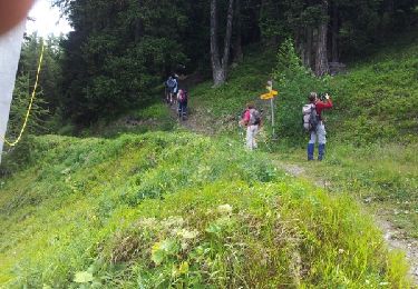
Trail Walking of 14.2 km to be discovered at Valais/Wallis, Sion, Sion. This trail is proposed by fraper.

Description

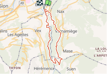
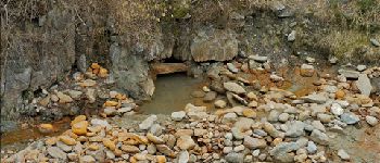
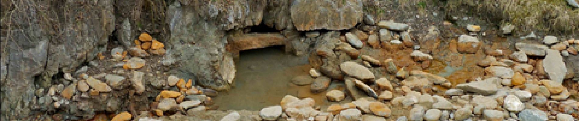
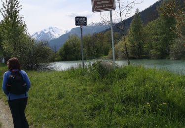
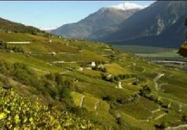
Un sentier pédestre permet de cheminer facilement au fond du vallon, dans les gorges, et de découvrir un paysage spectaculaire aux versants constitués de hautes falaises, de feuillus, de pinèdes ou de prairies sauvages sèches. Le chemin permet de rejoindre Combioula et ses fameuses sources d''eau chaude.
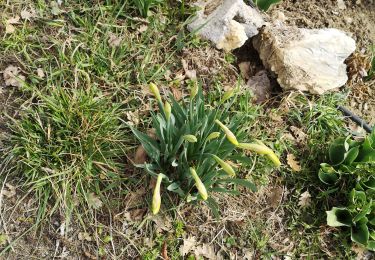
Une faune et une flore extrêmement riche et diversifiée ne manquera pas d''attirer l''attention du promeneur et captivera le spécialiste.

Elevation profile

Photos

Points of interest

Point of interest Saint-Martin (VS) - Photos - Photo
fraper
SAINT-MARTIN (VS) 

Positioning

Country:
Switzerland
Region :
Valais/Wallis
Department/Province :
Sion
Municipality :
Sion
Location:
Unknown
Start:(UTM)
377074 ; 5120685 (32T) N.

Trails nearby

Trail Walking Sion -  - Photo
Walking
npannatier

Walking

Very easy
(1)
Sion, Valais/Wallis, Sion, Switzerland
7.4 km | 9.6 km-effort
Unknown
No
Trail Walking Savièse - Mayen de la Zour-Prabé - Photo
Walking
lroux

Walking

Very easy
(1)
Savièse, Valais/Wallis, Sion, Switzerland
3.8 km | 10.3 km-effort
Unknown
No
Trail Nordic walking Savièse - bini  - Photo
Nordic walking
suzanne.bron

Nordic walking

Very easy
Savièse, Valais/Wallis, Sion, Switzerland
8.9 km | 12.2 km-effort
2h 59min
No
Trail Walking Arbaz - Botyre  - Photo
Walking
suzanne.bron

Walking

Medium
Arbaz, Valais/Wallis, Sion, Switzerland
5.2 km | 6.2 km-effort
1h 38min
No
Trail Walking Vex - Les Collons - Photo
Walking
cmike39

Walking

Medium
Vex, Valais/Wallis, Hérens, Switzerland
12.1 km | 18.8 km-effort
4h 9min
Yes
Trail Walking Saint-Léonard - Chemin du Vignoble - Photo
Walking
GUIDE+

Walking

Very easy
Saint-Léonard, Valais/Wallis, Sierre, Switzerland
25 km | 37 km-effort
9h 0min
No
Trail Other activity Mont-Noble - y10_eison_nax - Photo
Other activity
GUIDE+

Other activity

Very easy
Mont-Noble, Valais/Wallis, Hérens, Switzerland
13 km | 22 km-effort
5h 21min
No
Trail Other activity Mont-Noble - y10_koehlerweg - Photo
Other activity
GUIDE+

Other activity

Very easy
Mont-Noble, Valais/Wallis, Hérens, Switzerland
11.8 km | 23 km-effort
5h 2min
Yes
Trail Walking Arbaz - étang de botyre - Photo
Walking
suzanne.bron

Walking

Medium
Arbaz, Valais/Wallis, Sion, Switzerland
4.6 km | 6.7 km-effort
1h 45min
No


Close
My subscriptions