


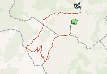

7.5 km | 13.1 km-effort


User


FREE GPS app for hiking
 SityTrail
IGN / Geographical institutes
SityTrail World
The world is yours!
Trail Other activity of 8 km to be discovered at Fribourg, Gruyère District, Gruyères. This trail is proposed by Threcani.
Parquer la voiture à Moléson-Village. Prendre le funiculaire puis le téléphérique jusqu''au sommet; opter pour un billet avantageux 3 sections puisque le retour se fera sans utiliser le téléphérique, mais bien seulement le funiculaire.
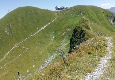
Vue splendide. Paysage varié. Tout en descente.

Snowshoes
On foot

Walking
Walking

Other activity

Cycle

Walking
Walking
Walking