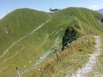
Gruyères, Gruyère District: Best trails, routes and walks

Gruyères: Discover the best trails: 7 hiking trails and 2 bike and mountain-bike routes. All these trails, routes and outdoor activities are available in our SityTrail applications for smartphones and tablets.


The best trails (15)
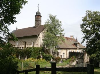
Trail On foot Gruyères - Sentier des Pauvres - Photo
On foot 5.918
Km
PRO

On foot

Easy
Gruyères, Fribourg, Gruyère District, Switzerland
5.9 km | 8.5 km-effort
1h 55min
181 m
229 m
No
SityTrail - itinéraires balisés pédestres

Trail Walking Gruyères - 2018-07-26 Plan Francey Moleson en boucle  - Photo
Walking 7.99
Km

Walking

Medium
Gruyères, Fribourg, Gruyère District, Switzerland
8 km | 16.1 km-effort
3h 12min
607 m
608 m
Yes
patpounet73

• Très belle randonnée. Les plus courageux peuvent partir depuis Moleson Village, mais il faisait trop chaud ce 26 juil...

Trail Other activity Gruyères - y10_gruyere - Photo
Other activity 6.896
Km
GUIDE+

Other activity

Very easy
Gruyères, Fribourg, Gruyère District, Switzerland
6.9 km | 10.3 km-effort
2h 5min
161 m
539 m
No
My Switzerland

Trail Cycle Gruyères - st_ral_5 - Photo
Cycle 33.935
Km
GUIDE+

Cycle

Very easy
Gruyères, Fribourg, Gruyère District, Switzerland
34 km | 55 km-effort
Unknown
1530 m
1874 m
No
My Switzerland

Trail Walking Gruyères - Käsereilehrpfad durchs Greyerzerland - Photo
Walking 6.499
Km
GUIDE+

Walking

Very easy
Gruyères, Fribourg, Gruyère District, Switzerland
6.5 km | 9.5 km-effort
Unknown
131 m
507 m
No
My Switzerland

Trail Walking Gruyères - st_test3 - Photo
Walking 11.211
Km
GUIDE+

Walking

Very easy
Gruyères, Fribourg, Gruyère District, Switzerland
11.2 km | 17.7 km-effort
3h 35min
187 m
1385 m
No
My Switzerland

Trail Other activity Gruyères - Vudalla - Photo
Other activity 8.837
Km

Other activity

Very easy
Gruyères, Fribourg, Gruyère District, Switzerland
8.8 km | 13.6 km-effort
Unknown
254 m
661 m
No
Mangold

Trail Cycle Gruyères - Moléson/Sterngucken auf dem Familienberg - Photo
Cycle 2.331
Km
GUIDE+

Cycle

Very easy
Gruyères, Fribourg, Gruyère District, Switzerland
2.3 km | 10.4 km-effort
Unknown
800 m
14 m
No
My Switzerland

Trail Other activity Gruyères - Dent de Broc par l''Encoche - Photo
Other activity 11.121
Km

Other activity

Very easy
Gruyères, Fribourg, Gruyère District, Switzerland
11.1 km | 26 km-effort
Unknown
1102 m
1100 m
Yes
Bachmann

Trail Walking Gruyères - Gruyères-La Chia-chemin des pauvres-07.08 - Photo
Walking 15.791
Km

Walking

Medium
Gruyères, Fribourg, Gruyère District, Switzerland
15.8 km | 28 km-effort
5h 0min
912 m
912 m
Yes
duamerg

Trail Walking Gruyères - Moléson village - Vudalla - Gros Moléson - Photo
Walking 12.64
Km

Walking

Medium
Gruyères, Fribourg, Gruyère District, Switzerland
12.6 km | 22 km-effort
4h 40min
693 m
693 m
Yes
duamerg

Trail Other activity Gruyères - Moléson - Photo
Other activity 8.014
Km

Other activity

Very easy
Gruyères, Fribourg, Gruyère District, Switzerland
8 km | 12 km-effort
Unknown
180 m
657 m
No
Threcani

Trail Winter sports Gruyères - Gruyères - Col de la Vudalla - Photo
Winter sports 22.077
Km

Winter sports

Very easy
Gruyères, Fribourg, Gruyère District, Switzerland
22 km | 36 km-effort
Unknown
1067 m
1067 m
Yes
vttnature

Trail Walking Gruyères - YHH087 Moléson-sur-Gruyère - Photo
Walking 2.675
Km

Walking

Easy
Gruyères, Fribourg, Gruyère District, Switzerland
2.7 km | 4.2 km-effort
49min
23 m
401 m
No
yveshumbert

Trail Other activity Gruyères - Dent de Broc - Photo
Other activity 2.493
Km

Other activity

Very easy
Gruyères, Fribourg, Gruyère District, Switzerland
2.5 km | 7 km-effort
Unknown
447 m
3 m
No
pnoth

15 trails displayed on 15

FREE GPS app for hiking

Logo SityTrail SityTrail

IGN / Geographical institutes

Download SityTrail from the App Store Download SityTrail from Google Play

Logo SityTrail SityTrail World

The world is yours!

Download SityTrail from the App Store Download SityTrail from Google Play Download SityTrail on Huawei AppGallery

Activities

Close
My subscriptions