Trail Walking Bourg-de-Sirod - Les Chamois - Photo
© OpenStreetMap contributors
Length
Length
7.3 km
Max alt
Max alt
788 m
Uphill gradient
Uphill gradient
325 m
Km-Effort
Km-Effort  
11.6 km
Min alt
Min alt
534 m
Downhill gradient
Downhill gradient
323 m
Boucle
Boucle
Yes
Creation date :
2014-12-10 00:00:00.0
Updated on :
2014-12-10 00:00:00.0

(0 Reviews)

Walking
Walking
2h27
Difficulty : Difficult

Scan this QR Code to open this trail in the SityTrail application

FREE GPS app for hiking

Logo SityTrail SityTrail

IGN / Geographical institutes

Download SityTrail from the App Store Download SityTrail from Google Play

Logo SityTrail SityTrail World

The world is yours!

Download SityTrail from the App Store Download SityTrail from Google Play Download SityTrail on Huawei AppGallery

About

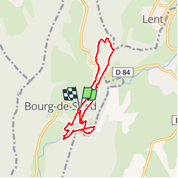
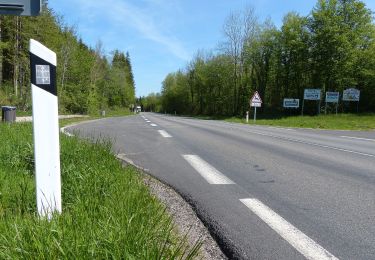
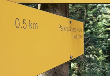
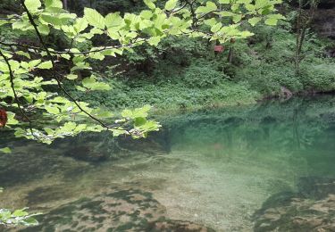
Trail Walking of 7.3 km to be discovered at Bourgogne-Franche-Comté, Jura, Bourg-de-Sirod. This trail is proposed by YannickPFENDT.

Description

Perte de l'ain -porte médiévale - passerelles - château villain - bélvedère de l'esperons - rochets des commères - barrage edf .

Elevation profile

Photos

Positioning

Country:
France
Region :
Bourgogne-Franche-Comté
Department/Province :
Jura
Municipality :
Bourg-de-Sirod
Location:
Unknown
Start:(UTM)
726157 ; 5179183 (31T) N.

Trails nearby

Trail Walking Nozeroy - Source de l'Ain - Photo
Walking
tracegps

Walking

Medium
(2)
Nozeroy, Bourgogne-Franche-Comté, Jura, France
13.4 km | 18.9 km-effort
3h 30min
Yes
Trail Walking Nozeroy - Nozeroy la source de l'Ain  - Photo
Walking
grasgilbert

Walking

Difficult
Nozeroy, Bourgogne-Franche-Comté, Jura, France
10.8 km | 15.1 km-effort
3h 26min
Yes
Trail On foot Pillemoine - GR - Photo
On foot
PRO

On foot

Easy
Pillemoine, Bourgogne-Franche-Comté, Jura, France
9.3 km | 12.9 km-effort
2h 55min
No
Trail Walking Conte - roro - Photo
Walking
chantal40

Walking

Medium
Conte, Bourgogne-Franche-Comté, Jura, France
11 km | 15.4 km-effort
6h 33min
Yes
Trail Walking Lent - roro - Photo
Walking
chantal40

Walking

Medium
Lent, Bourgogne-Franche-Comté, Jura, France
11.5 km | 17.3 km-effort
7h 30min
Yes
Trail Walking Conte - Source de l'Ain - Photo
Walking
Marie-Claire-mcp

Walking

Very easy
Conte, Bourgogne-Franche-Comté, Jura, France
4.4 km | 6.1 km-effort
1h 43min
No
Trail Walking Syam - Cascade de la Billaude - Photo
Walking
Alexandre1980

Walking

Very difficult
(1)
Syam, Bourgogne-Franche-Comté, Jura, France
15.3 km | 22 km-effort
4h 54min
Yes
Trail Walking Bourg-de-Sirod - les pertes de l'ain - Photo
Walking
Genisset

Walking

Easy
(1)
Bourg-de-Sirod, Bourgogne-Franche-Comté, Jura, France
8.1 km | 12.8 km-effort
2h 55min
Yes
Trail Walking Sapois - Sapois, Sirod,perte de l'Ain 3 sept 2019 CAF - Photo
Walking
TRIMAILLE

Walking

Difficult
Sapois, Bourgogne-Franche-Comté, Jura, France
21 km | 33 km-effort
6h 42min
Yes


Close
My subscriptions