


2018-08-26 Picnic CVA Cascades Stosswihr

holtzv
User GUIDE
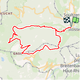

Length
19.2 km

Max alt
997 m

Uphill gradient
737 m
Km-Effort
29 km

Min alt
454 m

Downhill gradient
737 m
Boucle
Yes
Creation date :
2018-08-27 09:51:34.277
Updated on :
2018-08-27 10:50:51.274
3m
Difficulty : Easy

FREE GPS app for hiking
 SityTrail
IGN / Geographical institutes
SityTrail Plus
The world is yours!
About
Trail Horseback riding of 19.2 km to be discovered at Grand Est, Haut-Rhin, Stosswihr. This trail is proposed by holtzv.
Description
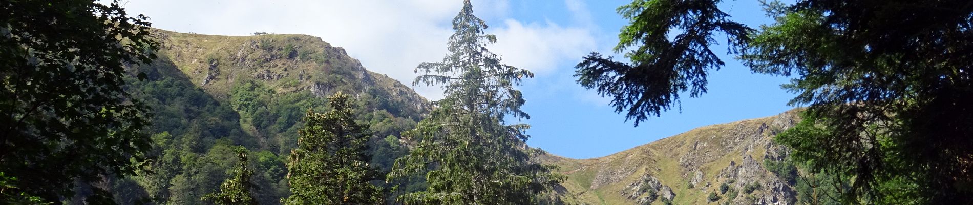
Picnic CVA Cascades Stosswihr en passant par le Gashney
Photos


Positioning
Country:
France
Region :
Grand Est
Department/Province :
Haut-Rhin
Municipality :
Stosswihr
Location:
Unknown
Start:(Dec)
Start:(UTM)
358455 ; 5324011 (32U) N.
Comments