


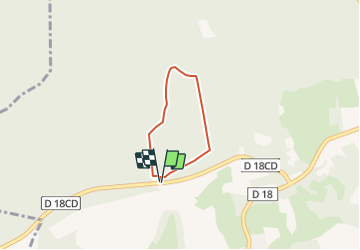


10.8 km | 13.4 km-effort

Randonnées de RandoFamili


FREE GPS app for hiking
 SityTrail
IGN / Geographical institutes
SityTrail World
The world is yours!
Trail Walking of 1.8 km to be discovered at Hauts-de-France, Aisne, Craonne. This trail is proposed by Rando Famili.
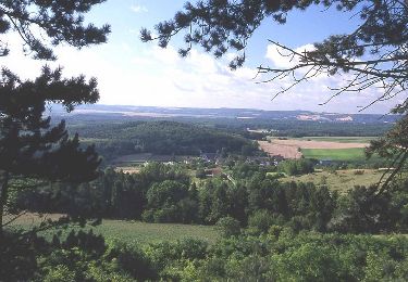
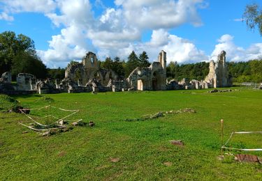
Sur le Chemin des Dames, site phare de la mémoire militaire en Picardie, cette balade courte et facile au départ du belvédère du plateau de Californie, offre de belles perspectives sur la vallée de l'Aisne située en contrebas. Le parcours de randonnée en corniche est jalonné de panneaux thématiques sur la Grande Guerre.


Walking
Walking

Walking

Walking
Walking
Walking
Walking
Walking