Trail Mountain bike Malbo - VTT Malbo N10 - Photo
 macleon
macleon

User

© OpenStreetMap contributors
Length
Length
22 km
Max alt
Max alt
1157 m
Uphill gradient
Uphill gradient
487 m
Km-Effort
Km-Effort  
28 km
Min alt
Min alt
910 m
Downhill gradient
Downhill gradient
489 m
Boucle
Boucle
Yes
Creation date :
2014-12-10 00:00:00.0
Updated on :
2014-12-10 00:00:00.0

(0 Reviews)

Mountain bike
Mountain bike
1h51
Difficulty : Medium

Scan this QR Code to open this trail in the SityTrail application

FREE GPS app for hiking

Logo SityTrail SityTrail

IGN / Geographical institutes

Download SityTrail from the App Store Download SityTrail from Google Play

Logo SityTrail SityTrail World

The world is yours!

Download SityTrail from the App Store Download SityTrail from Google Play Download SityTrail on Huawei AppGallery

About

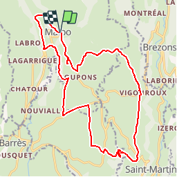
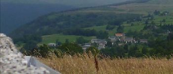
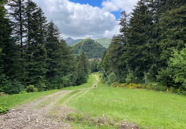
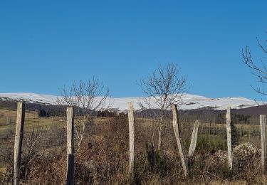
Trail Mountain bike of 22 km to be discovered at Auvergne-Rhône-Alpes, Cantal, Malbo. This trail is proposed by macleon.

Description

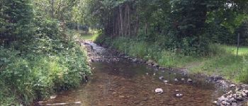
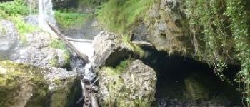
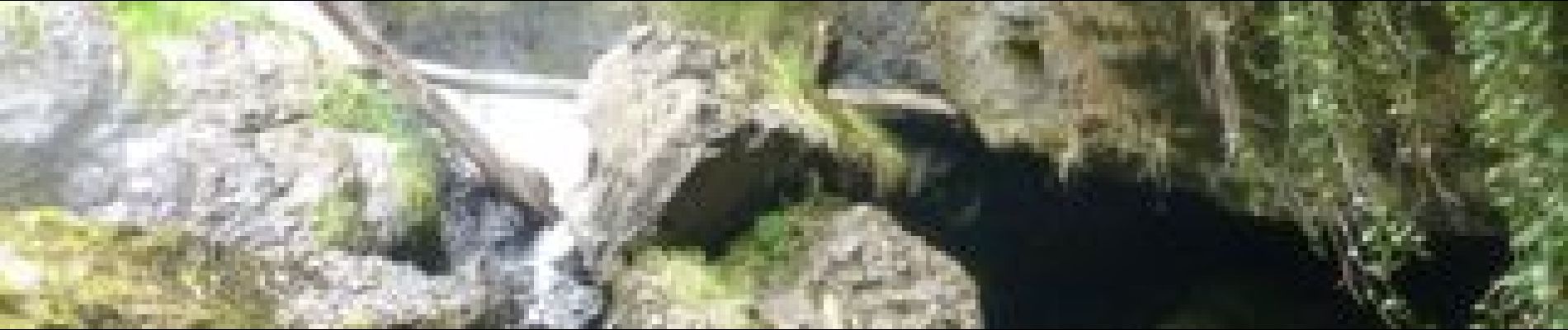
Circuit balisé au départ de Malbo ( petite extension Enduro entre le départ et le gué), Decente vers la cascade en option

Elevation profile

Photos

Points of interest

Point of interest Malbo - Gué - Photo
macleon
MALBO 
Point of interest Malbo - Croix - Photo
macleon
MALBO 
Point of interest Narnhac - chemin large - Photo
macleon
NARNHAC 
Point of interest Narnhac - La cascade - Photo
macleon
NARNHAC 

Positioning

Country:
France
Region :
Auvergne-Rhône-Alpes
Department/Province :
Cantal
Municipality :
Malbo
Location:
Unknown
Start:(UTM)
480885 ; 4980000 (31T) N.

Trails nearby

Trail Walking Pailherols - Du refuge des Fraux au Plomb du Cantal - Photo
Walking
tracegps

Walking

Difficult
Pailherols, Auvergne-Rhône-Alpes, Cantal, France
22 km | 32 km-effort
7h 0min
Yes
Trail Walking Thiézac - Cantal jour 5- Lafon- bufadou - Photo
Walking
philippe.beyebs

Walking

Easy
Thiézac, Auvergne-Rhône-Alpes, Cantal, France
18.8 km | 31 km-effort
6h 21min
No
Trail Walking Lacapelle-Barrès - puy de Bane - Photo
Walking
Jean-Marie Bousquet

Walking

Difficult
Lacapelle-Barrès, Auvergne-Rhône-Alpes, Cantal, France
19.2 km | 26 km-effort
4h 3min
Yes
Trail Walking Malbo - la garrigue - Photo
Walking
neleda

Walking

Medium
Malbo, Auvergne-Rhône-Alpes, Cantal, France
8.1 km | 10 km-effort
2h 14min
Yes
Trail Walking Thiézac - Thiezac- Lioràn - Photo
Walking
chantalwaltzer

Walking

Thiézac, Auvergne-Rhône-Alpes, Cantal, France
19.3 km | 31 km-effort
7h 58min
No
Trail Walking Thiézac - 2022 07 Cantal Jour 3 - Photo
Walking
rando1490

Walking

Easy
Thiézac, Auvergne-Rhône-Alpes, Cantal, France
23 km | 36 km-effort
6h 36min
No
Trail sport Pailherols - 2021-12-16_22h32m59_SityTrail - 215101 - du-refuge-des-fraux-au-plomb-du-cantal - Photo
sport
Sandrine 15

sport

Very easy
Pailherols, Auvergne-Rhône-Alpes, Cantal, France
22 km | 32 km-effort
Unknown
Yes
Trail sport Pailherols - 2021-12-16_22h31m25_SityTrail - 215101 - du-refuge-des-fraux-au-plomb-du-cantal - Photo
sport
Sandrine 15

sport

Very easy
Pailherols, Auvergne-Rhône-Alpes, Cantal, France
22 km | 32 km-effort
Unknown
Yes
Trail Walking Thiézac - Col de la chèvre du gite Lafon - Photo
Walking
Jean-Marie Bousquet

Walking

Medium
Thiézac, Auvergne-Rhône-Alpes, Cantal, France
17.1 km | 26 km-effort
5h 52min
Yes


Close
My subscriptions