Trail Walking Anse - anse - Photo
 aurel69
aurel69

User

© OpenStreetMap contributors
Length
Length
3.9 km
Max alt
Max alt
178 m
Uphill gradient
Uphill gradient
32 m
Km-Effort
Km-Effort  
4.3 km
Min alt
Min alt
166 m
Downhill gradient
Downhill gradient
34 m
Boucle
Boucle
No
Creation date :
2014-12-10 00:00:00.0
Updated on :
2014-12-10 00:00:00.0

(0 Reviews)

Walking
Walking
47m
Difficulty : Very easy

Scan this QR Code to open this trail in the SityTrail application

FREE GPS app for hiking

Logo SityTrail SityTrail

IGN / Geographical institutes

Download SityTrail from the App Store Download SityTrail from Google Play

Logo SityTrail SityTrail World

The world is yours!

Download SityTrail from the App Store Download SityTrail from Google Play Download SityTrail on Huawei AppGallery

About

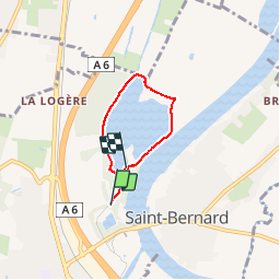
Trail Walking of 3.9 km to be discovered at Auvergne-Rhône-Alpes, Rhône, Anse. This trail is proposed by aurel69.

Description

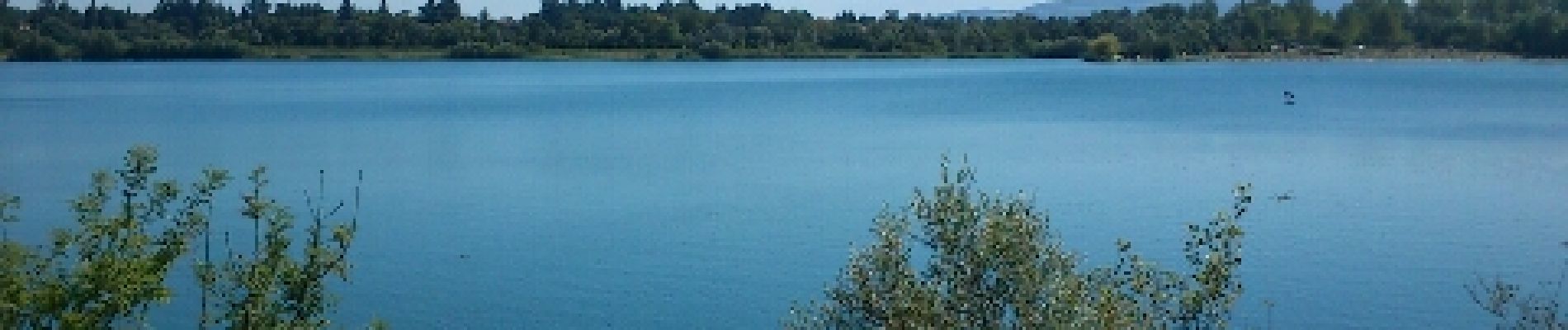
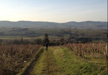
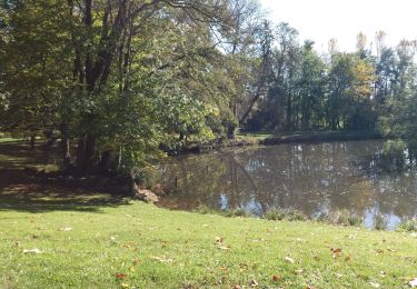
Promenade autour du Plan d’eau du Colombier à Anse dans le Beaujolais.
Dans un espace naturel de 70 ha, ce plan d’eau, de 120 ha, est une ancienne gravière réaménagée pour la baignade et les loisirs

Elevation profile

Photos

Positioning

Country:
France
Region :
Auvergne-Rhône-Alpes
Department/Province :
Rhône
Municipality :
Anse
Location:
Unknown
Start:(UTM)
633608 ; 5089581 (31T) N.

Trails nearby

Trail Walking Lucenay - Lucenay (69) - 9 km/D. 293 m - Photo
Walking
Thomasdanielle

Walking

Lucenay, Auvergne-Rhône-Alpes, Rhône, France
8.8 km | 12.7 km-effort
2h 50min
Yes
Trail Walking Trévoux - TREVOUX  -  01 - Photo
Walking
AndreLACOMBE

Walking

Very easy
Trévoux, Auvergne-Rhône-Alpes, Ain, France
11.7 km | 12.6 km-effort
3h 26min
Yes
Trail Walking Limas - Limas - Photo
Walking
thierry13710

Walking

Easy
Limas, Auvergne-Rhône-Alpes, Rhône, France
5.7 km | 7.6 km-effort
1h 37min
Yes
Trail Walking Porte des Pierres Dorées - Chemin du Tacot (1) - Photo
Walking
patrickmarchais

Walking

Medium
(1)
Porte des Pierres Dorées, Auvergne-Rhône-Alpes, Rhône, France
17.5 km | 22 km-effort
Unknown
No
Trail Walking Marcy - Marcy 2010-08-25 - Photo
Walking
gael.simon

Walking

Very easy
Marcy, Auvergne-Rhône-Alpes, Rhône, France
4.5 km | 6.1 km-effort
Unknown
Yes
Trail Walking Villefranche-sur-Saône - Itinérant Beaujolais etape 1 Villefranche sur Saone - Le Flagolet - Photo
Walking
chessyca

Walking

Medium
Villefranche-sur-Saône, Auvergne-Rhône-Alpes, Rhône, France
20 km | 25 km-effort
4h 43min
No
Trail Walking Lucenay - Lucenay  - Photo
Walking
Trotte-menu

Walking

Medium
Lucenay, Auvergne-Rhône-Alpes, Rhône, France
5.7 km | 6.7 km-effort
1h 35min
Yes
Trail Walking Trévoux - ars - Photo
Walking
GALIBER

Walking

Difficult
Trévoux, Auvergne-Rhône-Alpes, Ain, France
12.6 km | 15 km-effort
4h 35min
No
Trail Walking Jassans-Riottier - de Jassans à Ars - Photo
Walking
maclobar

Walking

Very easy
Jassans-Riottier, Auvergne-Rhône-Alpes, Ain, France
19.5 km | 23 km-effort
6h 1min
Yes


Close
My subscriptions