Trail Walking Marcy - Marcy 2010-08-25 - Photo
© OpenStreetMap contributors
Length
Length
4.5 km
Max alt
Max alt
401 m
Uphill gradient
Uphill gradient
122 m
Km-Effort
Km-Effort  
6.1 km
Min alt
Min alt
287 m
Downhill gradient
Downhill gradient
121 m
Boucle
Boucle
Yes
Creation date :
2014-12-10 00:00:00.0
Updated on :
2014-12-10 00:00:00.0

(0 Reviews)

Walking
Walking
--
Difficulty : Unknown

Scan this QR Code to open this trail in the SityTrail application

FREE GPS app for hiking

Logo SityTrail SityTrail

IGN / Geographical institutes

Download SityTrail from the App Store Download SityTrail from Google Play

Logo SityTrail SityTrail World

The world is yours!

Download SityTrail from the App Store Download SityTrail from Google Play Download SityTrail on Huawei AppGallery

About

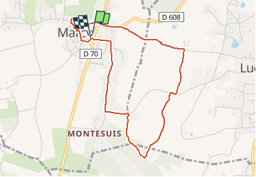
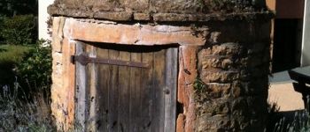
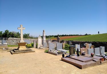
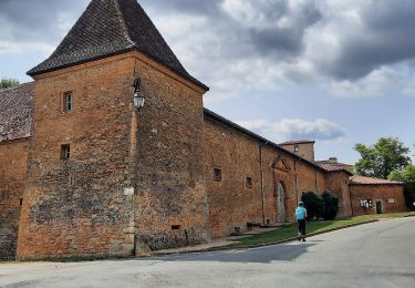
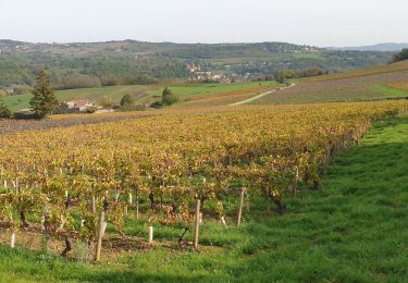
Trail Walking of 4.5 km to be discovered at Auvergne-Rhône-Alpes, Rhône, Marcy. This trail is proposed by gael.simon.

Elevation profile

Photos

Points of interest

Point of interest Lucenay - Vignes - Photo
gael.simon
LUCENAY 
Point of interest Marcy - télégraphe - Photo
gael.simon
Point of interest Lucenay - Paysage - Photo
gael.simon
LUCENAY 
Point of interest Lucenay - Vigne - Photo
gael.simon
LUCENAY 
Point of interest Lucenay - Borne - Photo
gael.simon
LUCENAY 
Point of interest Morancé - Vue sur les vignes - Photo
gael.simon
Point of interest Lucenay - Entretien des vignes - Photo
gael.simon
Point of interest Lucenay - Chaleins Croix - Photo
gael.simon
Point of interest Marcy - Vierge au loin - Photo
gael.simon
Point of interest Marcy - Travail - Photo
gael.simon
MARCY 
Point of interest Marcy - Maison - Photo
gael.simon
MARCY 
Point of interest Marcy - Maison - Photo
gael.simon
MARCY 
Point of interest Marcy - Choux et Citrouilles - Photo
gael.simon
Point of interest Marcy - Tracteur - Photo
gael.simon
MARCY 
Point of interest Marcy - Clocher Eglise de Marcy - Photo
gael.simon
Point of interest Marcy - Puits - Photo
gael.simon
MARCY 

Positioning

Country:
France
Region :
Auvergne-Rhône-Alpes
Department/Province :
Rhône
Municipality :
Marcy
Location:
Unknown
Start:(UTM)
630359 ; 5085968 (31T) N.

Trails nearby

Trail On foot Saint-Jean-des-Vignes - De Bagnols à Lozanne - Photo
On foot
PRO

On foot

Easy
Saint-Jean-des-Vignes, Auvergne-Rhône-Alpes, Rhône, France
4 km | 5 km-effort
1h 7min
No
Trail Nordic walking Bagnols - bagnol - Photo
Nordic walking
isabelle.xavier

Nordic walking

Very easy
(1)
Bagnols, Auvergne-Rhône-Alpes, Rhône, France
6.8 km | 8.4 km-effort
1h 40min
Yes
Trail Walking Saint-Jean-des-Vignes - A_ST JEAN DES VIGNES 69380 Pierre Folle - Fontainebleau - Photo
Walking
ANDREJAC

Walking

Easy
(1)
Saint-Jean-des-Vignes, Auvergne-Rhône-Alpes, Rhône, France
8 km | 11 km-effort
3h 0min
Yes
Trail Walking Morancé - morance - Photo
Walking
6974gros

Walking

Very easy
(1)
Morancé, Auvergne-Rhône-Alpes, Rhône, France
7.9 km | 9.7 km-effort
1h 46min
Yes
Trail Horseback riding Les Chères - 5 nov formation - Photo
Horseback riding
HOUDA DRIF

Horseback riding

Easy
(2)
Les Chères, Auvergne-Rhône-Alpes, Rhône, France
13.6 km | 15 km-effort
1h 58min
Yes
Trail Walking Chessy - Chessy à Bagnols - Photo
Walking
Jean-Marc C

Walking

Difficult
(1)
Chessy, Auvergne-Rhône-Alpes, Rhône, France
12.5 km | 15.8 km-effort
3h 35min
Yes
Trail Walking Charnay - Charnay (12 km - D. 330 m) - Photo
Walking
Thomasdanielle

Walking

Easy
Charnay, Auvergne-Rhône-Alpes, Rhône, France
12.5 km | 16.9 km-effort
3h 7min
Yes
Trail Walking Chessy - Chessy - Carrières de Gray - Photo
Walking
PhilDomDoxa

Walking

Very easy
Chessy, Auvergne-Rhône-Alpes, Rhône, France
9.7 km | 13 km-effort
2h 33min
Yes
Trail Walking Theizé - Theizé (11 km - D. 310 m) - Photo
Walking
Thomasdanielle

Walking

Medium
Theizé, Auvergne-Rhône-Alpes, Rhône, France
11.3 km | 15.5 km-effort
2h 43min
Yes


Close
My subscriptions