Trail Walking Samer - Le Bas Blaisel - Samer - Photo

Le Bas Blaisel - Samer

 tracegps
tracegps

User

© OpenStreetMap contributors
Length
Length
7 km
Max alt
Max alt
101 m
Uphill gradient
Uphill gradient
94 m
Km-Effort
Km-Effort  
8.2 km
Min alt
Min alt
48 m
Downhill gradient
Downhill gradient
93 m
Boucle
Boucle
Yes
Creation date :
10/12/2014 00:00
Updated on :
10/12/2014 00:00

(0 Reviews)

Walking
Walking
1h30
Difficulty : Medium

Scan this QR Code to open this trail in the SityTrail application

FREE GPS app for hiking

Logo SityTrail SityTrail

IGN / Geographical institutes

Download SityTrail from the App Store Download SityTrail from Google Play

Logo SityTrail SityTrail Plus

The world is yours!

Download SityTrail from the App Store Download SityTrail from Google Play Download SityTrail on Huawei AppGallery

About

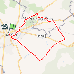
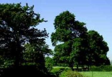
Trail Walking of 7 km to be discovered at Hauts-de-France, Pas-de-Calais, Samer. This trail is proposed by tracegps.

Description

Balade idéale en famille autour de Samer, découverte du village de Wierre au Bois et son manoir de Sainte-Beuve, le plus grand manoir du Boulonnais.

Elevation profile

Photos

Points of interest

Point of interest Samer - SAMER - Photo
tracegps
SAMER 
Point of interest Wierre-au-Bois - WIERRE AU BOIS - Photo
tracegps
WIERRE-AU-BOIS 

Positioning

Country:
France
Region :
Hauts-de-France
Department/Province :
Pas-de-Calais
Municipality :
Samer
Location:
Unknown
Start:(UTM)
411308 ; 5610505 (31U) N.


Close
My subscriptions