Trail Walking Roquefère - La cascade de Cubserviès - Roquefère - Photo

La cascade de Cubserviès - Roquefère

 tracegps
tracegps

User

© OpenStreetMap contributors
Length
Length
16.1 km
Max alt
Max alt
801 m
Uphill gradient
Uphill gradient
697 m
Km-Effort
Km-Effort  
25 km
Min alt
Min alt
314 m
Downhill gradient
Downhill gradient
704 m
Boucle
Boucle
Yes
Creation date :
2014-12-10 00:00:00.0
Updated on :
2014-12-10 00:00:00.0

(3 Reviews)

Walking
Walking
8h16
Difficulty : Difficult

Scan this QR Code to open this trail in the SityTrail application

FREE GPS app for hiking

Logo SityTrail SityTrail

IGN / Geographical institutes

Download SityTrail from the App Store Download SityTrail from Google Play

Logo SityTrail SityTrail World

The world is yours!

Download SityTrail from the App Store Download SityTrail from Google Play Download SityTrail on Huawei AppGallery

About

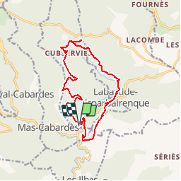
Trail Walking of 16.1 km to be discovered at Occitania, Aude, Roquefère. This trail is proposed by tracegps.

Description

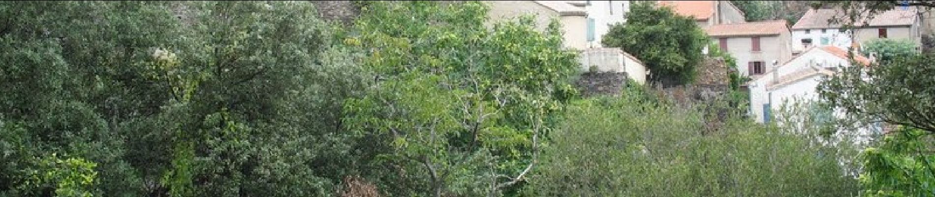
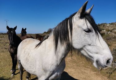
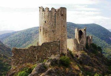
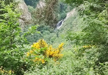
Départ de Roquefère, superbe parking randonneurs à l’entrée du village, que dire de cette rando que du bonheur, nous la faisons pour le 2 eme fois, beau sentier, paysages, panoramas, etc.…. La vidéo HD 25Mn de la rando est sur youtube (Roquefère - 11380 - la cascade de Cubserviès).

Elevation profile

Photos

Positioning

Country:
France
Region :
Occitania
Department/Province :
Aude
Municipality :
Roquefère
Location:
Unknown
Start:(UTM)
449525 ; 4802214 (31T) N.

Comments

Please log in to post a review or rate the element


Je ne la trouve pas difficile... Bcp d'ombre, TB en cas de chaleur. Vente de crème de marron très bonne chez le producteur à Roquefère.


Trails nearby

Trail Walking La Tourette-Cabardès - Rndonnée autour de la Tourette Cabardès - Photo
Walking
tracegps

Walking

Medium
(1)
La Tourette-Cabardès, Occitania, Aude, France
12 km | 17.2 km-effort
3h 19min
Yes
Trail Walking Miraval-Cabardès - Miraval - Lacoste - Roc du Bougre - Photo
Walking
mikaou.t

Walking

Difficult
(1)
Miraval-Cabardès, Occitania, Aude, France
11.4 km | 18.1 km-effort
3h 45min
Yes
Trail On foot Labastide-Esparbairenque - Les Villages Perchés - Photo
On foot
PRO

On foot

Difficult
Labastide-Esparbairenque, Occitania, Aude, France
24 km | 38 km-effort
8h 32min
Yes
Trail Walking Les Ilhes - Les Ilhes - Photo
Walking
GUIDE
Ada11

Walking

Easy
Les Ilhes, Occitania, Aude, France
17.3 km | 26 km-effort
4h 56min
Yes
Trail On foot Roquefère - Labastide-Espabïrenque, Prat Viel, Picarot haut - Photo
On foot
mikaou.t

On foot

Medium
(1)
Roquefère, Occitania, Aude, France
10.2 km | 15.6 km-effort
3h 0min
Yes
Trail Walking Les Ilhes - les Trois Vallées - Photo
Walking
Pierre11

Walking

Medium
(2)
Les Ilhes, Occitania, Aude, France
13.8 km | 22 km-effort
4h 41min
Yes
Trail Walking Lastours - Lastours dans l'Aude et ses tours... - Photo
Walking
tracegps

Walking

Easy
(1)
Lastours, Occitania, Aude, France
2.8 km | 4.2 km-effort
2h 0min
Yes
Trail Walking Limousis - Limousis  - Photo
Walking
Christophe Ferreres

Walking

Difficult
Limousis, Occitania, Aude, France
9.8 km | 14.9 km-effort
3h 48min
Yes
Trail Walking Roquefère - roquefere - cubservies - Photo
Walking
cappelle

Walking

Medium
Roquefère, Occitania, Aude, France
14.9 km | 23 km-effort
5h 25min
Yes


Close
My subscriptions