Trail Walking Baerenthal - Baerenthal, château de Ramstein de nuit - Photo

Baerenthal, château de Ramstein de nuit

 tracegps
tracegps

User

© OpenStreetMap contributors
Length
Length
19.5 km
Max alt
Max alt
328 m
Uphill gradient
Uphill gradient
477 m
Km-Effort
Km-Effort  
26 km
Min alt
Min alt
205 m
Downhill gradient
Downhill gradient
474 m
Boucle
Boucle
Yes
Creation date :
2014-12-10 00:00:00.0
Updated on :
2014-12-10 00:00:00.0

(0 Reviews)

Walking
Walking
5h30
Difficulty : Medium

Scan this QR Code to open this trail in the SityTrail application

FREE GPS app for hiking

Logo SityTrail SityTrail

IGN / Geographical institutes

Download SityTrail from the App Store Download SityTrail from Google Play

Logo SityTrail SityTrail World

The world is yours!

Download SityTrail from the App Store Download SityTrail from Google Play Download SityTrail on Huawei AppGallery

About

Trail Walking of 19.5 km to be discovered at Grand Est, Moselle, Baerenthal. This trail is proposed by tracegps.

Description

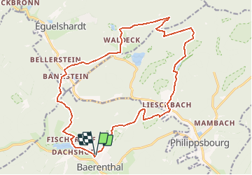
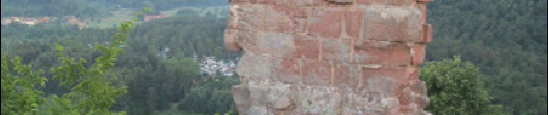
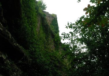
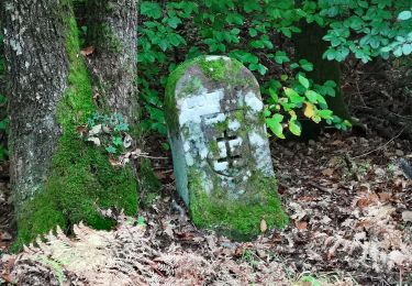
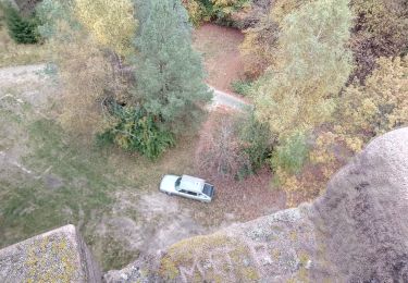
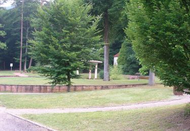
Marche de nuit, 20 juillet, du coucher au lever du soleil. Rendez-vous à 23h, sur le Parking devant la chapelle Notre Dame de la Confiance à Baerenthal. En suivant anneau vert, longer le plan d’eau vers Rosselhof. Arrivé à Fischerhof, tourner à droite et continuer sur losange jaune vers le Silberberg. Dans la descente traverser la route forestière du Hammerschless vers la maison forestière de Bellerstein. Suivre croix rouge, traverser la D662. À la maison forestière de Waldeck tourner à droite sur croix bleue vers la route forestière des Bornes. Tourner à gauche sur anneau vert vers le hameau de Waldeck. Après l’arche du Erbsenfelsen, descendre à droite toujours sur anneau vert. Voir la borne de 1605 en arrivant sur la route forestière. Au carrefour tourner à gauche sur triangle bleu. Après 1 km, tourner à droite sur chemin non balisé vers l’étang de Lieschbach, couvert de nénuphars. Continuer sur disque jaune, hameau de Lieschbach, traverser de nouveau la D662. Continuer sur disque jaune vers col de Grand Dunkelthal. A partir du col suivre anneau rouge, monter à la ruine du château de Ramstein, visite du château, magnifique panorama. Descendre vers le parking en suivant anneau rouge sur la rue du Ramstein.D'autres infos dans le topoguide du club vosgien de Bitche : "Balades dans le Pays de Bitche", circuit n°15.

Elevation profile

Photos

Points of interest

Positioning

Country:
France
Region :
Grand Est
Department/Province :
Moselle
Municipality :
Baerenthal
Location:
Unknown
Start:(Dec)
Start:(UTM)
391459 ; 5426214 (32U) N.

Trails nearby

Trail Walking Philippsbourg - Les 3 châteaux : Falkenstein, Rothenbourg, Waldeck - Photo
Walking
tracegps

Walking

Difficult
(1)
Philippsbourg, Grand Est, Moselle, France
16.1 km | 22 km-effort
4h 25min
Yes
Trail On foot Reipertswiller - Disque jaune - Photo
On foot
PRO

On foot

Easy
Reipertswiller, Grand Est, Bas-Rhin, France
8.5 km | 11.2 km-effort
2h 32min
No
Trail On foot Philippsbourg - Yellow X - Photo
On foot
PRO

On foot

Easy
Philippsbourg, Grand Est, Moselle, France
7.5 km | 11 km-effort
2h 29min
No
Trail On foot Philippsbourg - Red dot - Photo
On foot
PRO

On foot

Easy
Philippsbourg, Grand Est, Moselle, France
6 km | 9.3 km-effort
2h 7min
No
Trail On foot Philippsbourg - Red triangle - Photo
On foot
PRO

On foot

Easy
Philippsbourg, Grand Est, Moselle, France
5.1 km | 7.3 km-effort
1h 39min
No
Trail On foot Baerenthal - Yellow ring - Photo
On foot
PRO

On foot

Easy
Baerenthal, Grand Est, Moselle, France
12.3 km | 15.3 km-effort
3h 28min
Yes
Trail On foot Philippsbourg - Goldenberg trail - Photo
On foot
PRO

On foot

Easy
Philippsbourg, Grand Est, Moselle, France
5.3 km | 7.1 km-effort
1h 36min
No
Trail On foot Philippsbourg - Yellow cross - Photo
On foot
PRO

On foot

Easy
Philippsbourg, Grand Est, Moselle, France
12.6 km | 19.4 km-effort
4h 24min
No
Trail On foot Philippsbourg - Yellow triangle - Photo
On foot
PRO

On foot

Easy
Philippsbourg, Grand Est, Moselle, France
11.8 km | 15.5 km-effort
3h 30min
No


Close
My subscriptions