Trail Walking Les Belleville - Beranger La croix de Jean Les refuges Le col de la lune - Photo

Beranger La croix de Jean Les refuges Le col de la lune

 zazie
zazie

User

© OpenStreetMap contributors
Length
Length
14.5 km
Max alt
Max alt
2087 m
Uphill gradient
Uphill gradient
803 m
Km-Effort
Km-Effort  
25 km
Min alt
Min alt
1577 m
Downhill gradient
Downhill gradient
803 m
Boucle
Boucle
Yes
Creation date :
2019-08-06 07:54:09.284
Updated on :
2019-08-08 14:23:42.297

(0 Reviews)

Walking
Walking
4h12
Difficulty : Difficult

Scan this QR Code to open this trail in the SityTrail application

FREE GPS app for hiking

Logo SityTrail SityTrail

IGN / Geographical institutes

Download SityTrail from the App Store Download SityTrail from Google Play

Logo SityTrail SityTrail World

The world is yours!

Download SityTrail from the App Store Download SityTrail from Google Play Download SityTrail on Huawei AppGallery

About

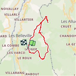
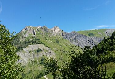
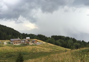
Trail Walking of 14.5 km to be discovered at Auvergne-Rhône-Alpes, Savoy, Les Belleville. This trail is proposed by zazie.

Description

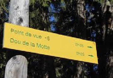
Randonnée en boucle en partant par la face la plus difficile. Attention, ouvertures des refuges à vérifier.

Elevation profile

Photos

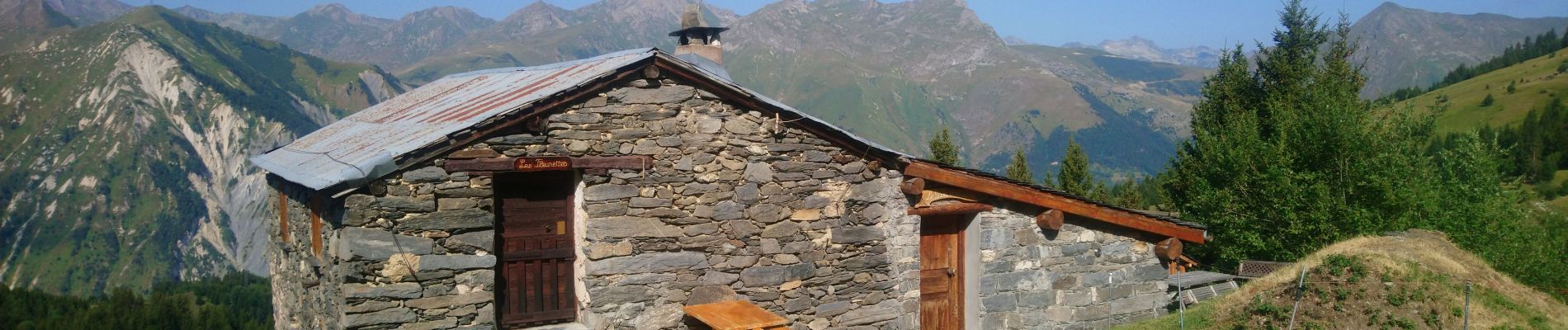
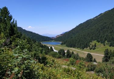
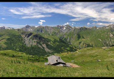
21 photos in total. Please click on a photo to see them all in the gallery.

Positioning

Country:
France
Region :
Auvergne-Rhône-Alpes
Department/Province :
Savoy
Municipality :
Les Belleville
Location:
Saint-Martin-de-Belleville
Start:(UTM)
305007 ; 5031261 (32T) N.

Trails nearby

Trail Walking Les Belleville - St Martin Belleville-gittamelon - Photo
Walking
GUIDE
HERRY

Walking

Easy
Les Belleville, Auvergne-Rhône-Alpes, Savoy, France
8.2 km | 13.3 km-effort
3h 30min
Yes
Trail Mountain bike Les Allues - Col de la Lune depuis Le Villard - Photo
Mountain bike
tracegps

Mountain bike

Difficult
(1)
Les Allues, Auvergne-Rhône-Alpes, Savoy, France
10.2 km | 18.1 km-effort
4h 0min
Yes
Trail Walking Les Belleville - crêtes de Méribel depuis Tougnete - Photo
Walking
bymarc26

Walking

Medium
Les Belleville, Auvergne-Rhône-Alpes, Savoy, France
14.7 km | 23 km-effort
4h 8min
No
Trail Walking Les Belleville - Montagne de Cherferie - Photo
Walking
flip38

Walking

Medium
Les Belleville, Auvergne-Rhône-Alpes, Savoy, France
17.4 km | 28 km-effort
5h 42min
Yes
Trail On foot Les Allues - Le Dou de la Motte en boucle depuis le Refuge de la Traye - Photo
On foot
Refuge de la Traye

On foot

Very easy
Les Allues, Auvergne-Rhône-Alpes, Savoy, France
4.5 km | 7.6 km-effort
1h 30min
Yes
Trail Walking Les Belleville - col du cheval Noir +Lacs - Photo
Walking
mapetite

Walking

Medium
Les Belleville, Auvergne-Rhône-Alpes, Savoy, France
13 km | 26 km-effort
7h 49min
Yes
Trail Walking Les Allues - les Allues à Combe Cure - Photo
Walking
Hubert78

Walking

Medium
Les Allues, Auvergne-Rhône-Alpes, Savoy, France
9.7 km | 17.8 km-effort
4h 4min
Yes
Trail Walking Les Allues - Meribel-les Allues par les cols de Saint-Jean et de la Lune - Photo
Walking
Leemans

Walking

Medium
Les Allues, Auvergne-Rhône-Alpes, Savoy, France
16 km | 28 km-effort
4h 50min
No
Trail Walking Les Belleville - Randoguide - Photo
Walking
jaki76

Walking

Medium
(1)
Les Belleville, Auvergne-Rhône-Alpes, Savoy, France
8.4 km | 13.3 km-effort
2h 52min
Yes


Close
My subscriptions