Trail Mountain bike Bassins - Les Pralets - Place d'Armes - Rionde Dessus - Le Vaud - Photo

Les Pralets - Place d'Armes - Rionde Dessus - Le Vaud

© OpenStreetMap contributors
Length
Length
23 km
Max alt
Max alt
1514 m
Uphill gradient
Uphill gradient
446 m
Km-Effort
Km-Effort  
30 km
Min alt
Min alt
801 m
Downhill gradient
Downhill gradient
916 m
Boucle
Boucle
No
Creation date :
2014-12-10 00:00:00.0
Updated on :
2014-12-10 00:00:00.0

(0 Reviews)

Mountain bike
Mountain bike
2h19
Difficulty : Medium

Scan this QR Code to open this trail in the SityTrail application

FREE GPS app for hiking

Logo SityTrail SityTrail

IGN / Geographical institutes

Download SityTrail from the App Store Download SityTrail from Google Play

Logo SityTrail SityTrail World

The world is yours!

Download SityTrail from the App Store Download SityTrail from Google Play Download SityTrail on Huawei AppGallery

About

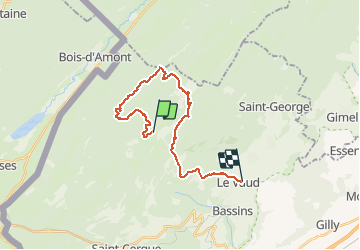
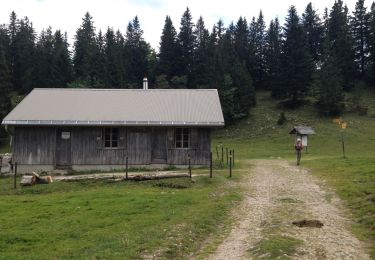
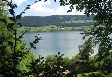
Trail Mountain bike of 23 km to be discovered at Vaud, District de Nyon, Bassins. This trail is proposed by tonymeyer.

Description

Monter depuis Bassins par la Rte de la Montagne et lasser la voiture à l'altitude 1263m sur la route de la Montagne, près des Pralets.

Elevation profile

Positioning

Country:
Switzerland
Region :
Vaud
Department/Province :
District de Nyon
Municipality :
Bassins
Location:
Unknown
Start:(UTM)
283402 ; 5153611 (32T) N.

Trails nearby

Trail Walking Bois-d'Amont - Roche Bernard - Bois d'Amont  - Photo
Walking
tracegps

Walking

Difficult
(1)
Bois-d'Amont, Bourgogne-Franche-Comté, Jura, France
15.1 km | 21 km-effort
5h 0min
Yes
Trail Walking Bois-d'Amont - La Roche du Creux - Bois d'Amont - Photo
Walking
tracegps

Walking

Medium
(1)
Bois-d'Amont, Bourgogne-Franche-Comté, Jura, France
8.7 km | 12.1 km-effort
3h 0min
Yes
Trail Walking Bois-d'Amont - Le Mont Sâla - Bois d'Amont - Photo
Walking
tracegps

Walking

Very difficult
(1)
Bois-d'Amont, Bourgogne-Franche-Comté, Jura, France
14.3 km | 22 km-effort
4h 30min
Yes
Trail Walking Bois-d'Amont - Le Livre d'Or du Risoux - Bois d'Amont - Photo
Walking
tracegps

Walking

Very difficult
(1)
Bois-d'Amont, Bourgogne-Franche-Comté, Jura, France
17.7 km | 24 km-effort
6h 40min
Yes
Trail On foot Bois-d'Amont - La Chaux Sèche - Photo
On foot
PRO

On foot

Easy
Bois-d'Amont, Bourgogne-Franche-Comté, Jura, France
10.1 km | 13.9 km-effort
3h 9min
Yes
Trail On foot Marchissy - Sentier du Coq - Photo
On foot
PRO

On foot

Easy
Marchissy, Vaud, District de Nyon, Switzerland
5.7 km | 11.2 km-effort
2h 32min
No
Trail Walking Bassins - Creux du Croue depuis route des Pralets - Photo
Walking
tonymeyer

Walking

Easy
Bassins, Vaud, District de Nyon, Switzerland
14.5 km | 21 km-effort
4h 16min
Yes
Trail Walking Bassins - Le Sentier des Begnines - Photo
Walking
tonymeyer

Walking

Easy
Bassins, Vaud, District de Nyon, Switzerland
14.9 km | 21 km-effort
4h 0min
Yes
Trail Cycle Bois-d'Amont - Tour du Lac de Joux - Bois d'Amont  - Photo
Cycle
tracegps

Cycle

Medium
Bois-d'Amont, Bourgogne-Franche-Comté, Jura, France
45 km | 51 km-effort
2h 0min
Yes


Close
My subscriptions