Trail Walking Siguer - Peyregrand - Neych - Photo

Peyregrand - Neych

© OpenStreetMap contributors
Length
Length
19.2 km
Max alt
Max alt
2324 m
Uphill gradient
Uphill gradient
1419 m
Km-Effort
Km-Effort  
38 km
Min alt
Min alt
938 m
Downhill gradient
Downhill gradient
1417 m
Boucle
Boucle
Yes
Creation date :
2019-08-29 05:46:45.094
Updated on :
2019-08-29 18:17:25.844

(0 Reviews)

Walking
Walking
9h44
Difficulty : Difficult

Scan this QR Code to open this trail in the SityTrail application

FREE GPS app for hiking

Logo SityTrail SityTrail

IGN / Geographical institutes

Download SityTrail from the App Store Download SityTrail from Google Play

Logo SityTrail SityTrail World

The world is yours!

Download SityTrail from the App Store Download SityTrail from Google Play Download SityTrail on Huawei AppGallery

About

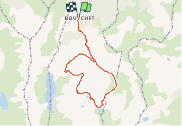
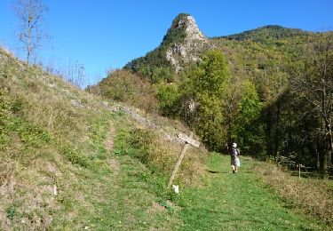
Trail Walking of 19.2 km to be discovered at Occitania, Ariège, Siguer. This trail is proposed by rolandariege.

Description

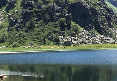
haute montagne non balisé en partie

Elevation profile

Photos

Positioning

Country:
France
Region :
Occitania
Department/Province :
Ariège
Municipality :
Siguer
Location:
Unknown
Start:(UTM)
381269 ; 4731908 (31T) N.

Comments

Please log in to post a review or rate the element


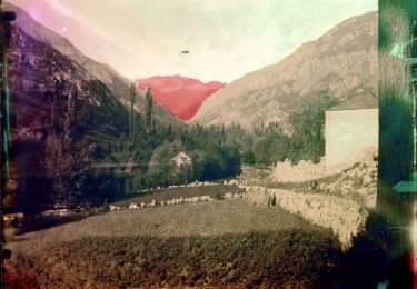
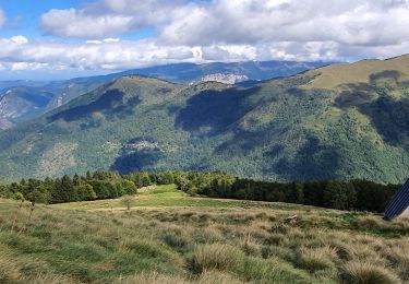
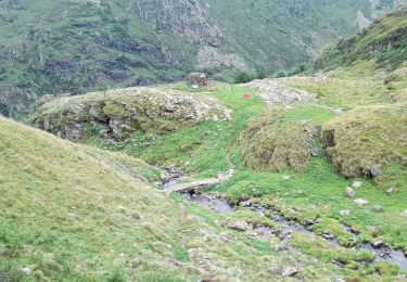
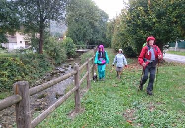
Très belle randonnée dans un secteur très peu fréquenté.


Trails nearby

Trail On foot Val-de-Sos - Le Palet de Samsom - Photo
On foot
PRO

On foot

Easy
Val-de-Sos, Occitania, Ariège, France
5.8 km | 10.3 km-effort
2h 20min
Yes
Trail Walking Lercoul - 2021-09-19_20h11m54_Pic-de-garbie-de-bresoul-depuis-lercoul-19x09x2021 - Photo
Walking
chrisgps

Walking

Medium
Lercoul, Occitania, Ariège, France
14.7 km | 28 km-effort
6h 21min
Yes
Trail Walking Siguer - col côte 2239m - Photo
Walking
bellouelo46

Walking

Difficult
Siguer, Occitania, Ariège, France
19.1 km | 38 km-effort
7h 46min
Yes
Trail Walking Siguer - lac de Peyregrand - Photo
Walking
altaya

Walking

Medium
Siguer, Occitania, Ariège, France
13.2 km | 25 km-effort
5h 12min
No
Trail Walking Val-de-Sos - 171007 EnCours - Photo
Walking
randodan

Walking

Very easy
(1)
Val-de-Sos, Occitania, Ariège, France
10.8 km | 17.1 km-effort
4h 50min
Yes
Trail Walking Val-de-Sos - 171005 EnCours - Photo
Walking
randodan

Walking

Very easy
Val-de-Sos, Occitania, Ariège, France
7 km | 10.4 km-effort
3h 40min
Yes
Trail Walking Val-de-Sos - SVG 170930 - Photo
Walking
randodan

Walking

Very easy
Val-de-Sos, Occitania, Ariège, France
6.4 km | 9.9 km-effort
2h 58min
Yes
Trail Walking Val-de-Sos - SVG 170929 - Photo
Walking
randodan

Walking

Very easy
Val-de-Sos, Occitania, Ariège, France
11.3 km | 18.9 km-effort
5h 39min
Yes
Trail Walking Val-de-Sos - SVG 170928  - Photo
Walking
randodan

Walking

Very easy
Val-de-Sos, Occitania, Ariège, France
8.6 km | 13.3 km-effort
4h 34min
Yes


Close
My subscriptions