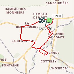
12.1 km | 14.7 km-effort
Le Mont de Doville
AACLARANDO
ensemble sur les chemins
Length
6.5 km
Max alt
43 m
Uphill gradient
63 m
Km-Effort
7.3 km
Min alt
15 m
Downhill gradient
63 m
Boucle
Yes
Creation date :
2019-09-19 09:44:08.766
Updated on :
2019-09-19 09:52:45.066
2h00
Difficulty : Easy
FREE GPS app for hiking
About
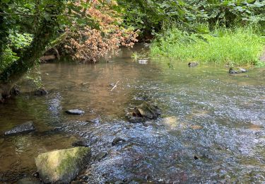
Trail On foot of 6.5 km to be discovered at Normandy, Manche, Doville. This trail is proposed by AACLARANDO.
Description
petits chemins et route sans difficultés
Positioning
Country:
France
Region :
Normandy
Department/Province :
Manche
Municipality :
Doville
Location:
Unknown
Start:(Dec)
Start:(UTM)
606064 ; 5465375 (30U) N.
Comments
Trails nearby
doville le 21 /09/2019
Walking
Very easy
(1)
Doville,
Normandy,
Manche,
France
10.8 km | 13.4 km-effort
3h 20min
No
Autour du Mont Doville - Lahaye-du-Puits
Mountain bike
Difficult
La Haye,
Normandy,
Manche,
France
38 km | 46 km-effort
3h 0min
Yes
St Sauveur Besneville boucle
Walking
Easy
Saint-Sauveur-le-Vicomte,
Normandy,
Manche,
France
13.2 km | 15.5 km-effort
3h 21min
Yes
Mont doville
Walking
Difficult
Doville,
Normandy,
Manche,
France
12.5 km | 15.1 km-effort
3h 37min
No
Pédestre - Promenade et Randonnée Le Mont de Doville
Walking
Medium
Doville,
Normandy,
Manche,
France
11.3 km | 14 km-effort
3h 10min
Yes
Le Mont Castre - La Haye du Puits
Mountain bike
Medium
La Haye,
Normandy,
Manche,
France
13.4 km | 15.8 km-effort
1h 30min
Yes
Le Mont de Doville
Walking
Medium
Doville,
Normandy,
Manche,
France
11.3 km | 14 km-effort
4h 0min
Yes
Le Mont de Doville et les marais de la Sangsurière
On foot
Medium
Doville,
Normandy,
Manche,
France
11.7 km | 14.4 km-effort
Unknown
Yes