Trail Walking Lamonzie-Montastruc - Lamonzie-Montastruc - Photo
 swp648
swp648

User

© OpenStreetMap contributors
Length
Length
10.8 km
Max alt
Max alt
132 m
Uphill gradient
Uphill gradient
198 m
Km-Effort
Km-Effort  
13.5 km
Min alt
Min alt
60 m
Downhill gradient
Downhill gradient
201 m
Boucle
Boucle
Yes
Creation date :
2019-10-06 06:34:45.756
Updated on :
2019-10-23 10:19:49.197

(0 Reviews)

Walking
Walking
3h44
Difficulty : Very easy

Scan this QR Code to open this trail in the SityTrail application

FREE GPS app for hiking

Logo SityTrail SityTrail

IGN / Geographical institutes

Download SityTrail from the App Store Download SityTrail from Google Play

Logo SityTrail SityTrail World

The world is yours!

Download SityTrail from the App Store Download SityTrail from Google Play Download SityTrail on Huawei AppGallery

About

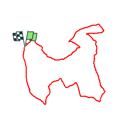
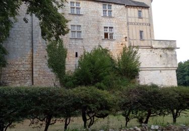
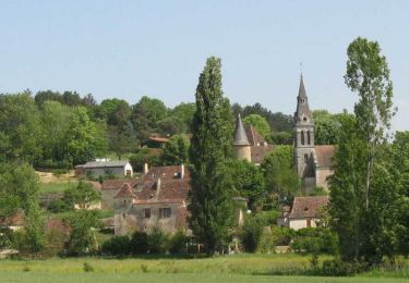
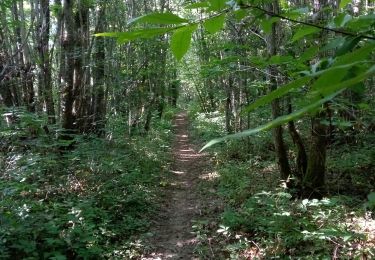
Trail Walking of 10.8 km to be discovered at New Aquitaine, Dordogne, Lamonzie-Montastruc. This trail is proposed by swp648.

Description

Départ de la Mairie de Lamonzie-Montastruc, petite variante pour allonger le balisage vert.

Elevation profile

Photos

Positioning

Country:
France
Region :
New Aquitaine
Department/Province :
Dordogne
Municipality :
Lamonzie-Montastruc
Location:
Unknown
Start:(UTM)
309732 ; 4973904 (31T) N.

Trails nearby

Trail On foot Queyssac - Chemin des Orchidées - Photo
On foot
PRO

On foot

Easy
Queyssac, New Aquitaine, Dordogne, France
6.9 km | 8.7 km-effort
1h 58min
No
Trail On foot Saint-Georges-de-Montclard - Boucle de Saint-Georges-de-Monclard - Photo
On foot
PRO

On foot

Easy
Saint-Georges-de-Montclard, New Aquitaine, Dordogne, France
5.8 km | 7.6 km-effort
1h 43min
No
Trail Walking Lamonzie-Montastruc - Lamonzie Montastruc 17,5km - Photo
Walking
amelie14

Walking

Easy
Lamonzie-Montastruc, New Aquitaine, Dordogne, France
17.7 km | 23 km-effort
3h 26min
Yes
Trail Walking Mouleydier - Forêt de Liorac 21km - Photo
Walking
amelie14

Walking

Medium
Mouleydier, New Aquitaine, Dordogne, France
21 km | 26 km-effort
4h 1min
Yes
Trail Walking Campsegret - Circuit de Campsegret - Photo
Walking
tracegps

Walking

Medium
(2)
Campsegret, New Aquitaine, Dordogne, France
9.6 km | 12.3 km-effort
2h 30min
Yes
Trail Walking Liorac-sur-Louyre - liorac  - Photo
Walking
michel calvo 2

Walking

Easy
Liorac-sur-Louyre, New Aquitaine, Dordogne, France
18.6 km | 23 km-effort
4h 17min
No
Trail Walking Liorac-sur-Louyre - Liorac 17km - Photo
Walking
amelie14

Walking

Medium
Liorac-sur-Louyre, New Aquitaine, Dordogne, France
17.3 km | 22 km-effort
3h 11min
Yes
Trail Walking Mouleydier - St Sauveur de B. 15,5km - Photo
Walking
amelie14

Walking

Medium
Mouleydier, New Aquitaine, Dordogne, France
15.5 km | 19.3 km-effort
2h 54min
Yes
Trail On foot Queyssac - Boucle des hameaux - Photo
On foot
PRO

On foot

Easy
Queyssac, New Aquitaine, Dordogne, France
8 km | 10.3 km-effort
2h 20min
Yes


Close
My subscriptions