Trail Walking Jougne - SUCHET - Photo
 BM25
BM25

User

© OpenStreetMap contributors
Length
Length
13.5 km
Max alt
Max alt
1576 m
Uphill gradient
Uphill gradient
655 m
Km-Effort
Km-Effort  
22 km
Min alt
Min alt
1045 m
Downhill gradient
Downhill gradient
655 m
Boucle
Boucle
Yes
Creation date :
2019-10-08 07:46:42.936
Updated on :
2019-10-08 11:02:48.447

(0 Reviews)

Walking
Walking
3h15
Difficulty : Easy

Scan this QR Code to open this trail in the SityTrail application

FREE GPS app for hiking

Logo SityTrail SityTrail

IGN / Geographical institutes

Download SityTrail from the App Store Download SityTrail from Google Play

Logo SityTrail SityTrail World

The world is yours!

Download SityTrail from the App Store Download SityTrail from Google Play Download SityTrail on Huawei AppGallery

About

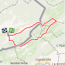
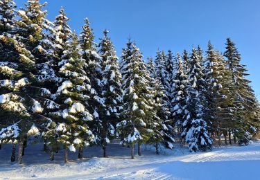
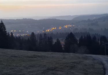
Trail Walking of 13.5 km to be discovered at Bourgogne-Franche-Comté, Doubs, Jougne. This trail is proposed by BM25.

Description

depuis Entre les Fourgs
bel coster, la poyette sommet descente vers grange neuve et retour par la roche marquee

Elevation profile

Positioning

Country:
France
Region :
Bourgogne-Franche-Comté
Department/Province :
Doubs
Municipality :
Jougne
Location:
Unknown
Start:(UTM)
302104 ; 5182022 (32T) N.

Trails nearby

Trail On foot Les Clées - fixme - fixme - Photo
On foot
PRO

On foot

Easy
Les Clées, Vaud, District du Jura-Nord vaudois, Switzerland
4.1 km | 5.9 km-effort
1h 20min
No
Trail On foot Les Clées - Tourisme pédestre - Photo
On foot
PRO

On foot

Easy
Les Clées, Vaud, District du Jura-Nord vaudois, Switzerland
3.5 km | 4.5 km-effort
1h 0min
No
Trail On foot Ballaigues - Ballaigues-Vallorbe - Photo
On foot
PRO

On foot

Easy
Ballaigues, Vaud, District du Jura-Nord vaudois, Switzerland
5.1 km | 6.3 km-effort
1h 25min
No
Trail Walking Jougne - Aiguilles de Baulmes - Suisse - Photo
Walking
albert39

Walking

Difficult
(1)
Jougne, Bourgogne-Franche-Comté, Doubs, France
16.4 km | 26 km-effort
5h 33min
Yes
Trail Walking Métabief - GTJ  Metabief - Pontarlier - Photo
Walking
svp59

Walking

Medium
(1)
Métabief, Bourgogne-Franche-Comté, Doubs, France
25 km | 35 km-effort
7h 17min
No
Trail Snowshoes Métabief - Les hauteurs de Metabief - Photo
Snowshoes
zefreefly

Snowshoes

Medium
Métabief, Bourgogne-Franche-Comté, Doubs, France
15.5 km | 23 km-effort
3h 51min
Yes
Trail Cross-country skiing Les Hôpitaux-Vieux - Les Essarts - Photo
Cross-country skiing
mallovon

Cross-country skiing

Easy
Les Hôpitaux-Vieux, Bourgogne-Franche-Comté, Doubs, France
6.5 km | 8.1 km-effort
2h 3min
Yes
Trail Walking Jougne - La Jougnena - Photo
Walking
daniellebou

Walking

Very difficult
(1)
Jougne, Bourgogne-Franche-Comté, Doubs, France
17.7 km | 24 km-effort
5h 32min
Yes
Trail Walking Jougne - La poyette - Photo
Walking
mallovon

Walking

Medium
Jougne, Bourgogne-Franche-Comté, Doubs, France
11.8 km | 17.9 km-effort
4h 7min
Yes


Close
My subscriptions